My latest Post.

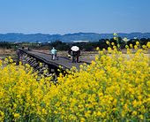
This view,this beauty
A tear unbidden
Creeps into my eye.

My stay is short
But I shall return to this place
If only my life is long enough.

Such beauty
Gazing upon it
I hope my years are many.

Bokusui Wakayama.

Friday, November 30, 2012

No Plan - Getting Lost in Ujitawara.

Ujitawara.
 
   So, what is a "no plan - getting lost" trip? Quite simply, it's where I choose a destination (that's the only plan), make a bee-line for that destination then, upon arrival, find a thoroughfare (of any shape-or-size) and go from there. Up to now I have never got lost on one of these trips, unlike a planned outing when I am almost guaranteed to get lost. They are awesome. I never know what to expect and, on all the occasions I have done one of these trips, I have returned and, in many cases, added to my created course.

   On this occasion I chose the Jubu-san road that borders the towns of Wazuka and Ujitawara. I have traveled this road many times - both on foot and bike - and have descended some of the many tracks that take one through a variety of environments - tea-plantations, rice-fields, dense forest, picturesque-secluded settlements - to reach the bottom. 
Map Location.
   It was this gate that captured my interest and, after a few minutes break (to this point I was 28km from home, the last 10km uphill), I decided that this was to be the beginning of today's "No Plan - Getting-Lost" course. 
   This Video is an introduction to the Jubu-san road and the junction (I will attach a link, at the conclusion of this post, of the descent and emergence from the forest. As-well-as other videos) .
Linden Baum - cafe & restaurant.
Map Location.

   15-minutes and 4.5km later, after a descent of 384m, I emerged into the settlement of Shimonoto, on the rural-outskirts of Ujitawara, and my first "discovery" of the day - the Linden Baum Cafe & Restaurant. Tucked-away amongst this little community one could have quite-easily missed this (the only reason I found it was because I wanted to record a video of the area). 
   An obscure-overgrown track, that disappeared into the bushy-hillside, lured me to my next destination but, after some searching, I decided to give-it-a-miss and u-turned back to the village.
   As I was returning, I happened-across this derelict/abandoned house. A friend of mine (softypapa), who specializes in discovering & recording abandoned houses, stirred-up my interest in the same and I soon found myself checking this out.
   About 1km down the road I arrived at a junction, in front of me I could make out a busy road (it was route-307), so I took the lane to my right and headed back into the hills via the village Yuyadani. These thoroughfares are so narrow they must be hell to navigate in a truck/bus. This lane soon petered-out and emerged into a clearing where a junction, comprising of six tracks, converged. In front of me was a noticeboard with a map of all the hiking trails in the area (further on, at my next stop,I found maps of these trails) but, not wanting to venture too far from home, I u-turned and took another track back in the direction I had just come from. After passing-by a tea-plantation, I was soon confronted by two men who's car had got stuck in the mud (check this video out) and was obliged to assist. After several failed attempts, a third man offered to get his small truck and tow them.
Chasomyo-jinja.
Birthplace of
Nagatani Soen.

     Emerging from the forest I was soon to happen-across my next "discovery" of the day. This site came as a shock to me and I decided to rest-up, have a bite-to-eat, and check-out the surroundings. The Shrine, looking many hundreds-of-years old (in fact it was erected in 1954), is used to enshrine the spirit of Nagatani Soen who developed the tea-processing method which involves steaming, kneading and drying, and is still used today. As I passed-through the Shrine complex, I noticed signs informing me of a hiking course in the area. Upon return home, and some map research, I discovered the track finishes at the same area where I first commenced this course (needless-to-say, it has been placed on my "must do" list). Across the lane from the Shrine is the birthplace of Nagatani Soen and today is used to preserve the Hoiro (equipment used to roast and dry tea-leaves over a fire). 
   When recording this video, I retraced my steps to give you an idea of the emotion I experienced as I descended into this site.

   After lunch, which consisted of a sultana-malt loaf and some sticky chocolate donuts, and washed-down with a hot coffee, I was back on my seat and another secluded track. Exiting the settlement of Yuyadani, and back towards route-307, a narrow lane up into the hills caught my attention, and I was off to explore more of Ujitawara. 
Map Location.
   Passing through more tea-plantation, I was soon to happen-across another wee treat. Yes. Another cafe and, like the Linden Baum Cafe discovered earlier, this too is in an isolated location. Bugger, if I'd known earlier, I would have stopped here for lunch. But, not to worry, I'll be back (now where have I hear that before?).
Map Location.
   I soon found myself at another junction and, checking the road-sign - giving directions to Jubu-san - I knew exactly where I was (I have descended this track twice in the past and is hair-raising to say the least). A concrete Torii, still adorned in Autumn foliage, with a long flight-of-steps disappearing into the forested hills, was my next stop. As I was doing good time (it was not yet 12pm) I decided to check this complex out ( sorry, unable to attach a name). It was nothing special but, as I have a fondness for these sites (if you hadn't already guessed) I couldn't see any harm stopping.
   By now I am nearing route-307, and the commercial area of Ujitawara and the completion of this outing. But, there was one more wee find that nearly made me to come in collision with a car. 
Map Location.
This obscured vermillion-colored Torii, flanked by  two Kitsune, told me that this was an Inari Shrine and, once ascending the steps, I discovered that it was  in need of urgent repair but, as I looked-around, I realized that this complex fitted-in with it's  environs perfectly. As seen in this video.

   A hundred metres down the road from the Inari Shrine, was the Sannomiya-jinja, which was where I decided to bring this fantastic journey to an end. As I had seen & experienced so much during the past 4.5-hours, I was eager to get home (an hours cycle from here), upload my videos and photos and search the internet for any relevant information to include in with this post. And what a lot there was too. I will definitely be returning to the Ujitawara area to add to this course - I am already planning to hike the trail from Chasomyo-jinja to Kontai-ji, and hope to do it in the next week.

   So, from Ujitawara, thanks for reading and watch-out for more from my files of "No Plan - Getting-Lost" outings.

   Videos from today's outing:   Tea Plantation, Jubu-zan Road Ujitawara.

                                                                Descent from Jubu-zan Road.

                                                                   Emergence from mountain into Shimonoto.


Tuesday, November 27, 2012

In Search of Fudo no Taki.

      Taki, in Japanese, means Waterfall. Fudo, being a Buddhist God-Type   figure, is associated with Mountain Asceticism.


Koishidani-jinja.
Map Location.
   The idea to go in search of Fudo no Taki goes-back some months when, while on one of my hiking expeditions ( I was hiking along the Kizugawa between Kasagi Town and Minaimyamashiro, on what is known as the Tokaido Road.) when I stopped for a bite-to-eat at the Koishidani-jinja. While sitting on the Kagura-den (in the right in the image), and consuming my lunch in the beautiful sunshine, I spotted a pile of maps. Curiosity getting the better of me, plus my hobby of collecting & reading maps, I took a peek and soon discovered a huge network of hiking tracks in the hills behind Minamiyamashiro. I have passed-through these hills several times in the past and wasn't aware that there were so many lanes & tracks throughout the area. The hills have a plateau on the summit, before descending into Wazuka-cho, with many secluded villages spread throughout (my kinda' environment). But it was an icon on the map that captured my attention. Fudo no Taki was located in such a position that would allow me to do a one-way hike, beginning at Kasagi-cho, and finishing at the village of Yubune. 
Kasagi Bridge & Kizu River.
Video.
   After crossing the Kizu River, via the Kasage Bridge, and before disappearing into the hills, an object midway up Kasagiyama captured my attention. Of the many times I have been in this area, I have never noticed this monument before (it has been placed on my "Must return and Check-out" list for a later date).
   From here I was to cross the very busy route-163 and head-into my kinda' environment - isolated settlements, rural scenery, dense forests/bush and, my most favorite, the sounds of the outdoors. The settlement of Yudani, still part of Kasagi Town, is one of those places where you envy those 
Yudani Settlement.
Video.
 that live there. But, as easy as it is for me to say that, I feel one has to be prepared for the isolation -  one can't just pop-around the corner for a bottle-of-milk. But dreams don't cost anything.


Map location.
   My first junction and my first Jizo of the day followed soon after, and, from here, time to farewell civilization and say hello to the hills and the forest. This area wasn't new to me. I discovered this mountain lane quite by accident when a signpost, informing me of a hiking course, lured me to investigate. On that occasion I was descending. 
   In the following video you get the impression I am unfit. Well, you would be partly correct. I have just spent the past hour ascending through a forest that still has splashes of Autumn color amongst the foliage. But, to emerge from that environment into the rural scenery of Dosenbo, was well worth the pain (brought-about by a pebble in my boot). 
 
   Passing through isolated areas, such as Dosenbo, one quite often stumbles-across interesting places such as this.
Video.
I have passed this dwelling twice in the past, both times on bike so, on this occasion, I was able to take a good look at it. My first impression, judging by the outdoor furniture, that this was an isolated cafe. No such luck. I would have fancied a coffee at this moment.
Map location.
   Three junctions later, and more great rural scenery, I arrive at this point. My plan is to take the right branch to Fudo-no-Taki then, upon return, continue via the left branch. My research leads me to believe that this track will bring me onto another track and, eventually onto route-5. But first, lets check-out the waterfall. I found the track to the 'falls to be undulating but, within about 5-minutes, I could hear the distinct sound of rushing water.
   I am always conscious, especially when on my own and in an isolated area, of the risks involved if I become too eager to explore the surroundings. And this is no exception. After the rain of the previous day, I was aware that the rocks may be slippery. And they were. As I got closer to the 'falls, the sound was quite deafening, as is evident on the video.
Hidden to one side, in amongst the bush, I spotted this old wooden ladder & guide-rope (or what was left of it) and, putting two-and-two-together, I deduced that it led to the top of the 'falls. Ascending & descending this wasn't easy. In one pocked was my (new) video-camera. In another was my G.P.S. device and, in my hand, was my other camera & tripod. But I made it. 
   The view from above was as brilliant as the view from below,but much more dangerous and, as the surface of the rocks were treacherous, I wasn't taking any risks. But up there, I could see how the water has gouged-out the canal into many smooth and various shapes. I am keen to return and take a better look further upstream. I got the feeling there was much more to see. Back to ground-level and a bite-to-eat before exiting and onto my next destination - bush-bashing through uncharted and unsignposted terrain.
Video.
   About 200-meters into the bush the track came to an abrupt end, and I was then left with the decision - do I u-turn or continue ahead? As I could see a stream below me, I decided to ascend to it and follow it out in the hope it would connect me to my next junction and onto route-5, and a lunch-stop. The video gives you an idea of the terrain I had just emerged from. As-soon-as I emerged onto the track, I knew exactly where I was and lunch was only a few minutes away.
Map location.

    
Lunch was at this disused (I suspect) cafe, and consisted of hot curry and bread-sticks, washed-down with a coffee. It also allowed me the opportunity to remove my boots and air-out my feet, before the next and final segment.
   The next 5-kilometers were along the narrow route-5 and a very different environment - farmland. 
Video.
And, in this case, Tea. Check-out how narrow the road is, and how close to the road the tea plants are. A good insurance policy is needed by the workers harvesting the tea.
Video.


My next destination was the village of Yubune and the settlement of Nakayama. A few weeks back, while out on my bike, I stopped-off here and discovered this amazing Temple and I was eager to return with video-camera. If the settlement itself was quaint, the temple was just awesome. Access was through the settlement and up some steep steps before arriving at the complex. 
   My plan was to end my day here then catch the bus back to the J.R.Kamo Station. This being an isolated rural area, the bus-service is few-and-far-between and I soon realized I had an hour to kill. So, what better way to pass-the-time, than a stroll through Yubune.
Map location.

I was also on the look-out for a spot where I could sit and use-up the last of my hot water for one more cup-of-coffee with the spicy doughnuts in my pack. And, as luck would have it, I happened-across the local Gateball court, where some senior residents of the town were competing. This was the perfect end to the perfect days hiking. 

   
   Links;   Kasagi-to-Yubune. Part-1.
                 Kasagi-to-Yubune. Part-2.
   

Tuesday, October 16, 2012

The Kozuya Bridge.

Kozuya Bridge.
Map/Location.
   The image on the left, taken recently, is of the Kozuya Bridge on a good day.


Kozuya Bridge.
Map/Location.

   The image on the right, taken today (Sunday 14th October 2012), is of the same bridge after the forces-of-nature had flexed their muscles.


   But, before I explain how one image drastically changed to become the other, let me give you a brief run-down of the bridges history.
   The bridges history dates-back several hundred years and spans the Kizugawa River and connects Yawata-shi (city) with Kumiyama-cho (town) in Joyo City. The bridge, at 356-meters long and 3.3-meters wide, is the longest extant wooden bridge in Japan. The modern bridge was constructed in 1953 to replace the ferry service, which was abandoned in 1951. The bridge is a popular stop on the Kizugawa cycle/walkway and, before descending the path, there is a nice shelter/picnic area where the traveller can rest-up and take in the surrounding scenery.
Many festivals are acted-out on the bridge, like the "Jidaigeki Matsuri" Festival, in the image on the left, with participants dressing-up in traditional Japanese costume. One will also witness the occasional television/film crew recording the latest blockbuster here too.
   The Kozuya Bridge, also known as the "Nagare Bashi" or "Flowing Bridge" (Nagare meaning flow,and bashi meaning bridge), was constructed in such a way that, whenever the river is flooded, the wooden floor will become afloat and wash-aside to one side of the river where it won't go-against the force of the current and thereby evading total destruction of the bridge. The reason why the wooden floor won't be washed-away, is because each section of the floor (all eight of them) are attached to the pier with wire ropes. 
The wooden piers are the only permanent parts of the bridge but, in saying that, they have been known to buckle-under the pressure when the water current has been too strong. Since 1953, when the current bridge was constructed, the bridge has been damaged sixteen times, four of those times in the eight years since I have been in Japan.

   I should have mentioned at the beginning of this post that there are two topics I wanted to cover. The second being the destruction caused by the forces of nature. The events of the 7th April 2011 - 2011 Tohoku Earthquake and Tsunami - are still fresh in the minds of many people; I remember watching the events unfold live on television, as did many millions of others, and sat overwhelmed at how houses, boats, motor-vehicles were just swept-aside, as this huge wall of water wiped-out many towns & villages in it's path. This bridge, after a flood, reminds me of the devastation that can be caused by an uncontrolled wall-of-water.
    It's difficult to say where the source of the Kizu River is but, looking at a map of the area, it's catchment is quite extensive so, when there is a long/heavy rain, there is sure to be some water flowing down to it's final destination - Osaka Bay.
The Kozuya Bridge from Kizugawa Cycle/Walkway.
Map/Location.
  As I approached the bridge, and got-over my initial shock of the destruction, I was intrigued as to where the river was. When you look at this image on the right, you can see the entire 350+-meters of the bridge has been wiped-out, but today, the river can just barely be seen (it's in the center-right in the image).
Entrance to Bridge.
Map/Location.
   The bridge is still popular with sightseers who, like myself, have come to marvel at the destruction (while I was here, I estimated several-dozen others in the vicinity).
   
Map/Location.


   The sight of this tree-stump, in this image on the right, brings-into perspective how high the river level must have been ( I am about 4-meters from the top, with about another meter to go, before I reach the river-bed).
The Wooden Floor.
  In the image below, you can see how the wooden floor has become detached from the main structure, but is still attached by the wire- ropes. I guess this flood mustn't have been as bad as previous floods, judging by the way the floor is still in close proximity to the bridge and not further downstream.


   In the two images above you get an idea how much debris can be washed-down a river during a flood. I have passed by many rivers after there has been a flood and there are many things that impress me - the amount of water and where it has come from (I am talking about rain here), how suddenly the river-water can rise & recede, and the debris. Wandering-around the bridge, there was very little pickings to sift through. My only hope, looking at the accumulated scrub, that no-one leaves a burning cigarette behind.
Nagare-bashi at sunrise.
    Before I sign off I will include one final image of the Kozuya Bridge at sunrise. If you are in the area, why not come-down, bring the kids and picnic and take-in the surrounding scenery. I can assure you, bridge or no bridge, it won't be a waste of your time.

   Links;   Video of Kozuya Bridge. 
                   Yawata City. 


Wednesday, September 5, 2012

A "Claytons" Blog.

Bottle of Claytons.
   "So whats a Claytons Blog anyway"? you're asking yourself. Well it has nothing to do with the Great Outdoors (unless you have packed a bottle in with your gear. But, as it's non-alcoholic,why would you want to take a bottle of this stuff along with you anyway?). To explain, I shall let the guys at Wikipedia put you in the frame - take note of the sentence "...the drink you have when you're not having a drink". If you're still confused, let me explain; this is a blog I'm composing that's not a blog.
   I have discovered that it has been 2-months since my last contribution to the blogging community. I must apologize for this. I appreciate some of you guys out there have become insomniacs as a result of this dry-spell, but there is a reason why (well actually there are several). This summer has been one of the most severest in Japans history (or since weather/climate information has been recorded) and, after a close-call a month or so ago, I decided to err on the side of caution and go-out on short expeditions only. Then there was work (that horrible 4-letter word) that has kept me off the scene. But, it's not to say I have forgotten about you guys. I have a couple of blogs in the pipeline that I am working-on (actually I was all set last Saturday,1st Sept', to complete my research,when "Mother Nature" intervened and it pissed-with-rain). So, let me assure you, I haven't fallen-off the face of the Earth
Map/Location.
   And, to prove I am still in the "Land-of-the-Living", here I am at precisely (or thereabouts) 09:35 on Sunday 2nd September 2012. I look good, don't I? Well actually I was knackered. At this point I was 37km into a 91-km ride. But, for the previous 1km, I had to lug my bike (and myself as well) up a creek (oh the joys of off-road cycling). It was close to this point, about 6-weeks ago, that I collapsed with heat-stroke and had to cool-down (it was only 10:30 and already in the mid-30c).
   In my post, "In Search of Shoryaku-ji Temple", I mentioned "....the track leading me to this spot looked very-inviting and may require further investigation on a later visit". Well, this is that trip. I have been planning this outing for a few weeks now but, thanks to one thing or another, I just never got-around to it. 
Map/Location.

    I always make a bee-line for this spot, on the border of Nara Park (it's a 2.5-hour x 28km ride to get to this point), where I can take on some water and munch on a banana before setting off. Today's course, Nara Park to the Kizugawa Cycleway (this is a great 'site for logging outings as it records elevation, distance & course, as-well-as posting images) is undulating and with the first 10km being relatively flat, I am aware of some hilly terrain ahead. As I am in "tourist mode", I want to take-in as much of the surrounding scenery as I can, like in this image on the right.
Map/Location.
I am passing-through the settlement of Kitatsubaocho and the rice is beginning to brown off before it's harvested, in about another months time. This area is used mainly for rice and is a spectacular sight, regardless of what stage the rice is at.
As I begin to put my camera away, I discover this set of Jizo behind me. One will find these anywhere/everywhere and are a delight to encounter.
Map/Location.

1,500-meters up the road is the magnificent complex of Shoryaku-ji Temple. Unlike the last time I was here, where I spent the best part of 2-hours, this time I am just passing-through. I have some uncharted territory ahead and I needed to be prepared for what was about to greet me and, believe me, I was in for a grunt of a climb. 
Map/Location.
Out of the forest and back onto a decent sealed road before my next destination - a 185-year old Japanese tea-House. If you check on the map link (just below the image) you will see how isolated this place is. The proprietor is the 6th generation of his family to have run this establishment, and is popular with hikers coming through this area. From here I join the "Nara Okuyama Driveway" (albeit for 1.5km), a toll-road that takes drivers through the dense Kasugayama Primeval Forest overlooking Nara City, and the opportunity to top-up with clean-fresh water. 
Map/Location.
    I have passed this junction several times over the years and I never payed much attention to the bridge and where the track lead to. On this occasion I decided to include this track in my plans. And I am so glad I did, as I was in for a treat.
The Uguisunotaki Falls.
Map/Location.
  About 700m from the junction I discovered the ideal location to break for lunch - the Uguisunotaki Waterfalls. Parking my bike, then taking the steps for 100m, I was able to dine amongst my favorite environment - running-water, the surrounding forest, bird-song - oh how I was in heaven. If I was in a brave mood, I might have stripped-off and took a well deserved shower (luckily I didn't as I was soon joined by a couple of love-birds (example-2)). Lunch, which consisted of an 8-pack of bread-rolls, is always a good opportunity to do a map check of my current location and prepare for the remainder of my trip. I estimated I am about mid-way through and am also aware of some more hill-climbing ahead. With the time being about midday, I was also conscience of the heat. 
Stairway to........
Belfry at Koufuku-ji temple.
Map/Location.
Returning to my bike I discovered another set of steps. So, with time on my side, I decided to check-out where they led to. Five minutes later I arrive at Koufuku-ji Temple (not to be confused with the famous Koufuku-ji Temple in the grounds of Nara Park. But,in saying that, there may be some link between the two. If I am able to gather information, I won't hesitate to share with you) with a quaint wee belfry on the left and.... 
Concrete Torii
and
Chozuya
     ....a Torii and Chozuya opposite. Normally these structures signify the entrance to Temple/Shrine, but all I could see were ruins behind a fenced-off area. This now requires a return visit to gather more information, maybe on foot.
   Soon after I was back-on-the-road-again (in this case a rutted-muddy track) and passing-through the village of Sonodacho. From here it was onto the familiar territory of Kamocho (Kamo Town). This time last year I spent several weeks cycling and discovering the many settlements and lanes than make-up this very beautiful area of Kizugawa City. 
   With 6km to go before I arrived at the end of this segment of my day, I changed-into cruise control and allowed myself the luxury to conserve my energy (Once reconnecting to the Kizugawa Cycleway, I still had 25km before home). On a good day, cycling along the Kizugawa can be a Piece-of-piss but, on a bad day, it can be hell. 25km can seem like 100km. On this day I only experienced two downpours but, what the hell, I was wet with perspiration anyway.
   Six-and-a-half hours after leaving home, I arrived back buzzing-with-joy at having experienced another great ride. After several weeks of no outings like this, it was good to be back into the groove again. Lets hope it's not another long spell before my next venture.
                                          Happy Cycling Everyone. 

Tuesday, July 3, 2012

In Search Of Shoryaku-ji Temple.

Shoryaku-ji
In Autumn.
                                  History of Shoryaku-ji.
   Shoryaku-ji (the suffix "ji" means Temple) was founded by the Priest   Kenshun, a son of Kaneie Fujiwara (the Prime Minister of the day) and was constructed by edict of Emperor Ichijo in 992AD. Upon completion the complex consisted of some 86 buildings - a large Temple, Halls and Pagodas - but, after several fires over the years, all that remain today is the Main Hall, Shoro (Belfry) and Fukujyuin (Guest Palace).
Bronze image of Yakusi-nyorai.
The Fukujyuin Temple houses many Buddhist artifacts, including this bronze image of Buddha Yakusi-nyorai, made in the 7th century. The image has been designated a National Cultural Asset.
   Shoryaku-ji is also famous for the Autumn colors that adorn the many trees surrounding the complex (as in the above image) and also has the distinction of being the first place to produce Refined Sake.

Map Location.

   Those of you that read my post on the SamaSama Beer Garden (If you didn't, now is your opportunity, it's an excellent piece of literature if I say so myself) will remember this image. It was here, while resting my bike against a signpost, that I noticed the placard advertising the facility. But there was another signpost that also attracted my attention.

It was this sign, giving wary travelers directions to Shoryaku-ji Temple. I took note of the temple's name and, when I returned home, began surfing-the-internet for any information. Within a short time I was placing this destination on my "Must See" list. Some of the images I found astounded me and, on top of that, it's location - tucked-away in the hills overlooking the Obitoke area of Nara City.
Before long I was mapping a circular-course (beginning/ending at the signpost) that would allow me the opportunity to experience some of the great Japanese rural scenery that I like so much, as-well-as some of the local history. I estimated my course to be around 6km long but, what I didn't take into account, was the four deviations I would come-across along the way.
              So, without any further-ado, lets go in search of Shoryaku-ji.
Tumulus Pond.
Map Location.
500-meters into my walk and I encountered my first deviation. The distinctive vermillion-colored Torii in the distance was a lure for me to investigate.
Map Location.
With the help of a noticeboard, and the assistance of my dear wife, I discovered that this is a Tumulus Pond and, where the Torii are located, is the Ookawaike Kofun. Within this area are five kofun, the most famous being the Itsutsuzuka-Tomb (sorry,unable to find any information). 
Map Location.
Back onto the sealed-road again, and some of the great rural scenery I mentioned earlier. In the past weeks the rice has been planted and, for the first few weeks, the fields are flooded which makes for some very beautiful photo opportunities. But also, when you are this isolated, the beauty is added-to with the serenity of the area. 
Roadside Jizo.
As I make my way up the valley I pass the occasional roadside Jizo Bodhisattva. One can come-across these everywhere and in some of the most unlikely places. They are one of the most beloved of all the Japanese Divinities. One of their (many) purposes is to protect children, expectant-mothers, firemen and travelers. 
Map Location.
Also, as I make my way up the valley, I notice at intervals along the way these posters tied to roadside fences & barriers. Judging by the art they were created by children and their content indicates they were put there to dissuade people from disposing of their rubbish.The one in the image on the right, I thought the best. 
Video.
Map Location.
I am about to enter the forest and leave the sealed-road behind. This is my kinda' environment and I am at home here with the sound of the water flowing down the stream, the calls of the different species of birds, the trees creaking as they rub against each other in the wind. A couple-of-weeks ago this area was struck by a severe typhoon. Severe, in as much of the amount of water it dumped on the ground, and evidence of the rain is still visible. The sign is informing me that Shoryaku-ji is just 700-meters away.
Video.
   Out of the bush, and back to civilization. The signpost is informing me that I am within reach of Shoryaku-ji as-well-as giving me directions the where I have just come from and where my next destination will be (after I have completed my tour of the area).
   As I step-onto the road I get my first glimpse of Shoryaku-ji. Within seconds I begin to get a feeling for what this place must look like in Autumn.


    This must be an artists heaven, and that is regardless of genre. With all the Autumn images I have seen of Shoryaku-ji, I will be placing this destination on my "Must return" list. After perusing a nearby noticeboard, with map of the complex, my plan is to wander to the top and work my way down. The feeling I am getting at this early stage, is that the complex will require at least an hour to cover (little did I know, it would be nearer two-hours).
Video.
Map Location.
   My first stop is this little temple nestled-amongst the forest (the track leading me to this spot looked very-inviting and may require further investigation, on a later visit) that has a stream flowing past on the right. In the distance is a bridge with waterfall behind it. All very picturesque.
Stone Buddha Images
with
Belfry.

    
Just a few meters down from the small temple is a collection of Stone Buddhist Images (there is another impressive display further-down the road that offered a better opportunity to photo) and, up in amongst the trees, is a belfry. To access the upper compound, one has to ascend some eighty steps (80-steps may not seem many, but, on a hot day, they can be quite a chore to climb).
Shoryaku-ji Head Hall.
(Main Hall).
 Upon arrival you are greeted with this magnificent structure and, regardless of the time of year you visit this complex, this would remain an image etched in ones memory for some time to come.
   There are not many buildings to see in this location, but, what is here, is well worth the effort to experience.
Belfry.
Map Location.
I will let this video give you an idea of the beauty and serenity of the site - Video of Main Hall and Belfry.
Pond
and
Small Shrine.
It is difficult today to conceive of the life of by-gone times and, what remains here, does little to remind us of Shoryakuji's glorious past.
   Now, onto the highlight of my visit to Shoryaku-ji, the Fukujyuin Temple. Designated a "National Cultural Asset" for it's Kyakuden's (Guest Palace) architectural style of the 17th-century, it has the Kokerabkui roof which consists of layered wooden shingles.
Gate, entrance to
Fukujyuin Temple.
As you stroll from the Main Hall area to the entrance to Fukujyuin Temple, the Bodaisen River meanders through the grounds and is partly camouflaged by the overhanging trees.
Fukujyuin Temple.
Please remember, when entering a temple, to remove your footwear. It's not until you enter the temple proper you realize the beauty that will unfold as you wander about the building. I was very-privileged to have been given a personal tour by the priest and was taken to see some of the many treasures that are housed here. All very precious and old (most dating-back many centuries). The most impressive was the "Sentai Jizo-bosatsu" with it's 1,007 carved miniature bodhisattivas' (all about 2cm in height).
One of the
"Four Seasons"
paintings
by
Painter Eino Kano.
Throughout the drawing-room are many paintings by Eino Kano, one of the representative painters of the 17th-century (you may be getting the idea by now, how my planned one-hour visit, was turning-into a two-hour visit). If the interior wasn't enough to capture my attention, then the exterior was just .............. (sorry,I can't find the right word to express my feelings. Maybe this image will give you a better idea).
Could you imagine a better view out of your drawing-room? I couldn't. I was able to capture some images on my video camera - Inside Fukujyuin Temple.
   Time to put my boots back on and grab my pack and hit-the-road. I was so grateful for the personal attention the priest gave me in showing me parts of the temple not many would get to see (I forgot to ask him about the Refined Sake Shoryaku-ji is famous for. Oh well, another excuse to return).
   About 500-meters down the road from Shoryaku-ji, was this collection of statues. The two, in the image on the left, are Nakiwarai Jizo. They stand at the foot of two very-tall trees.
   To the left of the jizo statues are a collection of Monk Tomb's. This collection, of which there are two, I found the easiest to photograph. This video will give you a better idea of the area.
   The second of my four deviations was just a stones-throw away when my attention was drawn to this Ryobu-torii, a daiwa torii, set in amongst the bush. This type of torii is distinctive for the four square posts that are used to reinforce the pillars. Those of you who have visited, or seen images of the Itsukushima Shrine in Hiroshima, will recognize this torii.

Torii, entrance
to
Shingu-jinja Shrine.
Map Location.
    Two down, and my third deviation is just another kilometer away. My original purpose was to find a spot to break for lunch and the track on my right seemed my best opportunity to sit in the shade.
Map Location.
This monument, made-up of many rocks, announced the entrance to the Tsubakimoto-jinja Shrine but, as it required another flight of steps to ascend, and I didn't have the energy to climb, I gave it a miss and pressed-on. No regrets though as this allowed me the opportunity to wander-through the quaint wee village of Kitatsubaocho and this interesting set of Jizo.
Map Location.
  Another kilometer later and I was becoming desperate for a shaded-spot to break for lunch (lunch? It was nearly 2pm,afternoon-tea more like it) so anything that offered me shelter and a place to sit on was fine by me.
 Map Location.
This rock marker on the side of the road gave me hope and, if luck was on my side, would lead me to somewhere to have lunch. The track passed-around the side of someones house (I must admit I was a bit worried that I may have been trespassing) and into the forest.
 Map Location.
The presence of a torii gave me the confidence to press-ahead then, after quite a steep climb, I rounded a corner and was greeted with.......
Torii, entrance
to an
Inari-jinja.
Map Location.
I had stumbled-upon an isolated Inari-jinja (so isolated that, as I rounded the corner, a wild deer scampered-into the bush. If I had been quick I could have taken a photo of it). Oh how delicious my lunch tasted - ham, tomato & cucumber sandwiches washed-down with a hot cup of latte. Then, and the icing-on-the-cake, a glass of nice warm Sake, courtesy of my friend Tanaka-san from Takayama. Domoarigatoogozaimasu Tanaka-san. This is the Video.
   An hour later, and with some reluctance, I made my way back down the path to resume my journey. As I entered the village of Takahicho, I happened-upon this very-unusual clock tower.
 Map Location.
I say unusual as, if I hadn't stopped to check my location, I would have passed this without knowing it was there, and also, it doesn't really resemble a clock tower, but something like a big fence-post.
   From here it was a nice, uneventful, one-kilometer walk back to the starting point and from there onto the J・R Obitoke Station and home. This was a great days outing and it has been a pleasure to share my experience with you. I know there is more in this area for me to explore and, who knows what surprises I shall discover.

I would like to take this opportunity to express my gratitude to the Priest at Shoryaku-ji for giving me his time to show me around Fukujyuin Temple. Also to the photographers, who's  images I have used in this blog. And, last-but-not-least, Tanaka-san for that great bottle of Sake. It was just the tonic for this wary traveler.

   This is a link to my "Ride With G・P・S" page. On this link is the course, along with information such as distance & elevation as-well-as points-of-interest and photos.