My latest Post.

This view,this beauty
A tear unbidden
Creeps into my eye.

My stay is short
But I shall return to this place
If only my life is long enough.

Such beauty
Gazing upon it
I hope my years are many.

Bokusui Wakayama.

Tuesday, November 27, 2012

In Search of Fudo no Taki.

      Taki, in Japanese, means Waterfall. Fudo, being a Buddhist God-Type   figure, is associated with Mountain Asceticism.


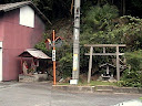
Koishidani-jinja.
Map Location.
   The idea to go in search of Fudo no Taki goes-back some months when, while on one of my hiking expeditions ( I was hiking along the Kizugawa between Kasagi Town and Minaimyamashiro, on what is known as the Tokaido Road.) when I stopped for a bite-to-eat at the Koishidani-jinja. While sitting on the Kagura-den (in the right in the image), and consuming my lunch in the beautiful sunshine, I spotted a pile of maps. Curiosity getting the better of me, plus my hobby of collecting & reading maps, I took a peek and soon discovered a huge network of hiking tracks in the hills behind Minamiyamashiro. I have passed-through these hills several times in the past and wasn't aware that there were so many lanes & tracks throughout the area. The hills have a plateau on the summit, before descending into Wazuka-cho, with many secluded villages spread throughout (my kinda' environment). But it was an icon on the map that captured my attention. Fudo no Taki was located in such a position that would allow me to do a one-way hike, beginning at Kasagi-cho, and finishing at the village of Yubune. 
Kasagi Bridge & Kizu River.
Video.
   After crossing the Kizu River, via the Kasage Bridge, and before disappearing into the hills, an object midway up Kasagiyama captured my attention. Of the many times I have been in this area, I have never noticed this monument before (it has been placed on my "Must return and Check-out" list for a later date).
   From here I was to cross the very busy route-163 and head-into my kinda' environment - isolated settlements, rural scenery, dense forests/bush and, my most favorite, the sounds of the outdoors. The settlement of Yudani, still part of Kasagi Town, is one of those places where you envy those 
Yudani Settlement.
Video.
 that live there. But, as easy as it is for me to say that, I feel one has to be prepared for the isolation -  one can't just pop-around the corner for a bottle-of-milk. But dreams don't cost anything.


Map location.
   My first junction and my first Jizo of the day followed soon after, and, from here, time to farewell civilization and say hello to the hills and the forest. This area wasn't new to me. I discovered this mountain lane quite by accident when a signpost, informing me of a hiking course, lured me to investigate. On that occasion I was descending. 
   In the following video you get the impression I am unfit. Well, you would be partly correct. I have just spent the past hour ascending through a forest that still has splashes of Autumn color amongst the foliage. But, to emerge from that environment into the rural scenery of Dosenbo, was well worth the pain (brought-about by a pebble in my boot). 
 
   Passing through isolated areas, such as Dosenbo, one quite often stumbles-across interesting places such as this.
Video.
I have passed this dwelling twice in the past, both times on bike so, on this occasion, I was able to take a good look at it. My first impression, judging by the outdoor furniture, that this was an isolated cafe. No such luck. I would have fancied a coffee at this moment.
Map location.
   Three junctions later, and more great rural scenery, I arrive at this point. My plan is to take the right branch to Fudo-no-Taki then, upon return, continue via the left branch. My research leads me to believe that this track will bring me onto another track and, eventually onto route-5. But first, lets check-out the waterfall. I found the track to the 'falls to be undulating but, within about 5-minutes, I could hear the distinct sound of rushing water.
   I am always conscious, especially when on my own and in an isolated area, of the risks involved if I become too eager to explore the surroundings. And this is no exception. After the rain of the previous day, I was aware that the rocks may be slippery. And they were. As I got closer to the 'falls, the sound was quite deafening, as is evident on the video.
Hidden to one side, in amongst the bush, I spotted this old wooden ladder & guide-rope (or what was left of it) and, putting two-and-two-together, I deduced that it led to the top of the 'falls. Ascending & descending this wasn't easy. In one pocked was my (new) video-camera. In another was my G.P.S. device and, in my hand, was my other camera & tripod. But I made it. 
   The view from above was as brilliant as the view from below,but much more dangerous and, as the surface of the rocks were treacherous, I wasn't taking any risks. But up there, I could see how the water has gouged-out the canal into many smooth and various shapes. I am keen to return and take a better look further upstream. I got the feeling there was much more to see. Back to ground-level and a bite-to-eat before exiting and onto my next destination - bush-bashing through uncharted and unsignposted terrain.
Video.
   About 200-meters into the bush the track came to an abrupt end, and I was then left with the decision - do I u-turn or continue ahead? As I could see a stream below me, I decided to ascend to it and follow it out in the hope it would connect me to my next junction and onto route-5, and a lunch-stop. The video gives you an idea of the terrain I had just emerged from. As-soon-as I emerged onto the track, I knew exactly where I was and lunch was only a few minutes away.
Map location.

    
Lunch was at this disused (I suspect) cafe, and consisted of hot curry and bread-sticks, washed-down with a coffee. It also allowed me the opportunity to remove my boots and air-out my feet, before the next and final segment.
   The next 5-kilometers were along the narrow route-5 and a very different environment - farmland. 
Video.
And, in this case, Tea. Check-out how narrow the road is, and how close to the road the tea plants are. A good insurance policy is needed by the workers harvesting the tea.
Video.


My next destination was the village of Yubune and the settlement of Nakayama. A few weeks back, while out on my bike, I stopped-off here and discovered this amazing Temple and I was eager to return with video-camera. If the settlement itself was quaint, the temple was just awesome. Access was through the settlement and up some steep steps before arriving at the complex. 
   My plan was to end my day here then catch the bus back to the J.R.Kamo Station. This being an isolated rural area, the bus-service is few-and-far-between and I soon realized I had an hour to kill. So, what better way to pass-the-time, than a stroll through Yubune.
Map location.

I was also on the look-out for a spot where I could sit and use-up the last of my hot water for one more cup-of-coffee with the spicy doughnuts in my pack. And, as luck would have it, I happened-across the local Gateball court, where some senior residents of the town were competing. This was the perfect end to the perfect days hiking. 

   
   Links;   Kasagi-to-Yubune. Part-1.
                 Kasagi-to-Yubune. Part-2.
   

No comments:

Post a Comment