My latest Post.

This view,this beauty
A tear unbidden
Creeps into my eye.

My stay is short
But I shall return to this place
If only my life is long enough.

Such beauty
Gazing upon it
I hope my years are many.

Bokusui Wakayama.

Thursday, September 21, 2017

The [S]Torii Still Contunies.


   If you read my post - 'Rural Nara Circuit' - you may have been impressed with my discovery of this metal Torii, partly obscured by trees and undergrowth, along route- 186 in the settlement of Nakahatacho, rural Nara.
   A Torii is suppose to signify a gate, or entrance to a Shinto Shrine. So, when I stumbled-across this find, I was keen to see if/where the shrine was. Nothing. This bugged-me and I needed to know more.


     So, 5-days after that visit, I returned on my 'The [S]Torii Continues' trip to see if more lies in the bush surrounding the Torii and, hopefully set my obsession to rest.
   Upon my arrival I forwarded a copy of this image - the tablet hanging from the Gakuzuka, or supporting strut - to a friend, and a reply came back almost immediately. The inscription reads, "Hachidai Ryuou Oogami", and is about the God who shaped the Dragon with Eight Bodies and is said to be the God of Water.


   As I was looking about, I discovered what looked like a track and, as I was only wearing my cycling shoes, decided to end my search there, with the intention of returning and seeing where the track leads.


   Today I arrived at the Torii on two feet, after a 90-minute bus & train ride to get to Yadawaracho, and took my time, as I strolled through the aftermath of the rice-growing season. On my first visit, 10-days prior, this looked so very different.

     Just as I was about to emerge onto route-186, I spotted this track and wondered where it lead to. A quick check of my internet map revealed it joined the track I was about to take. I would keep a lookout for this junction as my day progressed. 


   Once I set my G.P.S. App' into recording mode, I didn't waste any time getting underway. As I made my way down the hill I soon arrived at a stream, that I noticed how it's banks had been lined with rocks. I would experience many situations like this throughout the course of the day.

   I soon arrived at the spot where I ended my walk five days earlier. On a couple of trees in my vicinity, I espied some red tape and what looked like a track. As I was still close to the road, I felt this may return me to where I started and so moved-on. A little further on and, another rock-lined section of the stream, and what looked like the remains of a bridge.


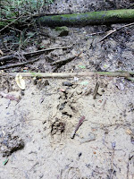
   As I was making my way along the stream, crossing it from time-to-time, I couldn't help but get the feeling I wasn't the only life-form that had recently passed through this way. I encountered many wild deer tracks running alongside the stream so, if I kept my noise-level to a minimum, I might be lucky in seeing one-or-two. 


   At times my track required some risky maneuvering - rock-hopping across the stream, clambering up the bank, bush-bashing - when, suddenly, I arrived at this junction. I decided to leave my planned route for a few minutes and take the other track when I suddenly realized this was the track I saw earlier. This was later confirmed when I checked my internet map.


   Up to this point I had come-across many forms of fungi, most of them on broken branches and tree-stumps. Some of them quite beautiful and in an assortment of colors.


   My next stop was at this bridge. Checking my map, to see where the track lead to, and liking what I saw, I decided on this occasion I would detour from my planned course. But, fifty meters on, I met a wall of overgrown scrub, vines and bamboo and soon u-turned back and continued on my way.

   
    The track, at this point, was becoming more defined and, as can be seen in this image on the right, just a beautiful. I was beginning to get the feeling I was closing-in on civilization and the conclusion of my days hike. So, while here, make-the-most-of-it and slow the pace a notch, or two. It had been just over an hour since starting-out.

       
   I was about to encounter my third, and final, rock-lined section of stream and a site that gave me the feeling there had once been a settlement here. The risky-looking bridge led to an area, about the size of a rugby field, that looked like it had been excavated many moons ago and all that remained were a scattering of trees. I took the path down to take a closer look. There was no evidence of any buildings, or pits, or water troughs. Strange.


     Gradually my course had progressed from a dirt track, to a concrete path and then finally a sealed lane. I turned a corner and, there in front of me, was the settlement of Kitatsubaocho. And the end of this section of my days hiking. After arriving at the junction, and switching-off my G.P.S. App', I headed up the road to Shoryaku-ji Temple, and . . . .


. . . . lunch. My feet were killing-me, and I needed to take-a-break, rest-up and take on sustenance. I discovered, when removing my boots, I had forgotten to insert the inner-soles. I thought there was something I had forgotten.

      From here I made my way through another forest, passing this Tumulus Pond, and eventually joined the Yamanobenomichi Path, one of the oldest paths in Japan, that would take me onto . . . . 

. . . . Nara Park. And another mug-of-coffee and sultana buns, before my final stretch to Nara station, and my train home. Although my curiosity over the Torii wasn't satisfied ( I hope that will happen this weekend, when my wife and spend the day at Yadawaracho), it was still a great days hiking.


So, until next time - 

               Sayonara. 


    Course details - https://ridewithgps.com/trips/17825270                                             

Sunday, September 17, 2017

The [S]Torii Continues.


   'The [S]Torii Continues', not a bad pun if I say so myself. All witticisms aside, it's that time again where my obsessive tendencies resurface, and I can't get something out of my head until I do something about it. This time the guilty object is this metal Torii I discovered along route-186, in an area bordering Nara and Tenri cities or, more accurately, the settlement of Nakahatacho.


   I was in the area on my 'Rural Nara Circuit' ride, and had just emerged from the settlement of Yadawaracho, onto route-186. A few hundred meters along from the junction, was this metal Torii, partly camouflaged by trees and assorted undergrowth and, I am hesitant to add, discarded refuse. After leaning my bike against a tree, I decided on a quick scout-around for any sign of a Shinto Shrine - nothing ( although I only took a fleeting look). Since returning home, I decided to take a closer look but not return via the same route and, while in the area, I might-as-well check-out what lies in the settlements and lanes of this area of Nara. I decided to make Kasagi Town my destination.


   I made a bee-line for Yasaka-jinja Shrine (Map Location), which lies on the border separating the city area of Nara from the rural. After a quick banana and setting-up my cameras, I was off onto a lane that has painful memories for me - several years ago, while ascending this lane, during the peak of summer, I collapsed of heat exhaustion. Luckily today it was much cooler and I experienced no problems.


     As I was making my descent onto route-80, I came-across this interesting site. To the casual passer-by, this may look like a derelict shed but, upon closer look, there is a large Buddhist Icon inside - maybe a Jizo. There were fresh flowers at the altar, indicating someone had been here recently. Outside, camouflaged by an assortment of undergrowth, was this well. The conclusion I came to was, with ladles close-by, that this may be a Chozuya. From here my lane emerged onto route-80 and the settlement of Yadawaracho, which I planned to take a closer-look at but, before that, I was to re-enter the rural environment and make my way to 'The Torii'.
Map Location.


   It was still there - not that I doubted it wouldn't be - and, when I found a suitable place to park my bike, I took a photo of the name plate (image on the right) and forwarded it to a friend to see if he could shed any light on the matter. Then I set-off to explore the site. A track, of sorts, attracted my attention and I decided to check where it went. I gradually descended, following a small stream, that eventually joined a larger stream, and signs that this was part of a hiking course - red tags tied to trees, discarded litter - but nothing to suggest the presence of a shrine.


   This is the environment I like & appreciate so much and I soon found myself in a trance as I admired my surroundings. While here I accessed my 'Google Maps' site to check my location. It was then I got a shock - I have been in this area before. Some years ago, when exploring the site where a castle (Tsubakio-jo) once stood, I bush-bashed down through a dense forest to a stream that eventually emerged amongst civilization. In this instance, the settlement of Kitatsubaocho. This was that stream.

   As I was only wearing my cycling shoes, I decided to end my exploration here (maybe returning later) and return to my bike. As I arrived I received a message from my friend with some very interesting information. The inscription reads - "Hachidai Ryuou Oogami" (the attached link is very interesting)- and is about the God who shaped the Dragon with eight bodies and is said to be the God of Water. 


   Now it was time to check-out the settlement of Yadawaracho, and some interesting surprises. The first of them being . . . .


  . . . . this Indian restaurant. Located where three narrow lanes converge, 'Vanam' is one of those places you would come to, to get-away from the city and all it's trappings. It is a combination of restaurant, cafe and cooking-class. As-much-as I would have loved to stay (has been placed on my 'must return' list) I needed to move-on. The reason why I chose this area was that, according to 'Google Maps', there was a museum opposite the restaurant. Sadly someone got the location wrong and it was further away.

   Lanes through settlements like Yadawaracho are like the vascular system of the human body, so I just cruised up-and-around and around-and-back, with no set course in mind.


   Then, just as I was cruising along a narrow lane (narrow enough to allow one vehicle at a time, albeit a small vehicle), out of the corner-of-my-eye I spotted this vermilion-colored Ryobu Torii. So named after the long association with Ryobu Shinto. As I was standing here, contemplating what to do next, a local approached me with a map of the settlement with local sights. This is the entrance to Tenmangu Shrine (Map Location), a hilltop shrine.


   With three flights of rock steps from this side, and a track descending on the other, needless-to-say what my plan was. With a flat stone row on either side of the steps, I thought this would be a piece-of-cake. I didn't bank on the following two flights not having these stones. But it was worth the struggle.


   As I neared the end of the third flight, I turned a corner, and there it was - Tenmangu-jinja. And what a sight. As I was doing good time, and my body wasn't showing any signs of exhaustion, I decided to take a short rest, take-on some fluids, have a banana, take the obligatory photos, before moving on. Places like this are so serene and quiet one doesn't feel like leaving. Although the peace was about to be broken by the mandatory fire sirens that go-off at this time of day, 12pm.


   The track descending from Tenmangu-jinja, didn't just give access to the shrine, but the tea plantations that dotted this side of the hill, and was quite overgrown with grass. Making the track a bit hairy in places. So care was needed. 

   Once back on the sealed road, my next destination was the Mausoleum of Emperor Konin (Map Location). Emperor Konin was the 49th Emperor of Japan, and sat on the throne from 770 -to- 781, before handing-over the reins to his son, Yamabe. Emperor Konin died a year later at the age of 73.


   My next destination was the Yagyuuyamaguchi-jinja, and a long-overdue lunch-break. But, before then, some serious and dense bush track to contend with. I was in familiar terrain, having cycled & hiked through this area several times in the past, and was keen to photograph a Sekibutsu that I knew existed in this area. But sadly it wasn't to be this day. The bush was so dense I had to give-up on the idea and rejoin the sealed road. Not to worry, there were other carvings of the like I was to experience.


                                                                                                                A few kilometers down from where I emerged from the bush, I turned a corner and was greeted with this sight - rural Japan at it's very best. In this instance, the settlement of Oyagyu. It would have been a more magnificent sight before the rice fields were harvested. All that green. 


   Yagyuuyamaguchi-jinja is located along the 'Old Yagyu Road', a road that was created to connect the town of Yagyu with Nara, at the time when a Kenjutsu, or a school for swordsmanship, was created here in 1565. It is a great road to walk and requires a full day to complete.

   But, for me, my main concern was to satisfy my hunger and take-on some fuel. I knew I was close to my destination of Kasagi, and another 30km after that to home, so I needed to rest-up before moving-on.


   After passing-through the town of Oyagyu, my next destination was the settlement of Sakaharacho and this stone carving of Buddha. This is a very small example of this type of icon, and, if not paying attention, very easily missed. The lane I was cycling on was narrow, windy and, in places, dangerous. As I discovered earlier, when I nearly came in contact with a postman, you never know what is coming-around the next corner. This is the first (it would have been the second if the bush wasn't so dense) carving of the day, the next was just a few kilometers away at . . . .


. . . . the settlement of Shimosagawacho. The story goes that these were placed on the outskirts of a village to ward-off any evil spirits that may have it's sights on the local population.


   The final stretch into Kasagi was uneventful and, when I reached the Kasagiohashi bridge, I was beginning to feel the strain of my day and thinking about to next 30km to home. But, before then, I needed to wrap-up my video recording and pack my cameras away. And knock-off the last two bananas in my pack.


   Although this trip did satisfy my obsession, and, thanks to my friends for researching and providing that information, I still want to return and, this time, check-out the stream and what lies beyond the Torii.


So, until next time - 

Sayonara.


   Trip details and images - https://ridewithgps.com/trips/17715746