If you read my post - 'Rural Nara Circuit' - you may have been impressed with my discovery of this metal Torii, partly obscured by trees and undergrowth, along route- 186 in the settlement of Nakahatacho, rural Nara.
A Torii is suppose to signify a gate, or entrance to a Shinto Shrine. So, when I stumbled-across this find, I was keen to see if/where the shrine was. Nothing. This bugged-me and I needed to know more.

So, 5-days after that visit, I returned on my 'The [S]Torii Continues' trip to see if more lies in the bush surrounding the Torii and, hopefully set my obsession to rest.
As I was looking about, I discovered what looked like a track and, as I was only wearing my cycling shoes, decided to end my search there, with the intention of returning and seeing where the track leads.
Today I arrived at the Torii on two feet, after a 90-minute bus & train ride to get to Yadawaracho, and took my time, as I strolled through the aftermath of the rice-growing season. On my first visit, 10-days prior, this looked so very different.
 Just as I was about to emerge onto route-186, I spotted this track and wondered where it lead to. A quick check of my internet map revealed it joined the track I was about to take. I would keep a lookout for this junction as my day progressed.
Once I set my G.P.S. App' into recording mode, I didn't waste any time getting underway. As I made my way down the hill I soon arrived at a stream, that I noticed how it's banks had been lined with rocks. I would experience many situations like this throughout the course of the day.
I soon arrived at the spot where I ended my walk five days earlier. On a couple of trees in my vicinity, I espied some red tape and what looked like a track. As I was still close to the road, I felt this may return me to where I started and so moved-on. A little further on and, another rock-lined section of the stream, and what looked like the remains of a bridge.
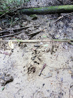
As I was making my way along the stream, crossing it from time-to-time, I couldn't help but get the feeling I wasn't the only life-form that had recently passed through this way. I encountered many wild deer tracks running alongside the stream so, if I kept my noise-level to a minimum, I might be lucky in seeing one-or-two.
At times my track required some risky maneuvering - rock-hopping across the stream, clambering up the bank, bush-bashing - when, suddenly, I arrived at this junction. I decided to leave my planned route for a few minutes and take the other track when I suddenly realized this was the track I saw earlier. This was later confirmed when I checked my internet map.
Up to this point I had come-across many forms of fungi, most of them on broken branches and tree-stumps. Some of them quite beautiful and in an assortment of colors.
My next stop was at this bridge. Checking my map, to see where the track lead to, and liking what I saw, I decided on this occasion I would detour from my planned course. But, fifty meters on, I met a wall of overgrown scrub, vines and bamboo and soon u-turned back and continued on my way.
I was about to encounter my third, and final, rock-lined section of stream and a site that gave me the feeling there had once been a settlement here. The risky-looking bridge led to an area, about the size of a rugby field, that looked like it had been excavated many moons ago and all that remained were a scattering of trees. I took the path down to take a closer look. There was no evidence of any buildings, or pits, or water troughs. Strange.
. . . . lunch. My feet were killing-me, and I needed to take-a-break, rest-up and take on sustenance. I discovered, when removing my boots, I had forgotten to insert the inner-soles. I thought there was something I had forgotten.
 From here I made my way through another forest, passing this Tumulus Pond, and eventually joined the Yamanobenomichi Path, one of the oldest paths in Japan, that would take me onto . . . .
. . . . Nara Park. And another mug-of-coffee and sultana buns, before my final stretch to Nara station, and my train home. Although my curiosity over the Torii wasn't satisfied ( I hope that will happen this weekend, when my wife and spend the day at Yadawaracho), it was still a great days hiking.
So, until next time -
Sayonara.
Course details - https://ridewithgps.com/trips/17825270


No comments:
Post a Comment