 |
| Sajikigatake - map location. |
So as not to cover too much of the same path from my last visit, I decided to take an alternative route to Sajikigatake and detour around Shimyo-in Temple which was to save me time, but at a cost. It was steep. 10-minutes in, and I reached this junction.
As I slogged my way up the concrete track I passed these two dilapidated shelters, which was comforting to know. Just in case there was a sudden downpour.
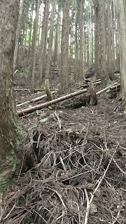
Then suddenly the track came to a halt and, as I scanned to scene in front of me, I spotted red tape tied to some trees that eventually disappeared up the hill. The track to the top junction was well marked and, at the beginning, steep.
As I was ascending I passed this rocky outcrop of, what looked like from past experiences, the foundation stones of some building that may have been here.
Once at the top I was in familiar territory and Sajikigatake about an hour or so away. But, before then, another junction and a short detour . . . .
 |
| Map Location. |
Back on the track then, within minutes, I came to a clearing which gave me some awesome views of the rolling hills and mountains of North Kyoto. As I scanned further round I could see the suburbs of Kyoto City. Next time I come here, I must bring my binoculars to spot any familiar landmarks.
A few minutes on, and a view to the south, with the settlement of Omoriashidocho nestled in the valley (I passed through this settlement two weeks ago after my descent from Sajikigatake).
Approximately 2-hours after setting-out, I arrived at the summit of Mt Sajiki. And a bit-to-eat. After some mental calculations, my return to Kumogahata could be done at a more relaxed pace, and I set-about to check-out more of the summit and my views.
Unlike my previous visit, I was here alone but for this character, who kept me entertained with his lovely singing voice. Because I was taking a different route from the summit, I did a circuit to find any markers that would indicate my next track. Then, a few meters in, and down, I spotted some red tape on a tree.
Before I entered the bush, I took one more look at the surrounding hills of western Kyoto.
 |
| Map Location. |
Checking the map contours I became aware that my descent would be steep. Well, that was the understatement of the day. As the mud marks on the seat of my pants will testify. The track was adequately marked, until I came to a clearing. From here I could see my mud lane below me, but I needed to get there first. Which wasn't as simple as it sounds. A stream had appeared on my right, which I followed . . . .
. . . . to this makeshift bridge. The two logs looked dubious and, as I was crossing them, my mind went into overtime: "Please-please don't break". After my nerves settled, I then began the final leg of my journey.
The next 4-km were uneventful, that was until I happened-across this interesting religious icon. Interesting, because of it's location - in the middle of nowhere,nestled up a hill. It never fails to amaze me where one can come-across something like this. This one was unusual as it wasn't an icon I could recognize. Most are quite distinguishable.
A few hundred meters on, and around a corner, Kumogahata. Looking at my watch, I still had 2-hours before my bus. So, I set-out to find a suitable site for a bite-to-eat, check my map, and plan what to do until my departure. And, what better place . . . .
 |
| Map Location. |
Lunch over, and still over an hour to fill-in, I decided on a leisurely stroll down the valley to the Deai Bridge. The purpose being to check-out the area for a future hike in the area, and take in the surrounding scenery - like this house built into the bank, right on the edge of the lane.
 |
| Map Location. |
 |
 |
| Map Location. |
So, until next time, Sayonara.
Further images, in video form - https://www.youtube.com/watch?v=4FbKf2Eb5co
Trip details - http://www.cateyeatlas.com/trip/detail/589235/


