My latest Post.

This view,this beauty
A tear unbidden
Creeps into my eye.

My stay is short
But I shall return to this place
If only my life is long enough.

Such beauty
Gazing upon it
I hope my years are many.

Bokusui Wakayama.

Monday, February 11, 2013

Kiriyama Road.

Canton Avenue.
Map Location.

Pittsburgh City has Canton Avenue.


Baldwin Street.
Map Location.
Dunedin City has Baldwin Street.


    And Kasagi Town has Kiriyama Road.
   So, if you hadn't already guessed,what do these thoroughfares have in common? Answer; they are very steep. I checked-out Baldwin Street, when visiting Dunedin some years ago, and I found the most scariest part was the anticipation of our descent. Although not as steep as Baldwin & Canton ( from top-to-bottom, a distance of 2.1km, Kiriyama drops from an altitude of 312m to 84m, as can be seen in this page from "Ride with G.P.S.") but,what makes Kiriyama Road just as hazardous, are the many distractions and curves that interfere with your concentration. On the day I researched this post I used my ascent for any photo/video opportunities, and my descent to concentrate on the road.
Map Location.
   Although the road goes further up the hill, I have commenced the journey at the Torii, or entrance to Hachimangu-jinja Shrine. Before you leave, I suggest you take a wander around the grounds of the complex. It will be time well spent. From this point also, you get your first vista's of the area surrounding the town of Kasagi, as captured in this Video.
   To record my descent, I have three cameras - my INOU, mounted on my helmet, my video-camera, mounted on the handlebar (which I had to hold as it kept tilting-over) and a still camera in my pocket. After two false-starts (I will add the bloopers at the completion of this blog) I set off but, after a few meters, the first distraction.
Video.
Now, if you are crazy,you can take these steps, but I suggest you be sensible and keep to the track. A bit further on, and some awesome rural scenery unfolds in front of you and a very-sharp right-hand turn. This is the first test of your brakes and their reliability.
Map Location.
Video.
A minute later, and (another) great video-opportunity. At this location you get a great view of Kasagi Town and the surrounding countryside. Once you leave this lane, and join Kiriyama Road, the environment changes and you enter the residential segment of your descent (as the road is narrow and windy, I suggest you concentrate as a car or local may pop-out from one of the many houses or side lanes in the area), and an opportunity to meet some of the very-friendly locals.
Map Location.
Video.
A little further on, and tucked-away amongst some trees, is this small Inari-jinja. The vermilion-colored shrine is always a welcome distraction for me, no matter where I am or what my mode is. But, while here, I discovered two other items of interest - a bus-stop and an unusual door (as seen in the video).


It wasn't until my descent that I had the opportunity to meet more of the locals, on this occasion it was a family of Saru. I have stumbled-across many of these guys in this area and, although they can be quite entertaining, I never stay-around long enough to get to know them.
Map Location.
Video.
Time to meet more of the locals that inhabit this area. If it wasn't for this abandoned car, I wouldn't have had the opportunity to meet this couple (who were more-than-happy for the break from their renovation chores) who provided me with information about Hachimangu-jinja. In situations like this, when departing, the phrase "kiotsukete" is spoken. Which, when translated, means "take care" (I love it). In the image you can see how the road makes a very-sharp left turn. 
Map Location.
Video.
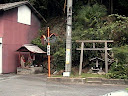
   Jizo's, found anywhere and in some of the most isolated of places, and this one is no exception. Most, like those described in the attached link, are little statuettes out in the open. Some, like this, are housed in small enclosures. Across the road is a homestead (photo at the heading of this page) that captured my attention. These buildings have a certain appeal to them. I'd say the view from the front room, overlooking Kasagi Town, would be spectacular. From here you are about to enter a series of sharp S-bends before the junction with route-163. But, there is one more distraction.....
Map Location.
Video.
"Love Hotels" are a Japanese icon, and very popular. Like the Jizo, they too can be found everywhere and in some isolated places.With Route-163 (a busy National Highway) just a stones-throw away, I couldn't imagine the guests having a very good nights sleep. But, there again, a good nights sleep wouldn't have been the only activity on the agenda. 
Map Location.
Video.
   A hundred-meters down from the Love-Hotel, your goal - the junction of Kiriyama Road and Route-163. Although I warn you in the video, I want to repeat my advice when reaching this point - make sure you stop in time.
   From here, if you still have time, I suggest you pop-across the Kizugawa River and soak-away your aches-and-pains in the Kasagi Onsen (Onsen) followed-up with a meal and drink in the restaurant. This would be the icing-on-the-cake to what (I hope) has been a great day.

   Extra Videos;
      This Video is from the camera on the handle-bars.
      Blooper-1.
      Blooper-2.
      From my INOU. mounted on my helmet.  


Saturday, January 19, 2013

Return to Fudo no Taki.

   
   I was here back in November 2012, In Search of Fudo no Taki, in what turned-out to be a great days hiking. The waterfalls weren't just the only experience that made my hike so memorable that day - the rural environment was abound plus the isolated villages I passed through. But, as I left the falls, and the weeks that followed, I have had this nagging feeling that there was more to see & experience in this area. It was the stream, that fed the falls, that was of interest to me so, after carefully studying my maps, I put-together a plan. 
Map Location.Video.
My route there was the same, as on my first trip, - depart from Kasagi Station, mountain track to Dosenbo Town then onto the 'Falls - through my kinda' environment. As the weather conditions were bleak - overcast, cold with flakes of snow - I was keen to keep on the move. Two-and-a-half hours and 13-kilometers later I arrived with my stomach making overtures to be fed. 
Video.
 The ice about the 'Falls prompted me to make a coffee along with a bite-to-eat. Fudo no Taki was as impressive as ever as I soaked-in the surrounding scenery. I was conscience that I was here on my own (I did leave instructions with my wife when departing home) and didn't want to do anything too foolish, like slipping on the rocks or getting wet. This location couldn't be more isolated.
Video.
About 100-meters back, before I made the short descent to the 'Falls, I spotted a sign that I am sure wasn't there the first time I visited. Now I knew I was onto something and my prediction was right - there is more to see & experience here. The track, after a short climb & descent through dense forest, emerged at the stream, not far from the top of the 'Falls. 
Location.
Video.
 All along the track I could hear the sound of the stream below, which was a very comforting, but it was the many logs, used for the growing of Shiitake, that caught my immediate attention. One can stumble across these (quite literally) in some of the most isolated of places, this being no exception. From this point the track became a narrow-muddy track, wide enough to drive a small vehicle on. Also in the vicinity, there was what I can deduce to be a camping/picnic facility. 
Map Location.
About a kilometer later I emerged from the forest into a rural environment and this small-isolated shed. Compared to many of these structures I have happened across, this one was in reasonably good condition. It overlooks rice fields about the size of three Rugby Fields and is surrounded by a tall electric fence. Who are they trying to keep out - deer,bears? Time to move on.
   My next destination was the village of Nodono, about 3km down the road, and Rokusho-jinja Shrine (Map Location).
Torii,entrance
to
Rokusho-jinja.
   From the first Torii that greets you, one walks in quietness along a pebbled-path through a forest of tall Cedars, until the second Torii, some 100-meters away. Once through you enter a serenity that I found difficult to leave. Evidence of the recent Shogatsu celebrations were still in place. As I mentioned in the Video, I have no information to include but, I suspect, this complex would have been frequented by those who were passing-by along the Tokaido Road, which skirts the village.
Benten-eke (Pond).
Map Location.
    About now I was becoming wary of the time, and I still had two more stops before my descent into the village of Tsukigaseguchi. The first being Benten-eke Pond. The small shrine, seen in the middle of the pond (in the image on the right) is dedicated to Benten-sama (Benzaiten), one of the Seven Gods of Fortune. As you can see in the video, the pond still has a thin coating of ice atop the surface. The track, on the right of the pond, led into the forest and, I hope, the last of my stops (according to my map) but, after nearly an hour of fruitless searching, I returned to the sealed road, and my descent.
Map Location.
About 2km into my journey I stopped for a break and spotted a sign partly obscured in the bush. Although my grasp of Kanji isn't anything to be proud of, some of the characters on the sign looked familiar. Upon closer inspection, with the aid of my map, the sign was giving directions to the object I searched for earlier. With time on my side, I entered the forest in search of........
Video.
Map Location.
   Roku-jizo Maigaibutsu. Now you can see why I was so obsessed in finding this carving. Let me explain; in Japanese, Roku means six. So, this is a carving of Six Jizo. But it's not just a carving, it's a Maigaibutsu. The Jizo are commonly found, in the shape of small statues, on the side of the road (as seen in the attached link) but, what intrigued me, was the location of this carving. If you look at the map location you will see what I mean. The only conclusion I came to was that this track was once part of the Tokaido Road and wary travellers paused here to offer prayers.
Yours Truly
and
Rokujizo Maigaibutsu.

With yours truly standing beside the rock, you get an idea of the size of the carving and it's height above the ground. Unless, since the carving was created, the ground has eroded, I get the impression the creator would have required some form of scaffolding to stand on. 
   Time to exit the forest and back to the sealed road. I estimated I had the best part of 5-km to walk, before my arrival at Tsukigaseguchi Station.
Abandoned Dwelling.
   After crossing the busy Route-163, I re-entered the bush and another abandoned building. As you will see in this video this, whatever it was, has some appeal and I couldn't help but stop and admire it. Some parts of it looked old - the mud & straw exterior cladding - but the electric door-bell made me think it wasn't all that old or that long-ago when someone resided there.
J.R. Tsukigaseguchi Station.
About seven-and-a-half hours after alighting the train at Kasagi, I finally reached my destination. This is an unusual station. The platform is elevated which allows panoramic views of the village and surrounding hills. From here I was able to look back from where I had just come from and reminisce about my day, but, unfortunately, with my train about to arrive, I couldn't do it while enjoying a drink of Sake to toast my accomplishment ( all was not lost, I did partake of a sip while on the train). Kanpai.

   Course Map.

Friday, November 30, 2012

No Plan - Getting Lost in Ujitawara.

Ujitawara.
 
   So, what is a "no plan - getting lost" trip? Quite simply, it's where I choose a destination (that's the only plan), make a bee-line for that destination then, upon arrival, find a thoroughfare (of any shape-or-size) and go from there. Up to now I have never got lost on one of these trips, unlike a planned outing when I am almost guaranteed to get lost. They are awesome. I never know what to expect and, on all the occasions I have done one of these trips, I have returned and, in many cases, added to my created course.

   On this occasion I chose the Jubu-san road that borders the towns of Wazuka and Ujitawara. I have traveled this road many times - both on foot and bike - and have descended some of the many tracks that take one through a variety of environments - tea-plantations, rice-fields, dense forest, picturesque-secluded settlements - to reach the bottom. 
Map Location.
   It was this gate that captured my interest and, after a few minutes break (to this point I was 28km from home, the last 10km uphill), I decided that this was to be the beginning of today's "No Plan - Getting-Lost" course. 
   This Video is an introduction to the Jubu-san road and the junction (I will attach a link, at the conclusion of this post, of the descent and emergence from the forest. As-well-as other videos) .
Linden Baum - cafe & restaurant.
Map Location.

   15-minutes and 4.5km later, after a descent of 384m, I emerged into the settlement of Shimonoto, on the rural-outskirts of Ujitawara, and my first "discovery" of the day - the Linden Baum Cafe & Restaurant. Tucked-away amongst this little community one could have quite-easily missed this (the only reason I found it was because I wanted to record a video of the area). 
   An obscure-overgrown track, that disappeared into the bushy-hillside, lured me to my next destination but, after some searching, I decided to give-it-a-miss and u-turned back to the village.
   As I was returning, I happened-across this derelict/abandoned house. A friend of mine (softypapa), who specializes in discovering & recording abandoned houses, stirred-up my interest in the same and I soon found myself checking this out.
   About 1km down the road I arrived at a junction, in front of me I could make out a busy road (it was route-307), so I took the lane to my right and headed back into the hills via the village Yuyadani. These thoroughfares are so narrow they must be hell to navigate in a truck/bus. This lane soon petered-out and emerged into a clearing where a junction, comprising of six tracks, converged. In front of me was a noticeboard with a map of all the hiking trails in the area (further on, at my next stop,I found maps of these trails) but, not wanting to venture too far from home, I u-turned and took another track back in the direction I had just come from. After passing-by a tea-plantation, I was soon confronted by two men who's car had got stuck in the mud (check this video out) and was obliged to assist. After several failed attempts, a third man offered to get his small truck and tow them.
Chasomyo-jinja.
Birthplace of
Nagatani Soen.

     Emerging from the forest I was soon to happen-across my next "discovery" of the day. This site came as a shock to me and I decided to rest-up, have a bite-to-eat, and check-out the surroundings. The Shrine, looking many hundreds-of-years old (in fact it was erected in 1954), is used to enshrine the spirit of Nagatani Soen who developed the tea-processing method which involves steaming, kneading and drying, and is still used today. As I passed-through the Shrine complex, I noticed signs informing me of a hiking course in the area. Upon return home, and some map research, I discovered the track finishes at the same area where I first commenced this course (needless-to-say, it has been placed on my "must do" list). Across the lane from the Shrine is the birthplace of Nagatani Soen and today is used to preserve the Hoiro (equipment used to roast and dry tea-leaves over a fire). 
   When recording this video, I retraced my steps to give you an idea of the emotion I experienced as I descended into this site.

   After lunch, which consisted of a sultana-malt loaf and some sticky chocolate donuts, and washed-down with a hot coffee, I was back on my seat and another secluded track. Exiting the settlement of Yuyadani, and back towards route-307, a narrow lane up into the hills caught my attention, and I was off to explore more of Ujitawara. 
Map Location.
   Passing through more tea-plantation, I was soon to happen-across another wee treat. Yes. Another cafe and, like the Linden Baum Cafe discovered earlier, this too is in an isolated location. Bugger, if I'd known earlier, I would have stopped here for lunch. But, not to worry, I'll be back (now where have I hear that before?).
Map Location.
   I soon found myself at another junction and, checking the road-sign - giving directions to Jubu-san - I knew exactly where I was (I have descended this track twice in the past and is hair-raising to say the least). A concrete Torii, still adorned in Autumn foliage, with a long flight-of-steps disappearing into the forested hills, was my next stop. As I was doing good time (it was not yet 12pm) I decided to check this complex out ( sorry, unable to attach a name). It was nothing special but, as I have a fondness for these sites (if you hadn't already guessed) I couldn't see any harm stopping.
   By now I am nearing route-307, and the commercial area of Ujitawara and the completion of this outing. But, there was one more wee find that nearly made me to come in collision with a car. 
Map Location.
This obscured vermillion-colored Torii, flanked by  two Kitsune, told me that this was an Inari Shrine and, once ascending the steps, I discovered that it was  in need of urgent repair but, as I looked-around, I realized that this complex fitted-in with it's  environs perfectly. As seen in this video.

   A hundred metres down the road from the Inari Shrine, was the Sannomiya-jinja, which was where I decided to bring this fantastic journey to an end. As I had seen & experienced so much during the past 4.5-hours, I was eager to get home (an hours cycle from here), upload my videos and photos and search the internet for any relevant information to include in with this post. And what a lot there was too. I will definitely be returning to the Ujitawara area to add to this course - I am already planning to hike the trail from Chasomyo-jinja to Kontai-ji, and hope to do it in the next week.

   So, from Ujitawara, thanks for reading and watch-out for more from my files of "No Plan - Getting-Lost" outings.

   Videos from today's outing:   Tea Plantation, Jubu-zan Road Ujitawara.

                                                                Descent from Jubu-zan Road.

                                                                   Emergence from mountain into Shimonoto.


Tuesday, November 27, 2012

In Search of Fudo no Taki.

      Taki, in Japanese, means Waterfall. Fudo, being a Buddhist God-Type   figure, is associated with Mountain Asceticism.


Koishidani-jinja.
Map Location.
   The idea to go in search of Fudo no Taki goes-back some months when, while on one of my hiking expeditions ( I was hiking along the Kizugawa between Kasagi Town and Minaimyamashiro, on what is known as the Tokaido Road.) when I stopped for a bite-to-eat at the Koishidani-jinja. While sitting on the Kagura-den (in the right in the image), and consuming my lunch in the beautiful sunshine, I spotted a pile of maps. Curiosity getting the better of me, plus my hobby of collecting & reading maps, I took a peek and soon discovered a huge network of hiking tracks in the hills behind Minamiyamashiro. I have passed-through these hills several times in the past and wasn't aware that there were so many lanes & tracks throughout the area. The hills have a plateau on the summit, before descending into Wazuka-cho, with many secluded villages spread throughout (my kinda' environment). But it was an icon on the map that captured my attention. Fudo no Taki was located in such a position that would allow me to do a one-way hike, beginning at Kasagi-cho, and finishing at the village of Yubune. 
Kasagi Bridge & Kizu River.
Video.
   After crossing the Kizu River, via the Kasage Bridge, and before disappearing into the hills, an object midway up Kasagiyama captured my attention. Of the many times I have been in this area, I have never noticed this monument before (it has been placed on my "Must return and Check-out" list for a later date).
   From here I was to cross the very busy route-163 and head-into my kinda' environment - isolated settlements, rural scenery, dense forests/bush and, my most favorite, the sounds of the outdoors. The settlement of Yudani, still part of Kasagi Town, is one of those places where you envy those 
Yudani Settlement.
Video.
 that live there. But, as easy as it is for me to say that, I feel one has to be prepared for the isolation -  one can't just pop-around the corner for a bottle-of-milk. But dreams don't cost anything.


Map location.
   My first junction and my first Jizo of the day followed soon after, and, from here, time to farewell civilization and say hello to the hills and the forest. This area wasn't new to me. I discovered this mountain lane quite by accident when a signpost, informing me of a hiking course, lured me to investigate. On that occasion I was descending. 
   In the following video you get the impression I am unfit. Well, you would be partly correct. I have just spent the past hour ascending through a forest that still has splashes of Autumn color amongst the foliage. But, to emerge from that environment into the rural scenery of Dosenbo, was well worth the pain (brought-about by a pebble in my boot). 
 
   Passing through isolated areas, such as Dosenbo, one quite often stumbles-across interesting places such as this.
Video.
I have passed this dwelling twice in the past, both times on bike so, on this occasion, I was able to take a good look at it. My first impression, judging by the outdoor furniture, that this was an isolated cafe. No such luck. I would have fancied a coffee at this moment.
Map location.
   Three junctions later, and more great rural scenery, I arrive at this point. My plan is to take the right branch to Fudo-no-Taki then, upon return, continue via the left branch. My research leads me to believe that this track will bring me onto another track and, eventually onto route-5. But first, lets check-out the waterfall. I found the track to the 'falls to be undulating but, within about 5-minutes, I could hear the distinct sound of rushing water.
   I am always conscious, especially when on my own and in an isolated area, of the risks involved if I become too eager to explore the surroundings. And this is no exception. After the rain of the previous day, I was aware that the rocks may be slippery. And they were. As I got closer to the 'falls, the sound was quite deafening, as is evident on the video.
Hidden to one side, in amongst the bush, I spotted this old wooden ladder & guide-rope (or what was left of it) and, putting two-and-two-together, I deduced that it led to the top of the 'falls. Ascending & descending this wasn't easy. In one pocked was my (new) video-camera. In another was my G.P.S. device and, in my hand, was my other camera & tripod. But I made it. 
   The view from above was as brilliant as the view from below,but much more dangerous and, as the surface of the rocks were treacherous, I wasn't taking any risks. But up there, I could see how the water has gouged-out the canal into many smooth and various shapes. I am keen to return and take a better look further upstream. I got the feeling there was much more to see. Back to ground-level and a bite-to-eat before exiting and onto my next destination - bush-bashing through uncharted and unsignposted terrain.
Video.
   About 200-meters into the bush the track came to an abrupt end, and I was then left with the decision - do I u-turn or continue ahead? As I could see a stream below me, I decided to ascend to it and follow it out in the hope it would connect me to my next junction and onto route-5, and a lunch-stop. The video gives you an idea of the terrain I had just emerged from. As-soon-as I emerged onto the track, I knew exactly where I was and lunch was only a few minutes away.
Map location.

    
Lunch was at this disused (I suspect) cafe, and consisted of hot curry and bread-sticks, washed-down with a coffee. It also allowed me the opportunity to remove my boots and air-out my feet, before the next and final segment.
   The next 5-kilometers were along the narrow route-5 and a very different environment - farmland. 
Video.
And, in this case, Tea. Check-out how narrow the road is, and how close to the road the tea plants are. A good insurance policy is needed by the workers harvesting the tea.
Video.


My next destination was the village of Yubune and the settlement of Nakayama. A few weeks back, while out on my bike, I stopped-off here and discovered this amazing Temple and I was eager to return with video-camera. If the settlement itself was quaint, the temple was just awesome. Access was through the settlement and up some steep steps before arriving at the complex. 
   My plan was to end my day here then catch the bus back to the J.R.Kamo Station. This being an isolated rural area, the bus-service is few-and-far-between and I soon realized I had an hour to kill. So, what better way to pass-the-time, than a stroll through Yubune.
Map location.

I was also on the look-out for a spot where I could sit and use-up the last of my hot water for one more cup-of-coffee with the spicy doughnuts in my pack. And, as luck would have it, I happened-across the local Gateball court, where some senior residents of the town were competing. This was the perfect end to the perfect days hiking. 

   
   Links;   Kasagi-to-Yubune. Part-1.
                 Kasagi-to-Yubune. Part-2.
   

Tuesday, October 16, 2012

The Kozuya Bridge.

Kozuya Bridge.
Map/Location.
   The image on the left, taken recently, is of the Kozuya Bridge on a good day.


Kozuya Bridge.
Map/Location.

   The image on the right, taken today (Sunday 14th October 2012), is of the same bridge after the forces-of-nature had flexed their muscles.


   But, before I explain how one image drastically changed to become the other, let me give you a brief run-down of the bridges history.
   The bridges history dates-back several hundred years and spans the Kizugawa River and connects Yawata-shi (city) with Kumiyama-cho (town) in Joyo City. The bridge, at 356-meters long and 3.3-meters wide, is the longest extant wooden bridge in Japan. The modern bridge was constructed in 1953 to replace the ferry service, which was abandoned in 1951. The bridge is a popular stop on the Kizugawa cycle/walkway and, before descending the path, there is a nice shelter/picnic area where the traveller can rest-up and take in the surrounding scenery.
Many festivals are acted-out on the bridge, like the "Jidaigeki Matsuri" Festival, in the image on the left, with participants dressing-up in traditional Japanese costume. One will also witness the occasional television/film crew recording the latest blockbuster here too.
   The Kozuya Bridge, also known as the "Nagare Bashi" or "Flowing Bridge" (Nagare meaning flow,and bashi meaning bridge), was constructed in such a way that, whenever the river is flooded, the wooden floor will become afloat and wash-aside to one side of the river where it won't go-against the force of the current and thereby evading total destruction of the bridge. The reason why the wooden floor won't be washed-away, is because each section of the floor (all eight of them) are attached to the pier with wire ropes. 
The wooden piers are the only permanent parts of the bridge but, in saying that, they have been known to buckle-under the pressure when the water current has been too strong. Since 1953, when the current bridge was constructed, the bridge has been damaged sixteen times, four of those times in the eight years since I have been in Japan.

   I should have mentioned at the beginning of this post that there are two topics I wanted to cover. The second being the destruction caused by the forces of nature. The events of the 7th April 2011 - 2011 Tohoku Earthquake and Tsunami - are still fresh in the minds of many people; I remember watching the events unfold live on television, as did many millions of others, and sat overwhelmed at how houses, boats, motor-vehicles were just swept-aside, as this huge wall of water wiped-out many towns & villages in it's path. This bridge, after a flood, reminds me of the devastation that can be caused by an uncontrolled wall-of-water.
    It's difficult to say where the source of the Kizu River is but, looking at a map of the area, it's catchment is quite extensive so, when there is a long/heavy rain, there is sure to be some water flowing down to it's final destination - Osaka Bay.
The Kozuya Bridge from Kizugawa Cycle/Walkway.
Map/Location.
  As I approached the bridge, and got-over my initial shock of the destruction, I was intrigued as to where the river was. When you look at this image on the right, you can see the entire 350+-meters of the bridge has been wiped-out, but today, the river can just barely be seen (it's in the center-right in the image).
Entrance to Bridge.
Map/Location.
   The bridge is still popular with sightseers who, like myself, have come to marvel at the destruction (while I was here, I estimated several-dozen others in the vicinity).
   
Map/Location.


   The sight of this tree-stump, in this image on the right, brings-into perspective how high the river level must have been ( I am about 4-meters from the top, with about another meter to go, before I reach the river-bed).
The Wooden Floor.
  In the image below, you can see how the wooden floor has become detached from the main structure, but is still attached by the wire- ropes. I guess this flood mustn't have been as bad as previous floods, judging by the way the floor is still in close proximity to the bridge and not further downstream.


   In the two images above you get an idea how much debris can be washed-down a river during a flood. I have passed by many rivers after there has been a flood and there are many things that impress me - the amount of water and where it has come from (I am talking about rain here), how suddenly the river-water can rise & recede, and the debris. Wandering-around the bridge, there was very little pickings to sift through. My only hope, looking at the accumulated scrub, that no-one leaves a burning cigarette behind.
Nagare-bashi at sunrise.
    Before I sign off I will include one final image of the Kozuya Bridge at sunrise. If you are in the area, why not come-down, bring the kids and picnic and take-in the surrounding scenery. I can assure you, bridge or no bridge, it won't be a waste of your time.

   Links;   Video of Kozuya Bridge. 
                   Yawata City.