My latest Post.

This view,this beauty
A tear unbidden
Creeps into my eye.

My stay is short
But I shall return to this place
If only my life is long enough.

Such beauty
Gazing upon it
I hope my years are many.

Bokusui Wakayama.

Monday, April 27, 2015

Sajikigatake.

Map Location.
   I have been in this area several times over the years on my mountain-bike and, on those occasions, I only went as far as the junction of routes-61 & 107 before heading for home. Whenever I was there I always wondered what was further up route-61. Then, a couple of months ago, when I was reading Wes' latest blog - Mt Sajiki - Sinking In. - my curiosity was further aroused. So, before long, I was digging-out my maps and planning my second hiking trip for 2015. I had to do a lot of research as to how to get there, what track to take, and where to finish my hike at. I decided on a one way course, commencing at Kumogahata and ending at Onogocho. With only two return buses from Kumogahata, and a more regular service from Onogocho, my plans were made.


    Alighting from the bus at the hamlet of Kumogahata
was like stepping-back in time; arriving here required one bus, followed by a train, then two subways and finally a 9-seater bus, a total of 2.5-hours travel. The 9-seater was full to capacity with three different groups and, as the day progressed, our paths would cross (no pun intended) more than once. To allow the others to get on the trail ahead of me, I spent the time preparing my cameras, relieving myself, and removing my hiking jacket and storing it in my pack (even at 9:10am it was beginning to heat-up).
Map Location.
   Once organized and on the road, my first stop was Shimyo-in Temple, 15-minutes away. As cameras and backpacks weren't permitted beyond the main gate, the above image is all I have to share. As a tour of the complex would have taken the best part of an hour, I opted to move-on, placing Shimyo-in on my "Must Return" list.
   From this point I was leaving-behind the sealed road and entering into mountainous terrain and the summit of Sajikigatake, criss-crossing a narrow stream that, as I proceeded, would soon disappear. About 40-minutes in, my first junction, and first wrong-turn of the day. As there were no signposts about, I checked my map and, putting two-&-two together, took the ascending track on my left. Wrong decision. 10-minutes further on I reached a summit, and the two ladies from the bus. They passed me while I was at the temple. Asking where I was, they informed me I had to back-track to the junction and take the track directly in front of me. As I was returning, I passed by the second group from the bus. Once back on the right track, Sajikigatake was just over an hour away. I was doing good time and, as it was closing-in on midday, time for a bite-to-eat. 
Map Location.
   I had no sooner sat down, and began tucking-into my lunch, when the third group from the bus arrived. If these guys had left before me, how was it I arrived at the summit before them? As they could speak English, we had a good chat about hiking and what tracks we have hiked. During our chat, the second group, who I passed earlier, arrived. After a good feed of curry & chocolate breadsticks, washed-down with two cups of cafe au-lait, I decided it was time to move-on. As the others were returning to Kumogahata, and the bus back to Kyoto, I was making my way, via another track, to the settlement of Onogocho. 
Destination.
   I had been warned that my track had some danger attached to it, and was very steep. It was by coincidence that I found the junction. Unlike the track(s) to this stage, this one was poorly marked and, as I progressed, I had to stop at each marker to find the next, before proceeding. I soon emerged into a clearing and was rewarded with this fine view overlooking the settlement of Omorihigashicho, about an 1-hour and several hundred meters descent away.


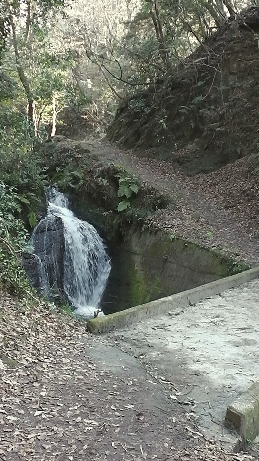
   The stream I was following, as I made my descent, suddenly disappeared and, as I was soon to discover, reappeared as this five-or-so meter high waterfall from a rocky outcrop. Any other day I would have stripped-off and took a well deserved shower.
   Soon my track would emerge onto a forestry skid-site and the access road now became my path to civilization and a smooth sealed road about 2km away. The Amori Resort Camp was my first contact with civilization and, judging by the many cars parked outside, was doing a good trade.
Map Location.
   As I progressed down the valley I passed a complex with some Sakura still in bloom, reminding me how beautiful this time of year is in Japan. Hanami is one of my most favorite celebrations and I look forward to the occasion each year.
   A bit further on and I was reminded of another important time of year - rice harvesting. It is now that the farmers will be flooding their fields and rotary-hoeing them in preparation for planting. To pass by a large area at the different stages of rice growing, can be a sight-to-behold.

Map Location. 
   The next 2km were uneventful and, just as my stomach, and feet, were reminding me to take-a-break, I turned a corner and there was Iwatoochiba-jinja Shrine. And the settlement of Onogocho, my destination. But, before I did anything else, I headed-off to check-out the nearest bus stop and timetable. Much to my confusion, at the time, the nearest stop was a kilometer up the road (little did I know it was near the shrine, thanks to the local policeman) and, upon arrival, I discovered I had about 90-minutes to wait. Great news as I could return to the shrine, have a bite-to-eat, take my boots off, and reflect on the day.
   
Kagura-den.
  Now, you would never believe what was about to happen. I was sitting on the stage, basking in the beautiful surroundings, having a hot cafe au-lait & current buns, when the two ladies from the bus suddenly appeared out of the bush. This was our third meeting of the day and Onogocho was their final destination too. After our last meeting, at the summit where I took the wrong turn, they headed in the opposite direction to me and, in a round-about way, ended-up here. Thankfully they could speak English and we had an hour or so chatting about hiking.

Map Location. 
3:53pm, and time to board the bus for home; the return trip consisted of one bus, followed by a walk, then train, then another bus-ride and finishing with a 10-minute struggle home. My hikers reward of a "One Cup Sake", that travelled with me, remained unopened to be used for another hike, but the two large cans of beer in the fridge, went-down a treat. Kanpai.
                                                 So, until next time, Sayoonara.

   Course details: http://www.cateyeatlas.com/trip/edit/complete/562976/
                                        http://www.cateyeatlas.com/trip/detail/562977/

   Video: https://www.youtube.com/watch?v=X0O9MOCclXM

   I would also like to acknowledge Wes, at Tozan Tales, for allowing me access to his site. Without his post this trip wouldn't have been possible.

Wednesday, March 12, 2014

Shijonawate Stn' to Ishikiri Stn', via Mt Ikomayama.

 
    This course comprises of four tracks that, in two instances, run in conjunction, or on the same stretch, albeit for about 50-meters. Having been in this area many times over the years, I was aware of the scenery in store for me but, my main reason were the several Temples and Shrines located along my course (if you hadn't guessed by now, I have a strong interest in these complexes).
Map Location.
   I departed from the J.R. Shijonawate Station in perfect hiking conditions - fine, calm & warm - and, after weaving my way through the throngs of people and traffic, made my way to my first junction; entrance to Shijonawate-jinja Shrine. In the past, when I have come hiking in this area, my path has taken me through the shrine grounds, followed by a steep ascent up the hills behind.
    But, on this occasion I was taking the lane on my left through a compacted residential area. This map helped confirm my route and, as I navigated my way through the maze of narrow lanes, being helped along my way with a series if signposts, to my first religious complex, . . . . 
Map Location.
. . . . Mitsukue-jinja Shrine. Not an enormous complex, compared to the likes of Fushimi-inari, but it lay on the border that separates the urban from the rural area of Shijonawate, which reminded me that I was now in my kinda environment.
   Soon after leaving the shrine the conditions began to change, thanks to the forest shelter, and became cooler. My path ran parallel to a stream that I would stay with until I reached the reservoir at the Midori-no Bunkoen Park. I couldn't resist the temptation to take a photo of this vending machine and seat and, as I did so, I was reminded of an interesting statistic I heard recently: Japan, a population of over 127-million, where there is one vending machine per 23-people. 
   The scenery, as I made my way up the valley, is a mixture of bridges, religious icons, rest-stops and my favorite - the sounds of nature. I was in my element. 
 
Set of Jizo.
   Along the way there are many junctions, all leading into the nearby park and all very-well signposted. But my path was to take me around the border of the park, passing this picnic area and shelter on my way.
By now the track was becoming busy with other hikers -this is a very popular area for fellow outdoorholics, most being social hikers just out for a days stroll through the forest and surrounding area. There is a large network of tracks through here with plenty of options for locals to explore. Shortly after leaving this site, I exit the forest and arrive at route-8 (the Shijonawate to Ikoma Road) where I cross, via a pedestrian bridge, and head in the direction of Mt Ikomayama. 
Map Location.
     Another junction, followed by another forest, and my path begins it's descent to Hozanji but, before then, my second complex of the day: Ikomahanyadakifudo-in Temple. One blink-of-the-eyelids, and you would easily miss this complex. The area in which this temple is located is very compact, to say the least and, one wrong step, you will find yourself in a stream that flows through the site. Judging by the two water fountains on the premises, the ritual known as Misogi (Ritual Purification) is performed here. 
Map Location.
   About 10-minutes from Ikomahanyadakifudo-in is the splendid complex of Hozan-ji. Located in the shadow of Ikomayama, Hozan-ji requires some time to explore and experience the variety of Buddhist Architecture on display. 
As-well-as the many paths circumnavigating the temple grounds, like this avenue of Religious Icons. This path takes you to the summit of the complex offering fine views of the grounds below.
   Hozan-ji is located at the junction of two tracks, of the Ikoma-sanke Hiking Course plus, with the summit of Ikomayama not far away, the area can be very busy with members of the local hiking community. Which brings me to my next destination, the summit of Ikomayama.

   There are two options to reaching the summit, via the path, or the more leisurely way, via the cable-car. I decided to walk and save myself the 280-yen (which was used to buy 2-cans of beer at the end of the day). It is a moderately steep climb but, if you take it easy, can be achieved in about 30-minutes. Reaching the summit of a mountain can be an exhilarating experience and, as this was my first visit to Ikomayama, I was looking forward to the occasion. But, it was not to be, as this video will show. Needless-to-say, I didn't stay round long. 
Map Location.
    From here my next destination was the Kuragari Pass. To get here I had to ascend down a very-muddy (thanks to the snow of the previous weeks) and steep track. Here I was to join track-10 which I would follow until the conclusion of my day, at the Kintatsu Ishikiri Station. The area is also popular with hikers as it lies at the junction of four tracks. To this point I had been hiking for about 5-hours and, as it had been some 7-hours since I had a bite-to-eat, I was beginning to look for a suitable spot to break for lunch.
Map Location.
   And, what better location than Jiko-ji Temple. Jiko-ji, the penultimate religious complex of my day, was the perfect site - located within a forest, surrounded by the sights & sounds of nature - to dine and check my map. My access to this site was via a lane that branched-off my main path but, during my time here, a party of hikers emerged from the forest and, after a quick look-around, moved on, via another track into the forest. This has got my curiosity-juices running and, as I compose this, am already planning my return.
   From here my path skirted-around the western base of Ikomayama to this junction - the Ikoma Nature Walk and the Zushidani Hiking Course - and my descent down a path that has quite a history attached to it. From as far back as 815AD, such notables as the Buddhist Monk Koubou Daishi, trained in this area.
  
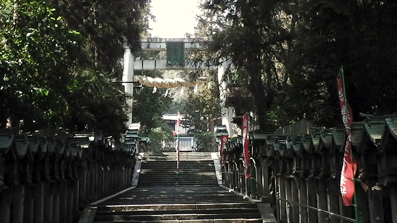
    Five Hundred meters into my descent, I turn a corner, and am greeted with this concrete Torii, heralding my arrival at . . . . 
Map Location.
 . . . . Kouhou-ji Temple. The temple was established here during the Jomei Period (629 -641), but the present temple was built around 1360. As I arrived it commenced snowing, which added to the atmosphere of the area. It's a compacted site, with not much distance between buildings. As I wondered around, I tried to imagine what it was like 1,300-years ago and how the complex was constructed - no trucks, no bulldozers, no cranes - and marvelled at the sheer willpower of those responsible for constructing this temple.

   The final 2km of my path was like walking through a corridor if religious Icons. And, with the snow still falling, I was treated to some awesome scenery. As seen in this video.
   Upon my arrival at the Ishikiri Station, a noticeboard, with map, alerted me to attractions in the area. Viewing it, I realized I had missed a lot of sites during my descent. Which was my cue to make the comment - "I'll be back". 
   
    This is the full video of my days outing.

   This is the full course , courtesy of 
   Ride With G.P.S.


Tuesday, February 25, 2014

Ikoma-sanke Hiking Course.

    Ikomayama, bordering the prefectures of Nara and Osaka, is the highest mountain in the Kongo-Ikoma-Kisen Quasi National Park (phew that's a mouthful), standing at 642m. The area is popular with hikers, picnickers, in fact anyone interested in the outdoors can be found in this area. Because of it's location, the range can be easily accessed via hundreds of thoroughfares, and regardless of mode. If you want to take the more leisurely way of experiencing the 'Park, then I suggest you use the "Shigi - Ikoma Skyline Road". 
   I have explored this area many times over the years - it is only a couple of kilometers from where I live - and have enjoyed the variety of scenery on display. It was on one such venture that, while checking-out a museum dedicated to the local wildlife, I discovered this map. The nice people who administer and maintain the park have created a series of tracks allowing the experienced, and the not-so-experienced, the opportunity to appreciate what lies just beyond the city boundaries. There are 24-tracks, ranging from a casual 4km hike up to the summit of Mt Ikoma, to the mammoth 39km hike that encompasses all twenty-three tracks. If one so wishes, they don't have to complete whatever track they are hiking and can create their own itinerary by mixing one-or-more tracks, like I have done on many an occasion. All tracks are well maintained and signposted, with facilities - toilets, shelters, vending machines - dotted throughout.
Map Location.
   There are many sights to attract your attention within the 'Park, like this settlement at Kuragari Pass on route-308 (regarded as the steepest road in Japan). At this point you are not far from Mt Ikoma. 
                                                                                                                                                                                                                   
Map Location.
    Chogosonshi-ji Temple, founded by Prince Shotoku, an important politician who built the foundation of the state of Japan during the Asuka Period (592-710), is located in the grounds surrounding Mt Shigi. As you approach this complex, you will be greeted by the worlds largest paper-mache Tiger, as-well-as throughout the temple grounds; the temple is related to the tiger of the Chinese Zodiac, which is used for the calendar, time and direction.                                                                                                                                                              
    Map Location.
   There is also some important history attached to area. In 1536, during the Sengoku Period, a gentleman by the name of Kizawa Nagamasa, constructed Shigisan Castle on the summit of Mt Shigisan (437m). The castle was a  Yamajiro, or mountaintop castle, and afforded fine views

over Kawachi (present day Osaka Prefecture) and Yamato (present day Nara Prefecture) Provinces. The castle must have been enormous - 700m from north to south and 550m east to west - but, unfortunately, was destroyed in 1577 during the Siege of Shigisan, and all that remains today is this monument atop the summit.

    My plan, over the coming months, is to enter the National Park via one of the many entrances & tracks, and  explore and compose a blog of the days outing, then add it to this post. My first two posts will be of track-24, the track that encompasses all 23-tracks of the Ikoma-sanke Hiking Course.

                             Tsuda to Shijonawate.


     This segment is close to where I live so I was able to walk to the start. There is a bus-service into the area, departing to-and-from the J.R.Tsuda Station, but I think they are few-and-far between. If you are exiting the track at this end, just over the bypass is the Lohas Public Baths (map location) and the perfect way to end your perfect day. At the other end - route-8 at Shijonawate - there is a bus that will terminate it's route at the J.R.Suminodo Station.

                           Shijonawate to Sango.


    Unlike the previous segment, you don't have much, if any, contact with small settlements. Within 15-minutes of alighting the bus, you begin your ascent and, from there the track undulates until you commence your final descent into Sango. They are not difficult hill-climbs/descents, but I suggest you don't push yourself. There are views aplenty along this 24km stretch and, if you have packed a set of binoculars, all the better. Study your map before your departure and pay attention to the signs along the way. Your sign reads - "Ikoma Nature Walk" (orange). There are several shelters/rest-stops and many benches along the way for you to break for lunch. I think I noticed two vending machines, so make sure you pack an adequate amount of food & drink. The Kintetsu Bus company operate a service to & from the start of this segment, departing hourly from the J.R. Suminodo Station.

                                   Shijonawate Sta' to Ishikiri Sta'
                                     via Mt Ikomayama.

   This 22-kilometer course I would rate as one of my best hikes, and will remain that way for some years to come. It was a pity the day had to come to an end. But, in saying that, I am already planning my return (not the same course) to check-out sights & tracks I missed on this trip. 
   There is a bit of everything here - narrow urban lanes, mountain valleys, nature in all it's glory, and, not to forget, temples and shrines. If you are partial to a bit of hill-climbing, and don't mind getting your boots dirty, then this course is for you.
   Getting to-and-from this course is easy, with the J.R.Shijonawate and Kintetsu Ishikiri Stations your arrival and departure points. It is very well sign-posted, directing you to your next junction or point-of-interest  plus with maps along the way.   


Shijonawate to Sango.

   Ikomayama (642m) standing sentinel over Osaka & Nara Cities, is included in this segment of the Ikoma-sanke Hiking Course. Although my path skirts around the mountain summit, I am sure I will still be in for some great views, especially of Osaka City & environs. 
   In the above image, taken 6-days prior to my trip, Ikomayama is blanketed in snow. The day before, the Pacific Coast of Japan was struck by a record-breaking snowfall (Japan Times), so I was conscience of my safety and took the appropriate measures - adequate clothing, maps, food & drink, e.t.c. - when preparing my gear. Within minutes of setting-out from my arrival point, Tozanguchi in Shijonawata City (map location), I was greeted with a 2cm carpet of snow, and would remain that way for most of my trip.

       Because I didn't carry a pair of crampons, I wasn't going to take any risks and tread carefully - I am aware of the risks involved in walking on compacted snow, so, whenever I needed to, I walked in the loose snow on the side of the track. Having hiked in this area several times over the years, I was aware of the terrain ahead.
   The first segment skirts-around the outer greens of a local golf course, before commencing the first ascent of the day. I soon arrive at my first junction, where route-9 of the 'Course descends down into Hozan-ji Temple  (map location), and the Shigi-Ikoma Skyline Road, which runs parallel to my track.
   Also at this junction are two other tracks, albeit one a lane providing vehicular access to the area, and my course. I needed to pay attention here and take the track up the wooden steps in front of me - take the wrong track, and god-knows where I will end up. There is a picnic area here (above image) and, to mention also, a signpost giving directions; I found these 'posts located throughout the course and they are very helpful. Although there are many tracks in the area, the sign I am following reads, "Ikoma Nature Walk" (orange). 
     Throughout this segment are several picnic spots, allowing the hiker the opportunity to break for that long-overdue food & liquid intake and, in the image on the right, their first opportunity for a view of the sights below. And what a view it is. Osaka City, in all it's glory and size, is laid-out for all to see and spot the many landmarks engulfed within it's confines. It's also at this location I come in contact with the first, of the many, hikers that I meet during the course of my day.
Map Location.
  As my track undulates and I pass another couple of junctions, I soon emerge into a clearing, and my first secluded settlement since commencing my hike. I now know exactly where I am. A few hundred meters on and I arrive at route-308. This road connects Osaka with Nara, and has the distinction of being the steepest road in Japan and, having walked down it, I can confirm that. In the above image I am looking upwards towards the Kuragari Pass ( the lane on the left in the image is route-308, my lane is straight ahead on the right) and, in the coming weeks, I plan to hike through this area as part of another post for this series. It is here I meet another hiker who was proud to inform me that he has been to New-Zealand on two occasions, on one occasion he hiked the Milford Track. He also complemented me on how good our local wine was. Pity he was going in the opposite direction, I would have enjoyed his company.
    Leaving route-308 behind, I soon re-enter the forest and, before I know it, my first rest-stop and shelter, and the opportunity to relieve myself and do a map-check. My calculations lead me to the conclusion that I am about a third of my way along. 
    The facility is well appointed and offers the weary traveller a warm, dry environment to rest-up. Several tracks converge here and, with the help of the signs, one should have no problem knowing which way to head. My track, directly in front of the shelter, ascends up a steep hill, and . . . . 
Map Location.
 . . . . my next viewpoint. And what a view it is. Ikomayama is directly in front of me (to the North) and, to my left, is Osaka City. Behind me, in the far distance, is Kongo-san (1,125m) and, in the foreground, Shigi-san.  
   As I wander off, my attention was drawn to this interesting piece of artwork. Very impressive. At this point I can hear the sounds of traffic using the 'Skyline Road, which I am about to re-join, and also the bells of a nearby Temple.


Map Location.
   After a couple of ascents/descents, the track soon emerges at a clearing, and this structure. This is a viewing platform (one would be forgiven, on first sight, if they thought this a diving platform) that offers 360-degree 
views and, if the conditions are right, views for as far as the eye can see - Wakayama, Kobe, Awaji Island, Osaka, Nara, the list goes on-and-on. 
It's also an ideal location for me to break for lunch, climb the steps for my view and check-out the interesting collection of padlocks (image on the right). I get the distinct feeling that this is a tradition, when visiting this site, to bring a padlock, inscribe a message or name on it, and attach it to the wire. 
   Upon leaving the viewing platform, I discover the signage changes and I have to rely on instinct, and my maps. I am somewhat disappointed as to how this has happened and I come to the conclusion that, over time, they will eventually upgrade the signs. The track crosses the 'Skyline Road, via a bridge, and, soon after, I arrive at a junction where three tracks converge. Taking the time to admire this religious icon, and maps, I become confused as to what track is mine. So, not wanting to take to wrong track and end-up miles of course, I walk along the Road and, before long, my track re-emerges from the forest and I heave a sigh-of-relief. I reach a tunnel, that goes under the 'Skyline Road, and I know exactly where I am.
   This is confirmed soon after, when I reach this junction. It is here I say farewell to track-24 and join track-20 and descend towards Sango. While checking the map another hiker passed-by. I had seen this man earlier, at the junction where I wasn't quite sure what track to take,  confirming that my track did proceed from that point.

    As I make my descent, through the rural outback of Sango Town, my muddy track has now become a sealed lane, and the sounds of traffic are about, albeit farmers vehicles. I reach a junction that directs me to Shigi-san and Chogosonshi-ji Temple.
Map Location.
   My track soon emerges, albeit briefly, at this pond, and I take the time to envy the anglers relaxing in the warm sunshine trying to catch that evenings meal. In the distance, behind the trees, is a secluded temple, that I stop at briefly before my next destination . . . .
Map Location.


. . . . Chogosonshi-ji Temple. As I was hiking, and aware I still had some distance to cover, I didn't want to spend too much time here, so decided to place this complex on my "Must Return" list. It's a huge site and, I would say, requires some hours to take-in and explore the many buildings that are here. 
     Exiting the complex, I say farewell to track-20, and my friend the tiger-dragon (for want of a better name) and say hello to track-23, the final track
of the day. 
Map Location.
    Twenty-four kilometers x seven-hours after leaving Shijonawate, I arrive at this signpost, heralding the end of my hike. And what a hike it has been. In my video I use the "f" word to describe how I am feeling at this point. It has been an awesome outing and am excited to review the data collected and sharing my experience with others. I still have another 1km before I reach the Kintetsu Shigisanshita Station and, from there, a 4-connection x 90-minute train ride home. I was wise, when preparing my gear, to have packed a small bottle of red wine and, with a pack of current buns, I spent my home trip reviewing my day.
   From start to finish - Tsuda to Sango - the total distance covered is just short of 44km. I am very keen to return to the area and, on that occasion, I would plan to stay the night and check-out some of the other side-tracks that connect with track-24. So watch this space.

                                                     Sayonara.

   Links: Full video of the days outing.
                 
                Cateye Enou; Shijonawate to Sango - part-1 and part-2

                Ride With G.P.S.