My latest Post.

This view,this beauty
A tear unbidden
Creeps into my eye.

My stay is short
But I shall return to this place
If only my life is long enough.

Such beauty
Gazing upon it
I hope my years are many.

Bokusui Wakayama.

Wednesday, May 18, 2016

Kamodani-no Taki Waterfalls . . . .


   It was by sheer coincidence that I had been given a map of activities, for the outdoor enthusiast in the Yamashiro province of  south Kyoto, that I discovered the Kamodani Waterfalls.
Map Location.
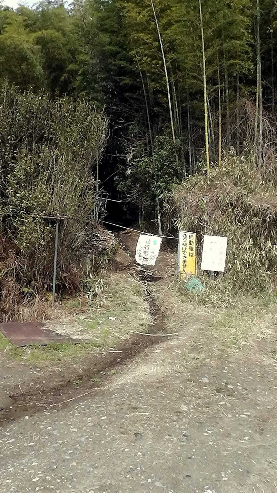
   Located along route-307 in Joyo City, the entrance to the area would be easily missed as the sign, promoting the 'falls, is so small and overgrown with shrubs and vines (see arrow in image).
   My first venture to the 'falls was by  bike and it was while I was reading this noticeboard, with map
of the course, when three ladies approached me. They were horrified that I was going to attempt this course with my mountain-bike slung-over my shoulder. "Oh no,no,no" they said, "it's far too dangerous to take your bike with you, and with those shoes you are wearing". So I returned a week later, again on bike, but with hiking boots in my backpack, for my second attempt. 

   The area was in the midst of Hanami and the Sakura were in full bloom, even in as isolated places as this. After a few meters of following this meandering stream, I turn a bend . . . . 
. . . . and I immediately come to appreciate the advice the ladies had given me. Suddenly I found myself enclosed in this gorge with vertical walls of rock on both sides.
   It was from this point that I was about to get my boots wet and get-into some rock-hopping - in conditions such as these, a very dangerous practice.
    Soon it was time for the first of several rope-climbs. These two took me above the stream but, a little further on, I would be taken up a steep hill, over a ridge, and descend back to the stream.
Map Location.
   It was at this point where I felt I was nearing the end of the course. On the map there was one more waterfall to explore, but I needed to branch-off and follow another stream. I had reached that point.
   And there, obscured by the surrounding foliage, was this beauty.
As it was a hot day, and I had worked-up a sweat, what better way to freshen-up than with a refreshing cold rinse. I would have stripped-off but one never knows who is lurking in the bushes.
   Then, before I knew it, I had reached the end, and the track back to where I commenced this exploration. It was a 1.6km x 2-hour meander through some of the most magnificent scenery I have experienced, and it ended too soon. But it wasn't going to end there. I decided that I needed to return and, when completing the course, continue and explore some more. But I had to wait until the 'rainy season' had run-it's-course  before I could return.
                                                          . . . . and Beyond.

   Six weeks later I returned to route-307, this time by bus. After re-exploring the stream and it's waterfalls, I put my 'no plan, getting lost' idea into motion, and followed the stream further up the valley. I few hundred meters on and I reached the confluence of two streams then, on my right, I spotted a disused track.
Map Location.
   About eight hairpin turns later I stumble-across this abandoned bulldozer. Judging by the state of the track to this point, any chance of returning this machine to civilization would be near to impossible, that's if  someone went to the expense of hiring a heavy-duty helicopter.
    Some more bush-bashing, some more walking in circles, and I am again reunited with a track. Of sorts. And, before I know it, I emerge at this clearing. Thanks to my friends translation, I am informed that this is the highest point in Joyo City. As this site isn't marked on the map, and I am without my G.P.S. device, I am unable to pinpoint my exact location.
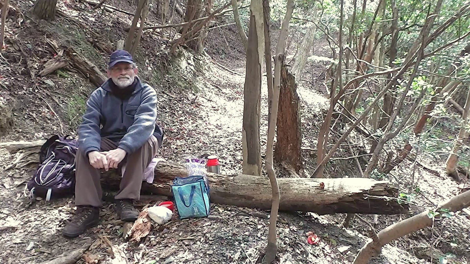
   Five minutes on and I reach another summit, and another junction. As it's closing-in on midday, I decide to take the weight off my feet, and break for lunch. I still don't have the foggiest idea where I am, but hey, that's what I like about my 'no plan, getting lost' outings. The usual fare - curry, bread-rolls, banana and washed-down with cafe au-lait.
Map Location.
   Not far from my lunch site, I arrive at another summit and suddenly I know where I am. I have arrived at Gonzan, or Mt Ushitoriyama. I was last here about 2-months ago on my Ujideka Revisited  excursion. Wanting to stay with my original plan, I descend from here in search of another track to get lost on. And I didn't have to wait long.
   About 500-meters on, after crossing another familiar track, I re-entered another forest. Then the weirdest of things happened. Suddenly, on the ground in front of me, were these two drinking vessels - Japanese tea-cups? Sake cups? Maybe the latter. As I was admiring them ( I have this fondness for Japanese pottery) I got the feeling someone was looking over my shoulder. One never knows what is lurking in the forest. 
   Behind me, partly obscured by a tree, was this interesting collection of religious icons, well the seven at the rear anyway (I'm not sure about the front two). Enquiries revealed that I had arrived at, what was once, the village of Taga-Niita. Erected in the mid-Edo Period, the village was deserted in the early- Showa Period. The statues at the rear are called Rokutai Sekibutsu and were carved 1771.
   Moving-on from here I encounter one more summit and, from here, it's all downhill (no pun intended), as the track & markers suddenly become nonexistent. In situations like this I keep an ear out for running water - when hiking in such environments, the chance of their being a stream nearby is high - and, before long I am rewarded with a crystal-clear stream that brings me to a unsealed and rocky road. Recognizing it as the road I had crossed-over an hour-or-so earlier, I knew I wasn't far away from civilization. In this instance, the town of Ida. From here it was an hours walk to my station, and my return home. A good hot shower, a lovely dinner, and a few cans-of-beer topped-off what was another great day. 
   The remains of the village of Taga-Nitta has got my curiosity juices running and am planning a return visit, this time on two wheels, and what lurks amongst the forest in the area. So, until next time, Sayonara.

Images of Kamodani-no Taki. 

Video of Kamodani-no Taki.

Sunday, March 27, 2016

Ujideka - the obsession continues.

Map Location.
   It was just over a week ago that I exited this forest after another great hike, - Ujideka Revisited -  but for one incident. On the penultimate section, when leaving the summit of Mt Takaoyama, the trail-markers became nonexistent and, as a result, I had to do some bush-bashing before re-joining my planned route.
   Today's plan was to return to Takaoyama, discover where I went wrong and, if successful, do some exploring in the area. 
   After my one-hour walk from Kyotanabe station, and through the town of Ide, it was great to step-into my kinda' environment - muddy tracks, dense forest, the serenity, on my own - and make my way to the junction where I had emerged onto the previous week.
    It was about 30-minutes before I reached my junction where four tracks converged. Over the course of the next hour, I would pass-through this section five times before departing the area.
   In the middle of the junction there was this sign, written in Kanji, directing me to Takaoyama. The problem was that the sign didn't point to any particular track, but was pointing between the two most likely tracks that would lead to where I wanted to go so, after a quick check of my map, I came to the conclusion that the track that was the most likely one to take, was the one with the ribbons & tape tied to the trees. WRONG. 
   Instead, it led me to this stone marker, in the middle of nowhere, where the ribbon & tape ceased to exist from this point. Oh well, it was only 10-minutes of my time. As I was returning to the junction, I discovered another track that I decided to check-out. And another dead-end.
   It was now time to see if track-2 got me any closer to my goal. Five minutes in and I discovered another sign. The strange thing with this sign, was that it was located off the track - the track is at the bottom of the above image, behind the sign - and, after some debate, I decided on staying on the track. WRONG AGAIN. Ten minutes on and I reached a junction that seemed familiar and I immediately realized where I was. I had bypassed Takaoyama and was closing-in on Gonzan (also Ushitorayama). So, another u-turn. Partway back I decided to take the risk and headed-off the track and enter the bush in hope of finding my prize.
    And, before I knew-it, there appeared some trail markings which gave me a gut-feeling I was closing-in on Takaoyama. As I made my way I came to realize these were the markings I followed the week before, when I was exiting the summit. And when I took the wrong turn. 

   A few meters on and whala, I had arrived. Unlike my first visit, I stayed longer and checked-out my surroundings - as the summit was covered in dense forest, there weren't any views - and take the usual 'selfie'. 


   I couldn't help notice, as I looked around, at the many signs revealing the fact that I was on the summit of Takaoyama. I counted six in all. The thought crossed my mind to remove one of the signs and re-place it where it would more beneficial - at the junction down below. But decided to leave well enough alone. 
   From here I returned to the junction and an early lunch-break. As time was on my side, I had a close look at my map and decided to explore the 4th track. My map showed this track, after ascending/descending a couple of hills, would emerge onto route-307 and a short bus-ride back to Kyotanabe. WRONG AGAIN.
   About 100-meters in the track came to an abrupt halt, and I stood there looking-into a short but steep gully. As I was in the mood to explore, I descended into the base and followed it out. The gully soon connected with a trickling stream and, a few meters on,  fed-into a more stronger stream. As I scaled along the side of this stream I encountered this short waterfall. It was at about this point I discovered more trail markers and decided to follow them. About half-an-hour further on, I emerged onto a well defined track and immediately burst into raucous laughter. I had completed an almost 360-degree loop and arrived a few hundred meters from the four track junction.
    My course from here would be to return to Kyotanabe by the same route I took to get here.  That was until I happened across another track. This one was well marked and, as I made my way, was treated to some very impressive fungi.
   Throughout the day I was impressed by the many varied types of fungi and where they grew. This has become a new interest for me and I post many images onto my collection of social media pages.
Map Location.
    After some time ascending/descending along the track, I spotted this building hidden amongst the trees. When I emerged onto a sealed lane, route-307 was in front of me and the building was a shrine. The ideal location for another rest-stop, a bite-to-eat and a cafe au-lait. From here it was a one-hour walk to Kyotanabe station, then home and a cold beer.

                                            So, until next time, Sayonara.


   Video of the days outing.

Friday, March 18, 2016

Ujideka Revisited.


     Today's course is made-up of six different tracks, four of which I have explored in recent weeks, the other two unexplored territory.
Map Location.
   After a 7km x 75-min' walk from where I alighted my bus, I reached this small tea-plantation on route-62, on the border seperating Ujitawara & Wazuka Towns. For the next 4-hours my surroundings would consist of trees, trees and more trees, with very few view opportunities. 
The tracks are well marked and defined with an assortment of markers ranging from red-colored pegs, tape, and signs hanging from trees.
Map Location.
   Twenty minutes in and my first junction (actually it would have been 15-minutes, but I overshot the junction and had to backtrack). The last, and first, time I came through here, it was from the other direction and, if my memory served me right, most of this next segment would be undulating, but mostly downhill.
   Ten minutes later and I reached this rocky-outcrop. Although I had only been on the track for little under an hour, it had been in fact 2-hours since alighting the bus, and 5-hours since I last had anything to eat or drink. So, as I wasn't in any great rush, this was an ideal location for a banana and some ice-coffee. 


   Throughout  the day I would pass trees with a varying array of fungi, something I have taken a photographic interest in over recent weeks. In the image on the right, if my research is correct, is a member of the Ganoderma  family. 
Map Location.
   Two hours, two junctions, one descent and one ascent (I'm cutting a long story short here) after my rest-stop, I enter into the first of my unexplored tracks. But, before I do, . . . .
. . . . I manage to take-in a couple of vistas of the surrounding area. In the image on the left, I look back at where I have just come from. The hill, I hazard to guess, is about where I had my rest-stop. On the right is Jubusan (632m), famous for the 13-hundred year-old Kontai-ji Temple that lies a few meters below the summit.
   The next segment passes very quickly and, another power-pylon and two junctions later, I arrive at . . . . 
Map Location.


 . . Gonzan, or Ushitorayama, (443.7m) depending on what map you read - both names use the same Kanji characters. Just as I arrive, I can hear the fire-alarm sirens sounding below, heralding 12pm, and time for a well deserved lunch-break.
   I am back in unexplored territory and, from here, things began to turn to custard. The track, that I assumed would be there, was there and, like up to this point, also well marked.
   My next destination was Takaoyama (433m) and, about 15-minutes after leaving Gonzan, I arrived at, what I thought was, my next summit - if my Japanese language skills were better than what they are, I would have realized that this wasn't Takaoyama.
   Moving on I began to notice the track markings began to change - gone were the red-colored pegs, to be replaced with faded and tatty ribbon. But I wasn't panicking (that was about to come, sooner, more than later) when, just a bit further on . . . .
Map Location.
 . . . . I arrive at this clearing and, guess what, yes, Takaoyama (the Kangi characters concurring with what was on my map). From here any markings became few-and-far-between, and eventually nonexistent. 
   After some bush-bashing, I could hear the faint sound of a running stream below me, and so I decided to head for there. I soon emerged at a track which revealed where exactly I was and, not liking where I was, did a u-turn and headed back up the hill and through the bush in search of my planned track. I soon found that track which eventually led me onto another track that I had biked on a couple-of-weeks prior. Phew. 
   Also at this point I could hear the sounds of civilization, in the form of traffic moving along route-307. I had arrived at Ide Town.
Map Location.
   Four-and-a-half hours after entering the forest at route-62, I emerged from the forest to be greeted by the sound of a motor pump-sprayer and farmers spraying their tea crop. From here it was a leisurely stroll through Ide Town, over the Kizugawa River and onto Kyotanabe Station for my train trip home.
   Since completing this hike, my mind has been working overtime with questions such as - Where did I do wrong? Are there other tracks there that I missed? 
   So, in line with my obsessive nature, I plan to return and, on that occasion, commencing from the Ide Town end.   
         Until next time - Sayonara. 


Video-https://www.youtube.com/watch?v=9djFrhhipHI
Course Details - https://ridewithgps.com/trips/8184942