My latest Post.

This view,this beauty
A tear unbidden
Creeps into my eye.

My stay is short
But I shall return to this place
If only my life is long enough.

Such beauty
Gazing upon it
I hope my years are many.

Bokusui Wakayama.

Friday, November 22, 2013

In Search of Tsubakio-jo Castle.


   There is very little I can tell you about the layout of Tsubakio-jo, just to say that it was a "Yamajiro", or "Mountaintop Castle", like "Iwakuni-jo" in the image above. 
   Tsubakio-jo was constructed between 1523-&-1555, during the Sengoku Period, by Tsutsui Jinkei (1549-to-1584). The castle was used as a refuge for Tsutsui while his main castle (Honjo) Tsutsui-jo, was under attack by forces loyal to Matsunaga Hisahide. The battle lasted for two years, from 1559 and, when it was all over, Tsutsui went on the become the Lord of Yamato Province, a position bestowed upon him by Oda Nobunaga. Tsutsui then constructed a new castle at Yamatokoriyama (Yamatokoriyama-jo) and Tsubakio-jo was abandoned and left to rack-and-ruin.


   My adventure commences and finishes here, at the J.R.Obitoke Station. I have been to this area many times over the years, both on foot and bike, and it is always a pleasure to return and check-out new destinations. The Yamanobe-no Michi Path, a leg of Japan's oldest road, passes through this area and my route joins it, albeit for a few hundred meters.
Map Location.
The sights & sounds of the busy roads are about to become a distant memory as I reach a junction that soon becomes a narrow rural lane..... 
....and I get my first taste of rural Japan, at it's very best. It is so easy to become attached to this scenery, along with the serenity. Maybe that is why I am so addicted to it.
Map Location.
   My narrow rural lane is about to become a narrower, and more hillier,  rural lane, as I arrive at this junction. I am now entering unfamiliar territory, and am becoming excited as to what lies ahead. The sign is directing travellers to Shoryaku-ji Temple, erected some 563-years before Tsubakio-jo was constructed.
   A few hundred meters on and I arrive at the settlement of Kitatsubao-cho. I often wonder what it would be like to live in an isolated environment like this, with the nearest convenience-store/supermarket some kilometers away and having to use land-line phone services because you are out of cellphone range. It sounds so tempting. From here I am on the lookout for, believe it or not, a more narrower lane that will eventually take me to Kasuga-jinja Shrine. Isolated shrines are a favorite of mine and, when researching my route, I pay attention to any shrines that may be in my vicinity. 
Map Location.
My turn-off soon appears and I ascend up the lane.... 


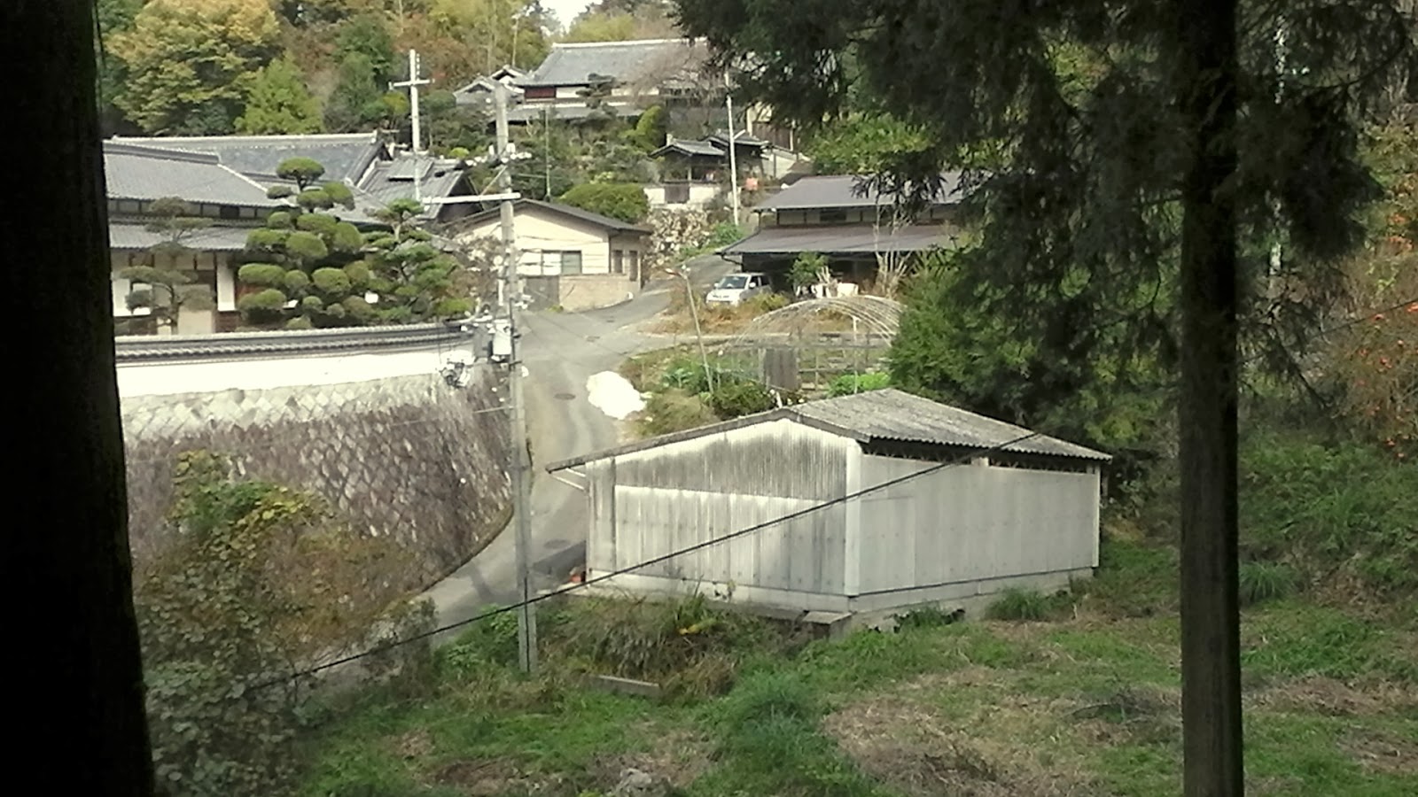
....into a quaint wee settlement nestled-amongst the hills and surrounded by trees. This has to be paradise at it's very best. Although that is easy to say on a nice warm, fine Autumn day. In winter it would be a very different story.
I reach a junction where four lanes converge and, as I am debating as to which I should take, a local, out walking his dog, stops and gives me instructions. As he can speak some English (in Japan, if someone can speak English, they love to stop and chat), we strike up a conversation - Where do you come from? How long have you lived in Japan? Do you like it here? - and I am invited to join him for a coffee or cup-of-tea. Sadly I decline his offer as I want to keep on the move. But I will return here and take-up his offer at a later date. As I take the path to the shrine I pass this collection of logs. These are used for the cultivation of  Shiitake and one can come-across these sites in some of the most isolated of places.
Map Location.
   I turn a bend and, without warning, I stumble-across this concrete lantern and, amongst the trees, the distinct vermilion-colored Torii,  signifying the entrance to Kasuga-jinja. The shrine has served the needs of the locals for some 400-years, which is young in comparison to other shrines I have visited. Some dating back 1,200-years and more.
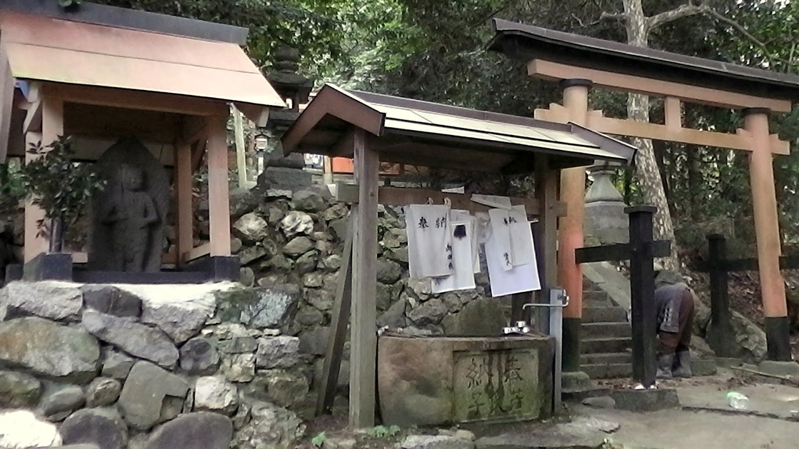
As I ascend the steps into the complex proper, two locals are busy sweeping and tiding-up the grounds. As I wander the grounds I notice the absence of any Haiden, but there are a few Sessha/Massha
    The Chozuya is always of interest to me, in particular some designs of the fountain. In this instance it's just a common house tap. This is my video of Kazuga-jinja.
Map Location.


   My lane from the shrine takes me around the back of the settlement of Minamitsubao-cho. From this point I get a view of the Tenri City area of Nara Prefecture before I descend back onto my original lane....


....and some more picturesque rural scenery.
Map Location.


   I soon reach the end of the road, when the sealed lane becomes a dirt track. I am mindful, after studying my map, that my next junction, where I turn off to the castle, is about 1-kilometer away. As I walk through the forest, I can't help notice the many side-tracks, so I remind myself to be vigilant.

Map Location.

   As you can see in the image above, the track joins from a very sharp angle and can be easily missed. As I did, and found myself walking an extra few-hundred meters and had to u-turn. About 20-meters in and another junction. My instructions were to take the track on the left to the ruins. 


As I make my way deeper into the forest, I begin to notice a mound on my right. At this time I find some large stones that indicate that this may indeed be the foundation of Tsubakio-jo. My track takes me in a circular route around the mound.

Map Location.


   Partway around I notice this icon atop the mound. I investigate and, while up there, decide to take a look around. From where I am standing, I get an idea of the layout of the castle and what the view must have been like when Tsutsui resided here. Today, the site is shrouded in trees, no bad thing, but, back then, the view over the Yamato Province below must have been spectacular.
   Back onto the track, and onto my next destination - Mt Shiro (Shiroyama). 
    As I beat my way through the dense grass track, I am suddenly confronted by this (very new) Torii, and I immediately knew where I was.
Map Location.
                                                                   
   Directly behind the Torii, and other religious icons, was the summit of Shiroyama. I spend several minutes at the summit taking-in the surroundings, plus the obligatory photos and video, and am reminded that it has been some hours since I last ate. I was aware that I was about midway through my planned route and needed to restock my fuel supplies. So I set off in search of a suitable place to sit.
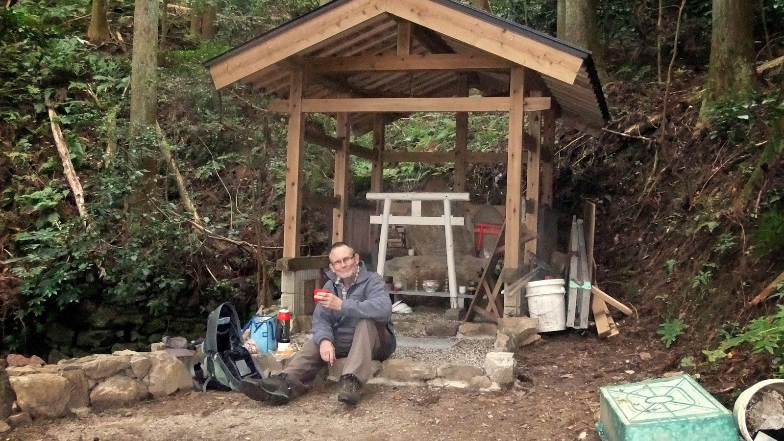


And I soon find it. A track, branching-off between the ruins and the summit, takes me to this small shrine where I dine on a flask of hot curry, bread, bananas and washed-down with a cup of cafe au lait. After checking-out other sites in the area, I begin my descent. 
Map Location.
   I have decided to be bold and descend down the other side of Shiroyama, where there is no formed track. On my way down I could hear the sound of a running stream and head for it. This requires some bush-bashing and, after a few hairy moments, I reach the stream. 
Map Location.
Trudging downstream I soon discover a dirt track and climb the bank and commence my exit from the area. With all the recent storms the area experienced, there was still plenty of debris lying about. 
Map Location.
   Two kilometers later I arrive at the junction, with the road I turned-off earlier in the day (the one that goes to Shoryaku-ji Temple). I know of another track from this road that takes me back in the direction of Obitoke Station. I am now back in familiar territory and am aware of what distance I have left to walk. I am also in need of another fix of cafe au lait and some fruit-loaf.
Map Location.
   After emerging from the forest I take a short detour to check-out this interesting site. This is a Tumulus Pond and, where the Torii are situated, is the Ookawaike Kofun, or burial mound. There are five located within this area.
   I soon rejoin my earlier route and, 2-kilometers later, arrive back at Obitoke Station, and in dire need of sustagen. But, as luck would have it, my train was only a few minutes away and I would have to wait until I got home. 
   Well, it's been another great outing and I am already planning my return. Maybe then I will be able to have that coffee with the resident of Kitatsubao-cho. I hope you have enjoyed this post. So,until next time, happy hiking.

   I would like to take this opportunity to acknowledge the guys at "JCastle" for the use of their image of Iwakuni-jo.

  This is the full Video of the hike.

   Course details and map - http://ridewithgps.com/trips/1975533


Tuesday, October 15, 2013

Tiki Touring from Nara to Kizu.

Tiki Tour (New-Zealand Slang)
   1. a sightseeing journey with no particular destination in mind.
   2. to take the scenic route to a destination.
   3. to wander aimlessly.


Map Location.
   Nara Park, famous for it's Temples & Shrines, and the tame Deer that roam freely about the precincts of the park, is the starting point of what was to be one of the best bike-rides I have done in many years. I did have a plan, of sorts, and that was to keep-off any main thoroughfare, and travel via the narrow lanes & paths through the rural outback of Nara Prefecture. I didn't have a destination in mind (my final destination of the day would be home of course), that decision would come when I reached a certain junction and, after a bite-to-eat and an energy check, I would proceed.
   Exiting the park, and taking a narrow lane lined with quaint typical Japanese restaurants, I stop to admire (and photograph) some young deer grazing before heading-into a forest and my first hill-climb of the day. Although it wasn't a hot day, being amongst the trees provides a cool shelter from the sun as I wound my way up the hill to the junction with the Nara Okuyama Driveway (Map Location.)
Map Location.
   A few hundred meters before the summit though, I paused for a few minutes at the junction of four tracks, which I was soon to connect with. The track has three different names - the "Tokaido Road", which was created during the Edo Period (1603-to-1867) to enable people to migrate between Osaka and Tokyo. In the late 16th-century, when the settlement of Yagyu became the home of a sword-fighting school, the road also became known as "The Old Yagyu Road". Then, in the late 1960's, construction began to create a long distance hiking trail, and was given the name of "The Tokai Nature Walk".
Map Location.
   After reaching the summit, I now connect with the aforementioned road, albeit for about 2km, and these interesting collection of buildings. This is the Tagenochyuo Tea-House, and has been on this site for over 180-years. The present proprietor is the 6th generation of his family to run this establishment. The place is like a museum with a couple of flintlock rifles hanging on display, along with other weapons and assorted memorabilia dating-back many centuries.     
Map Location.


   I now exit the forest and emerge into the open rural outback of Nara, and enter the settlement of Setarin-cho. This is my kind of cycling environment and I am becoming excited as to what lies ahead. It has been a couple of weeks since the rice was harvested, but the ground is still a sea of green where the grass has taken over.
   Tucked-into an alcove, by the side of the road, 
Hachisaka-jinja.
is this "Hokora", or miniature Shinto Shrine. This, I am hoping, will be the first of many religious icons and sites I will experience on today's trip.
Map Location.


   As I leave the settlement of Setarin-cho, my narrow lane becomes a narrower lane and I enter another forested area. I emerge soon after into another settlement and from here my track takes me through some very dense and overgrown bush. I emerge onto a road where my immediate task is to remove the many spiders and their webs that have entangled themselves into my cycle-helmet. 
Map Location.
   Oyagyu-cho (not to be confused with the town of Yagyu mentioned earlier) is situated on the Tokaido/Old-Yagyu Road. I have passed-through here on a few occasions on one of my many hikes through this region. 
   As I pass through the town I arrive at a bridge (Map Location) and, as I cross it, my attention is drawn to a path that runs alongside the stream. Staying with my plan to keep off as many roads as possible, I take the lane and soon find myself entering another wooded area. Stopping to record more scenes for my video of this trip, I spot a small Sekibutsu (Stone Carving of Buddha) carved into a rock in the hill behind me. 
Map Location.
       
   I have a strong fascination with these carvings, especially their isolated locations. As you can see on the attached map link, this one is no different from the many others I have stumbled-across on my travels. Some years ago I wrote an article for a travel website covering a pilgrimage, with many such carvings located throughout an area of Nara Prefecture - "Touno Sekibutsu no Sato"
Map Location.
   A short while later I emerge into the settlement of Sakahara-cho and, as I wind my way through the narrow lanes, some only wide enough for one vehicle, I come-across the Nagao-jinja Shrine.
Nagao-jinja Shrine.


   I was able to recognize the name of the shrine by the Kanji characters embossed on this lantern. The complex was a hive of activity ( as seen on this video) with, what I presume, to be preparations for an upcoming festival.


   Nestled on the Kagura-den (a special stage) was this Mikoshi palanquin, used in a festival known as Matsuri , which is held throughout Japan to celebrate the shrine's deity.
   Time to move on, and down another narrow lane, past some more quaint houses and over another narrow bridge from Nagao-jinja, I reach another road that disappears into another forest.
Map Location.
   Route-173, as I later discovered it's name, was narrow, windy, pot-holed, wet and down-hill. Keeping any attempt to get carried-away and go-for-it, I changed into cruise mode, relaxed and enjoyed the experience. I emerged at a junction that I immediately recognized - route-33, a road that connects the town of Kasagi with Nara City - and a sheltered lunch-spot. By now I was in dire need of an energy top-up (in this instance bread-rolls, chocolate and banana) before deciding where to from here.
   A few meters away from where I was dining was a rocky outcrop with several Buddhist carvings engraved into the surface. In this instance they all appear to be Jizo, of one form or another. The full video of this trip will allow you a better view.

   Having topped-up my fuel tanks, I decided to continue with my tour. Unlike the first segment, from here I will be in familiar surroundings but still keeping to the back lanes & tracks, and isolated settlements.
Map Location.
   Another forest, another narrow rural lane, another settlement and, before I know it, I have arrived at the settlement of Kamocho Takasari. There is a dirt track that branches-off the lane that will eventually take me around the town of Kamo (the video will give you a better idea of the terrain) and onto my final destination.
Map Location.
   I arrive at a cut through the hill and, as I pass through it, carved into the clay earth, is this Jizo (again the video will give you a better view).
Map Location.


   After a few hairy moments during my descent, I arrive back on a sealed road and the opportunity to top-up my water bottles. There is nothing nicer than fresh spring water to satisfy your thirst and, if the need be, to take a rinse-off to cool your body on a hot day.
   From here I bypass Kamo Town and follow the Kizugawa River to Kizu, where I connect-up with the Kizugawa cycle/walk-way. A kilometer along and I arrive at a shelter/rest-stop (Map Location), popular with users of the path, and decide to bring this trip to a conclusion. While having the last of my bananas, I reflect on the past 7-hours and the 44km I covered over that time, and come to the conclusion that this has been one of my best rides since arriving in Japan. I will place this in my "must do again" folder.

   Thank-you for taking the time to view this post. I hope you have enjoyed it, as much as I have enjoyed sharing it with you. And, until next time, happy travels and Sayonnara.

   Full Video of this trip.

   The Course (distance,elevation,time &images) as recorded on my "Cateye     INOU" device.


Sunday, August 11, 2013

Hiking the Border in the Soraku District.

   It seems, when I look back over the past year, I have been spending a lot of time in this area, either on foot or on my bike. The Soraku District has a lot to offer for the outdoors person, like myself and, each time I venture into the area, I discover a new track that lures me back to check-out. About 4-months ago I hiked a course, commencing at Tsukigaseguchi, and finishing at Shigarakicho Tarao (my ENOU recording of the trip), which required me to follow the borders that separate the prefectures of Kyoto, Mie & Shiga. When I reached the junction, where I was to leave the border track and descent into Tarao (map location), I became curious as to whether the track I was on continued and, if so, where did it end?

Map Location.
   So, an idea was born, and a plan created - I would return to Tsukigaseguchi, re-acquaint myself with the border track and hike through to route-138 (the Tarao-to-Iga road) and, if possible, descend a track into the settlement of Shimagahara (my planned route). I was wary that this area of Japan was experiencing a heatwave and, with the first part of my hike up a steep ascent through dense forest, I needed to pace myself.
   The track is well marked with concrete posts (as seen in the image on the left) and red tape tied to trees.
Map Location.
   About 2-kilometers in I reached the settlement of Okuda. The rural scenery in Japan at this time of year is very green, with the rice fields midway through their growth, before harvest in around September/October. The next time I see this scenery, I hope, will be when I descend into Shimagahara. After some bush-bashing, and an ascent up a dirt incline, I reach my track (in the above-left image). On my last trip through here I happened-across some wild deer but was unable to get my video-camera out in time to record them. On this occasion I was better prepared but, as luck would have it, no deer.
Map Location.

As I ascend I am treated to some splendid vistas overlooking the Tsukigaseguchi area, and the opportunity to take-in some water. Then, nearing the top of this section, I pass Yurugi-iwa (rock). The rock resemble the legendary creature Tengu and, the previous two times I have passed-by this rock, there have been flowers in the vases.
   Five minutes on from the rock I arrive at the junction with the Mikune-goe Rindo then, my next segment and my first rest-stop.
Map Location.
   This sheltered rest stop is an ideal location to take a break, have a bite to eat, and admire the 90-degree view below. And what a view it is. With views like this, one finds it difficult to move-on.
Map Location.
    A couple-of-hundred meters on and this knob. In the video I refer to this as an "un-named mountain" ( it's about 637m above sea-level) but in fact it's the junction of Kyoto, Mie & Shiga Prefectures. My track veers off to the right. Unlike the first few hundred meters to this point, the next segment is a bit overgrown with pig fern and I have to watch where I place my feet.
Map Location.
   Now something I debated with myself, as to whether I should include in this post. But, what the hell. Japan pays a lot of importance on it's infrastructure, in particular in the area of access-roads, motorways, mountain-lanes (as in the image on the left). Suddenly, as I was making my way through the forest, I emerge onto this mountain lane. This is not uncommon but, in this instance, it goes nowhere. Maybe it's on the 10-year plan. 
   Not much further on and the junction that descends into the settlement of Shigarakicho Tarao. From here I am in uncharted territory, but, like the track to this location, it is well posted and tagged. The track also is well defined ( I began to suspect that the lane I mentioned, may eventually pass along this route). In some parts the track and markers crisscross. 
Map Location.
   I suddenly come-across a junction, with some felled trees lying around, which was my cue to break for lunch - hot curry & chocolate bread sticks, all washed down with a mug of cafe au lait. Little did I realize at the time, I was now off course (as seen in the "Map Location" attached to the above image). The track I was on was still well defined and marked, but not for long. Soon the track began to descend very steeply through dense bush, to emerge onto the "Mikuni Forest Road", on the outskirts of the settlement of Shimagahara. As I wasn't in the mood for another ascent (to rejoin my planned route) I opted to leisurely make my way to the station, taking-in some of the local scenery, and home.
   As the trains through Shimagahara Station are few-and-far-between, I spent my 50-minutes waiting time consuming another cafe au lait & a pack of current buns, while I also assessed my day. 
   Later that night, accompanied with a 6-pack of beer, I uploaded my G.P.S./trip details (Hiking the Borders of Soraku) and, along with other maps, I was able to pinpoint where I strayed-off my course - about 50-meters back from my lunch site. For the following few days I obsessed as to whether I wanted to complete this course and, the conclusion I came to.......

......Hiking the Border in the Soraku District - part-2.
Map Location.

   So, one week later (almost to the hour), I was back here and my second attempt at hiking the border to route-138. If last weeks heat was bad enough, today's forecast was for temps' peaking at about 37c (two extra bottles of water were included in my pack, just in case). I followed the same course but, when I reached the junction of the 'Tarao track, I followed the pegs and not the track. That way, I hope, I wouldn't stray-off course. 
Map Location.
I soon reached this peg (in the image on the left) and, in the distance I could see other pegs. Putting two-and-two together, I felt I was still on course (oops, wrong. I should have turned left here). Little did I know, I was about to pass my lunch site from the week before, albeit on another track.
Map Location.
The track was still well defined & marked then, when I arrived at this point (the image on the right), the pegs suddenly stopped. At this point certain expletives could be heard emanating from my mouth. A quick check of the G.P.S. function on my cellphone (something I didn't realize I had) and yes, like last week, I was (again) off course. I followed what looked like an old track, which connected to other old tracks, which eventually emerged at, guess where, yes, the Mikuni Forest Road, but a bit further down from last week.
    In a way I was relieved, as it gave me the excuse to stop for lunch, and wring the sweat out of my clothing. I was soaking wet and ..... hungry. I returned to the station via the same route as last week and, on this occasion, I only had a 40-minute wait for my train. Still time for a cafe au lait and current buns. 
   Upon return home I again uploaded my G.P.S./trip details (Hiking the Borders of Soraku - part-2.) and, along with other maps, discovered where I strayed-off my course.

......Hiking the Borders in the Soraku District - part-3. 

   Will there be a part-3? Yes, I think so. But, this time I will plan my attempt from the other end - route-138 (map location) - when this heatwave is over. 
                So, until next time, Sayonara from the Soraku District.

   Full video of both outings.