My latest Post.

This view,this beauty
A tear unbidden
Creeps into my eye.

My stay is short
But I shall return to this place
If only my life is long enough.

Such beauty
Gazing upon it
I hope my years are many.

Bokusui Wakayama.

Tuesday, July 7, 2015

Mt Kibuneyama & Mt Mukoyama . .

. . . . or, more appropriately - "The Best Laid Plans of Mice and Men" e.t.c. Yep, I thought I did all my homework when planning for this trip - check the map & course, the weather, food & drink ++++ but, one wrong turn, and I ended-up back about where I commenced my hike, adding an hour or more and a couple of extra kilometers to my outing.
   I was returning to the mountain hamlet of Kumogahata, after several weeks respite, in what was to be my fifth trip into the area; the first two hiking in the Sajikigatake area, the second two on my mountain-bike into the area where I was heading today.
   Japan is in the midst of the annual "Rainy Season" and, what makes it difficult, when planning any outdoor event, is the unpredictability of the weather; all week the forecast had been for cloudy weather but, come the morning of my hike, rain was predicted for later in the day. As I was all prepared and packed, I decided to go for it.
Map Location.
   I arrived at the Deaibashi Bridge, at the confluence of the Kamogawa and Nakatsugawa Rivers, after a 30-minute bus-ride from downtown Kyoto but, before I headed-off, I needed to set-up my G.P.S. device plus record the introduction for my video.

         Five minutes in and my first stop - Tokoku-ji Temple didn't rate very highly on my list of Buddhist Temples, actually, if it wasn't for the monument (pictured above and right) that I read about, I would most probably have walked straight passed it. In the rear of the cemetery, on top of a large rock, is a stone monument bearing a Haiku by the famous poet, Matsuo Basho.
"How I miss my Father and Mother - the cry of the Pheasant".
   Back on the road again and my lane soon becomes an unsealed and muddy track - great off-road cycling territory. Earlier in the week there had been some precipitation and I needed to be aware of the rivers and streams, as-well-as landslides.
Map Location.
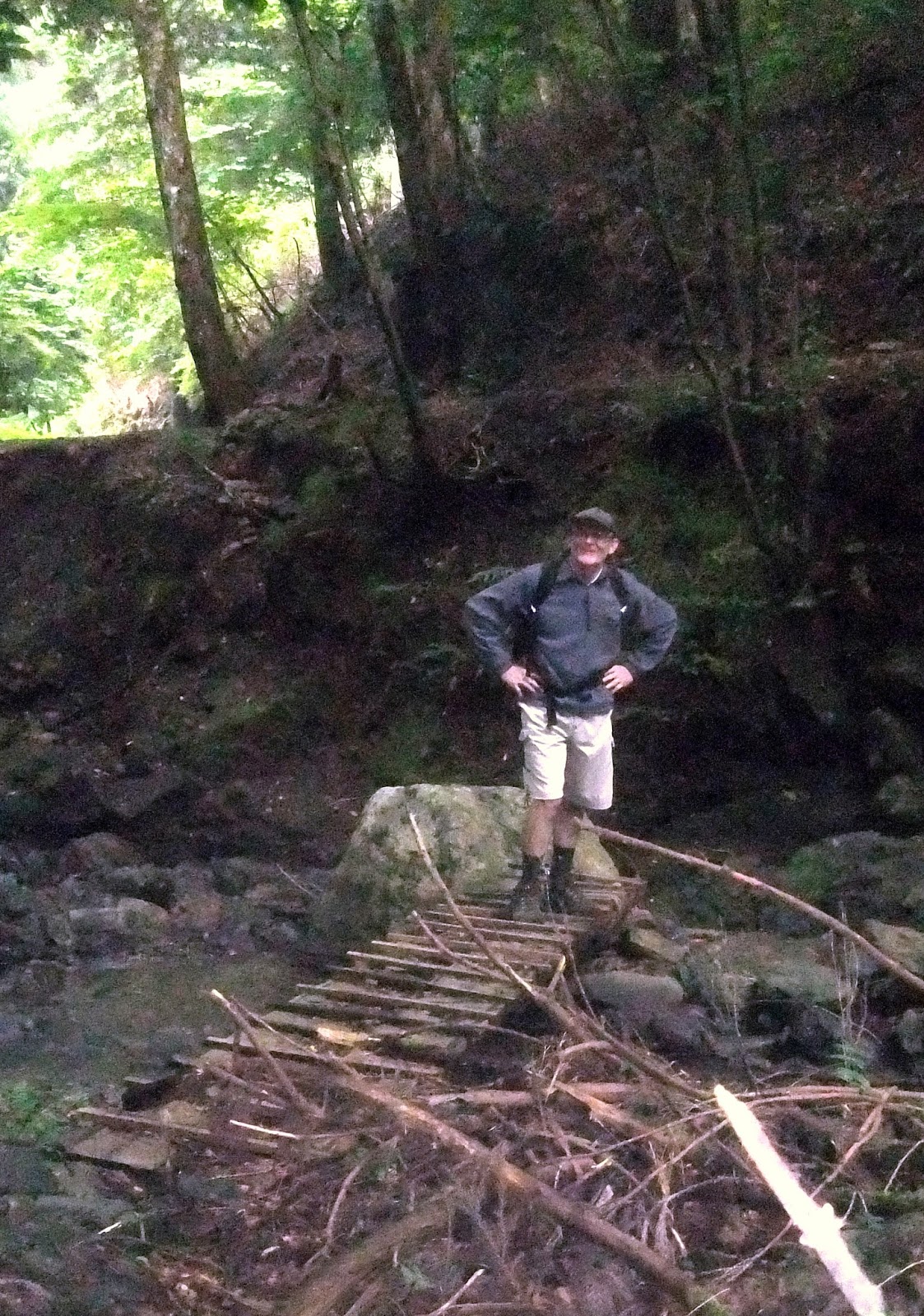
   40-minutes after setting-off from the Deaibashi Bridge, I reached a junction and it was from here that I would commence my ascent to Mt Kibuneyama. The atmospheric conditions by now had become quite unbearable. My glasses kept on fogging-up, my body and clothing were damp and I was sweating profusely. On top of that, the temperature had dropped several degrees, a far cry from the conditions back at the start. I needed to stop and put on my hiking jacket to avoid becoming too chilled. The wooden bridge, pictured on the left, didn't inspire confidence but, if I didn't want to get my boots and feet wet, I had no other option to cross the stream. As I made my ascent I was never far from a stream, and the sound of running water.


   Then, without realizing it, it was very-very quiet. The local bird life being the only sound discernible. And my panting. As I stopped to take-in the serenity, I discovered I had arrived at the junction to Mt Kibuneyama.
Map Location.
    Mt Kibuneyama (map location), 699.4m, is not mentioned in the Nihon Hyaku-meizan list but, to me, after weeks of planning this hike, it was an accomplishment. There was no view to be had (if there was, it would have been shrouded in mist), just a concrete block signifying the summit and a sign with the altitude written on it. As I was conscience of the predicted rain, I didn't hang-around long, and returned to the junction and on to my next destination. It was at this point I made my error. The junction was the confluence of three tracks and, thinking my track led-away from where I had just came from, I proceeded. The track was well marked and defined, not allowing any suspicion that I was heading in the opposite direction to where I thought I was meant to be going. 
Somewhere out there is Kyoto City.
    Along the way I was rewarded with views overlooking Kyoto, albeit shrouded in mist. An hour-and-quarter after departing from the junction, I was reunited with civilization and the first sign that something wasn't quiet right. I think the gentleman, sitting in his car, thought I was crazy as I stood in the middle of the road laughing my head-off, when I discovered where I was. This allowed me the opportunity to stop for lunch and plan what to do from here; do I abort and return another day, or take another track that would put me back on course? I chose the latter. 
Tokaido Road.
   The track I was now on was part of the Tokaido Road, created some 500-600 years ago, for people to migrate between Naniwa (modern day Osaka) and Edo (modern day Tokyo). It was at this point the meteorologists got their prediction right, and the heavens opened-up. Luckily I packed a rain jacket. No sooner that it began pouring-down, it stopped. The gods must have been smiling on me. About a kilometer on (thanks to the signposts) I arrived at a junction with a track leading to Mt Mukoyama. I was now back on my original course. 

   The map said it was a 15-minute walk to the summit, which it was, but it was quite steep and, as my physical condition was deteriorating, this was the last thing I needed. Along the way I took note of the variety of growths on the trees. Mt Mukoyama (map location), 426m, did offer me a partial view of the northern suburbs of Kyoto. As I was in urgent need of a coffee intake, along with some sultana buns, I didn't stay long at the summit and made my way down into the settlement of Ninose. And it was a steep descent, with many hairpin bends to navigate. 
Map Location.
   Moriya-jinja shrine, and at last a dry sheltered spot to enjoy a hot cafe au-lait before my train back into Kyoto. It's amazing how a couple of cups of coffee can revitalize one, it was just the tonic, both physically and mentally. 
   From the shrine I strolled through the settlement of Ninose to the local railway station. The train I was about to take is part of the Eizan Line, which links Kyoto City with the village of Kurama, a popular tourist destination. Once back at Demachiyanagi, I boarded my train for home and, once safely ensconced in my comfortable seat, time for my hikers reward - One-Cup Sake. Kanpai. 

Video - https://www.youtube.com/watch?v=6Fyz-nIaNKA

Course Details - http://www.cateyeatlas.com/trip/detail/682953/     

Sunday, May 10, 2015

Sajikigatake Revisited.

Sajikigatake - map location.
   Two weeks ago I came here to climb Mt Sajiki and, at the end of the day, I was chafing-at-the-bit to return to explore what else was in this area to experience. On this trip my plan was to do a loop course - commencing & ending at the small hamlet of Kumogahata - but, as there was only two buses per day in-and-out of here, I only had a window of 6-hours to complete my route. 
    So as not to cover too much of the same path from my last visit, I decided to take an alternative route to Sajikigatake and detour around Shimyo-in Temple which was to save me time, but at a cost. It was steep. 10-minutes in, and I reached this junction.


   As I slogged my way up the concrete track I passed these two dilapidated shelters, which was comforting to know. Just in case there was a sudden downpour.
    Then suddenly the track came to a halt and, as I scanned to scene in front of me, I spotted red tape tied to some trees that eventually disappeared up the hill. The track to the top junction was well marked and, at the beginning, steep.


   As I was ascending I passed this rocky outcrop of, what looked like from past experiences, the foundation stones of some building that may have been here.
   Once at the top I was in familiar territory and Sajikigatake about an hour or so away. But, before then, another junction and a short detour . . . .
Map Location.
. . . . to  Iwatakeyama (Mt Iwatake)811m. The 10-minute detour offered me the opportunity to take-a-break, check my time and location, and soak-in the tranquility of my surroundings. Interesting to note, the two signs, both detailing the name of the mountain, had two different altitude recordings.


    Back on the track then, within minutes, I came to a clearing which gave me some awesome views of the rolling hills and mountains of North Kyoto. As I scanned further round I could see the suburbs of Kyoto City. Next time I come here, I must bring my binoculars to spot any familiar landmarks.
   A few minutes on, and a view to the south, with the settlement of Omoriashidocho nestled in the valley (I passed through this settlement two weeks ago after my descent from Sajikigatake).

   Approximately 2-hours after setting-out, I arrived at the summit of Mt Sajiki. And a bit-to-eat. After some mental calculations, my return to Kumogahata could be done at a more relaxed pace, and I set-about to check-out more of the summit and my views.

   Unlike my previous visit, I was here alone but for this character, who kept me entertained with his lovely singing voice. Because I was taking a different route from the summit, I did a circuit to find any markers that would indicate my next track. Then, a few meters in, and down, I spotted some red tape on a tree.
   Before I entered the bush, I took one more look at the surrounding hills of western Kyoto.
Map Location.


                Checking the map contours I became aware that my descent would be steep. Well, that was the understatement of the day. As the mud marks on the seat of my pants will testify. The track was adequately marked, until I came to a clearing. From here I could see my mud lane below me, but I needed to get there first. Which wasn't as simple as it sounds. A stream had appeared on my right, which I followed . . . . 


. . . . to this makeshift bridge. The two logs looked dubious and, as I was crossing them, my mind went into overtime: "Please-please don't break". After my nerves settled, I then began the final leg of my journey.
   The next 4-km were uneventful, that was until I happened-across this interesting religious icon. Interesting, because of it's location - in the middle of nowhere,nestled up a hill. It never fails to amaze me where one can come-across something like this. This one was unusual as it wasn't an icon I could recognize. Most are quite distinguishable.

    A  few hundred meters on, and around a corner, Kumogahata. Looking at my watch, I still had 2-hours before my bus. So, I set-out to find a suitable site for a bite-to-eat, check my map, and plan what to do until my departure. And, what better place . . . .
Map Location.
. . . . than this Kagura-den at the Koretaka-jinja Shrine. The shrine, like most of the religious sites in the area, date-back many hundreds of years, or about 1,800-years to be precise.

   Lunch over, and still over an hour to fill-in, I decided on a leisurely stroll down the valley to the Deai Bridge. The purpose being to check-out the area for a future hike in the area, and take in the surrounding scenery - like this house built into the bank, right on the edge of the lane.
Map Location.
   This interesting carving, in the image on the right, heralds the entrance to Koun-ji Temple, several hundred steps up the hill.

   This sea of flowers - name unknown - reminded me of the beauty that surrounds us and, along with the tranquility, gives us a certain appreciation & respect in what we have on this planet.
Map Location.
   The Deai Bridge is located at the confluence of the Kamogawa and Nakatsugawa Rivers, that eventually flows through Kyoto City, Osaka City, before entering the Bay of Osaka. It is here that I intend to return for my next adventure into the area but, before I do, I still have three more chocolate bread-sticks and some iced coffee to consume.

                                                    So, until next time, Sayonara.

   Further images, in video form - https://www.youtube.com/watch?v=4FbKf2Eb5co

   Trip details - http://www.cateyeatlas.com/trip/detail/589235/


Monday, April 27, 2015

Sajikigatake.

Map Location.
   I have been in this area several times over the years on my mountain-bike and, on those occasions, I only went as far as the junction of routes-61 & 107 before heading for home. Whenever I was there I always wondered what was further up route-61. Then, a couple of months ago, when I was reading Wes' latest blog - Mt Sajiki - Sinking In. - my curiosity was further aroused. So, before long, I was digging-out my maps and planning my second hiking trip for 2015. I had to do a lot of research as to how to get there, what track to take, and where to finish my hike at. I decided on a one way course, commencing at Kumogahata and ending at Onogocho. With only two return buses from Kumogahata, and a more regular service from Onogocho, my plans were made.


    Alighting from the bus at the hamlet of Kumogahata
was like stepping-back in time; arriving here required one bus, followed by a train, then two subways and finally a 9-seater bus, a total of 2.5-hours travel. The 9-seater was full to capacity with three different groups and, as the day progressed, our paths would cross (no pun intended) more than once. To allow the others to get on the trail ahead of me, I spent the time preparing my cameras, relieving myself, and removing my hiking jacket and storing it in my pack (even at 9:10am it was beginning to heat-up).
Map Location.
   Once organized and on the road, my first stop was Shimyo-in Temple, 15-minutes away. As cameras and backpacks weren't permitted beyond the main gate, the above image is all I have to share. As a tour of the complex would have taken the best part of an hour, I opted to move-on, placing Shimyo-in on my "Must Return" list.
   From this point I was leaving-behind the sealed road and entering into mountainous terrain and the summit of Sajikigatake, criss-crossing a narrow stream that, as I proceeded, would soon disappear. About 40-minutes in, my first junction, and first wrong-turn of the day. As there were no signposts about, I checked my map and, putting two-&-two together, took the ascending track on my left. Wrong decision. 10-minutes further on I reached a summit, and the two ladies from the bus. They passed me while I was at the temple. Asking where I was, they informed me I had to back-track to the junction and take the track directly in front of me. As I was returning, I passed by the second group from the bus. Once back on the right track, Sajikigatake was just over an hour away. I was doing good time and, as it was closing-in on midday, time for a bite-to-eat. 
Map Location.
   I had no sooner sat down, and began tucking-into my lunch, when the third group from the bus arrived. If these guys had left before me, how was it I arrived at the summit before them? As they could speak English, we had a good chat about hiking and what tracks we have hiked. During our chat, the second group, who I passed earlier, arrived. After a good feed of curry & chocolate breadsticks, washed-down with two cups of cafe au-lait, I decided it was time to move-on. As the others were returning to Kumogahata, and the bus back to Kyoto, I was making my way, via another track, to the settlement of Onogocho. 
Destination.
   I had been warned that my track had some danger attached to it, and was very steep. It was by coincidence that I found the junction. Unlike the track(s) to this stage, this one was poorly marked and, as I progressed, I had to stop at each marker to find the next, before proceeding. I soon emerged into a clearing and was rewarded with this fine view overlooking the settlement of Omorihigashicho, about an 1-hour and several hundred meters descent away.


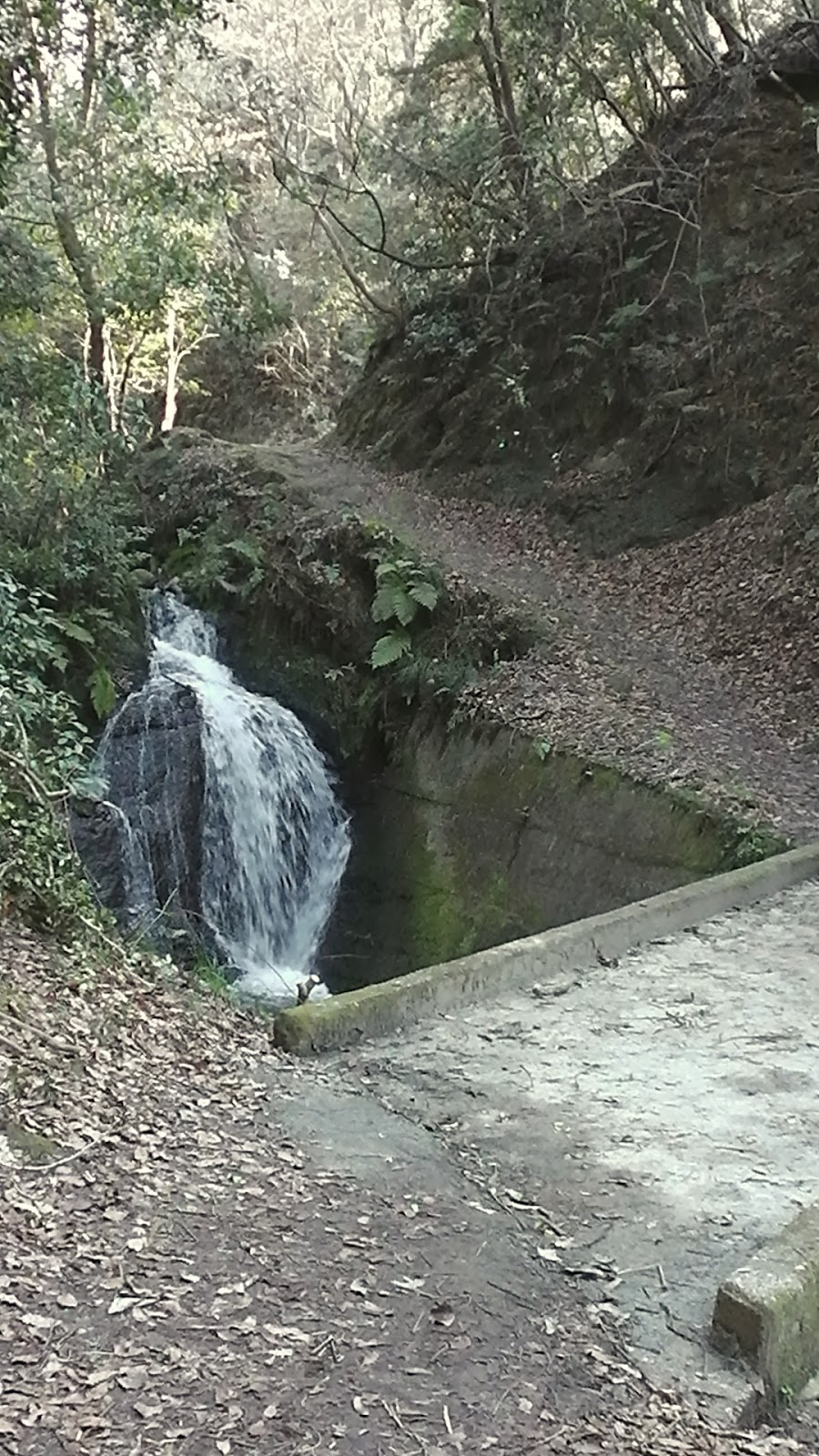
   The stream I was following, as I made my descent, suddenly disappeared and, as I was soon to discover, reappeared as this five-or-so meter high waterfall from a rocky outcrop. Any other day I would have stripped-off and took a well deserved shower.
   Soon my track would emerge onto a forestry skid-site and the access road now became my path to civilization and a smooth sealed road about 2km away. The Amori Resort Camp was my first contact with civilization and, judging by the many cars parked outside, was doing a good trade.
Map Location.
   As I progressed down the valley I passed a complex with some Sakura still in bloom, reminding me how beautiful this time of year is in Japan. Hanami is one of my most favorite celebrations and I look forward to the occasion each year.
   A bit further on and I was reminded of another important time of year - rice harvesting. It is now that the farmers will be flooding their fields and rotary-hoeing them in preparation for planting. To pass by a large area at the different stages of rice growing, can be a sight-to-behold.

Map Location. 
   The next 2km were uneventful and, just as my stomach, and feet, were reminding me to take-a-break, I turned a corner and there was Iwatoochiba-jinja Shrine. And the settlement of Onogocho, my destination. But, before I did anything else, I headed-off to check-out the nearest bus stop and timetable. Much to my confusion, at the time, the nearest stop was a kilometer up the road (little did I know it was near the shrine, thanks to the local policeman) and, upon arrival, I discovered I had about 90-minutes to wait. Great news as I could return to the shrine, have a bite-to-eat, take my boots off, and reflect on the day.
   
Kagura-den.
  Now, you would never believe what was about to happen. I was sitting on the stage, basking in the beautiful surroundings, having a hot cafe au-lait & current buns, when the two ladies from the bus suddenly appeared out of the bush. This was our third meeting of the day and Onogocho was their final destination too. After our last meeting, at the summit where I took the wrong turn, they headed in the opposite direction to me and, in a round-about way, ended-up here. Thankfully they could speak English and we had an hour or so chatting about hiking.

Map Location. 
3:53pm, and time to board the bus for home; the return trip consisted of one bus, followed by a walk, then train, then another bus-ride and finishing with a 10-minute struggle home. My hikers reward of a "One Cup Sake", that travelled with me, remained unopened to be used for another hike, but the two large cans of beer in the fridge, went-down a treat. Kanpai.
                                                 So, until next time, Sayoonara.

   Course details: http://www.cateyeatlas.com/trip/edit/complete/562976/
                                        http://www.cateyeatlas.com/trip/detail/562977/

   Video: https://www.youtube.com/watch?v=X0O9MOCclXM

   I would also like to acknowledge Wes, at Tozan Tales, for allowing me access to his site. Without his post this trip wouldn't have been possible.

Wednesday, March 12, 2014

Shijonawate Stn' to Ishikiri Stn', via Mt Ikomayama.

 
    This course comprises of four tracks that, in two instances, run in conjunction, or on the same stretch, albeit for about 50-meters. Having been in this area many times over the years, I was aware of the scenery in store for me but, my main reason were the several Temples and Shrines located along my course (if you hadn't guessed by now, I have a strong interest in these complexes).
Map Location.
   I departed from the J.R. Shijonawate Station in perfect hiking conditions - fine, calm & warm - and, after weaving my way through the throngs of people and traffic, made my way to my first junction; entrance to Shijonawate-jinja Shrine. In the past, when I have come hiking in this area, my path has taken me through the shrine grounds, followed by a steep ascent up the hills behind.
    But, on this occasion I was taking the lane on my left through a compacted residential area. This map helped confirm my route and, as I navigated my way through the maze of narrow lanes, being helped along my way with a series if signposts, to my first religious complex, . . . . 
Map Location.
. . . . Mitsukue-jinja Shrine. Not an enormous complex, compared to the likes of Fushimi-inari, but it lay on the border that separates the urban from the rural area of Shijonawate, which reminded me that I was now in my kinda environment.
   Soon after leaving the shrine the conditions began to change, thanks to the forest shelter, and became cooler. My path ran parallel to a stream that I would stay with until I reached the reservoir at the Midori-no Bunkoen Park. I couldn't resist the temptation to take a photo of this vending machine and seat and, as I did so, I was reminded of an interesting statistic I heard recently: Japan, a population of over 127-million, where there is one vending machine per 23-people. 
   The scenery, as I made my way up the valley, is a mixture of bridges, religious icons, rest-stops and my favorite - the sounds of nature. I was in my element. 
 
Set of Jizo.
   Along the way there are many junctions, all leading into the nearby park and all very-well signposted. But my path was to take me around the border of the park, passing this picnic area and shelter on my way.
By now the track was becoming busy with other hikers -this is a very popular area for fellow outdoorholics, most being social hikers just out for a days stroll through the forest and surrounding area. There is a large network of tracks through here with plenty of options for locals to explore. Shortly after leaving this site, I exit the forest and arrive at route-8 (the Shijonawate to Ikoma Road) where I cross, via a pedestrian bridge, and head in the direction of Mt Ikomayama. 
Map Location.
     Another junction, followed by another forest, and my path begins it's descent to Hozanji but, before then, my second complex of the day: Ikomahanyadakifudo-in Temple. One blink-of-the-eyelids, and you would easily miss this complex. The area in which this temple is located is very compact, to say the least and, one wrong step, you will find yourself in a stream that flows through the site. Judging by the two water fountains on the premises, the ritual known as Misogi (Ritual Purification) is performed here. 
Map Location.
   About 10-minutes from Ikomahanyadakifudo-in is the splendid complex of Hozan-ji. Located in the shadow of Ikomayama, Hozan-ji requires some time to explore and experience the variety of Buddhist Architecture on display. 
As-well-as the many paths circumnavigating the temple grounds, like this avenue of Religious Icons. This path takes you to the summit of the complex offering fine views of the grounds below.
   Hozan-ji is located at the junction of two tracks, of the Ikoma-sanke Hiking Course plus, with the summit of Ikomayama not far away, the area can be very busy with members of the local hiking community. Which brings me to my next destination, the summit of Ikomayama.

   There are two options to reaching the summit, via the path, or the more leisurely way, via the cable-car. I decided to walk and save myself the 280-yen (which was used to buy 2-cans of beer at the end of the day). It is a moderately steep climb but, if you take it easy, can be achieved in about 30-minutes. Reaching the summit of a mountain can be an exhilarating experience and, as this was my first visit to Ikomayama, I was looking forward to the occasion. But, it was not to be, as this video will show. Needless-to-say, I didn't stay round long. 
Map Location.
    From here my next destination was the Kuragari Pass. To get here I had to ascend down a very-muddy (thanks to the snow of the previous weeks) and steep track. Here I was to join track-10 which I would follow until the conclusion of my day, at the Kintatsu Ishikiri Station. The area is also popular with hikers as it lies at the junction of four tracks. To this point I had been hiking for about 5-hours and, as it had been some 7-hours since I had a bite-to-eat, I was beginning to look for a suitable spot to break for lunch.
Map Location.
   And, what better location than Jiko-ji Temple. Jiko-ji, the penultimate religious complex of my day, was the perfect site - located within a forest, surrounded by the sights & sounds of nature - to dine and check my map. My access to this site was via a lane that branched-off my main path but, during my time here, a party of hikers emerged from the forest and, after a quick look-around, moved on, via another track into the forest. This has got my curiosity-juices running and, as I compose this, am already planning my return.
   From here my path skirted-around the western base of Ikomayama to this junction - the Ikoma Nature Walk and the Zushidani Hiking Course - and my descent down a path that has quite a history attached to it. From as far back as 815AD, such notables as the Buddhist Monk Koubou Daishi, trained in this area.
  
    Five Hundred meters into my descent, I turn a corner, and am greeted with this concrete Torii, heralding my arrival at . . . . 
Map Location.
 . . . . Kouhou-ji Temple. The temple was established here during the Jomei Period (629 -641), but the present temple was built around 1360. As I arrived it commenced snowing, which added to the atmosphere of the area. It's a compacted site, with not much distance between buildings. As I wondered around, I tried to imagine what it was like 1,300-years ago and how the complex was constructed - no trucks, no bulldozers, no cranes - and marvelled at the sheer willpower of those responsible for constructing this temple.

   The final 2km of my path was like walking through a corridor if religious Icons. And, with the snow still falling, I was treated to some awesome scenery. As seen in this video.
   Upon my arrival at the Ishikiri Station, a noticeboard, with map, alerted me to attractions in the area. Viewing it, I realized I had missed a lot of sites during my descent. Which was my cue to make the comment - "I'll be back". 
   
    This is the full video of my days outing.

   This is the full course , courtesy of 
   Ride With G.P.S.