Before you make a grab for your map, or head to the internet in search of Ujideka, don't. Because you won't find it (or I don't think you will). It's a place I have conjured-up to save on space. Over this past February I have spent many hours and traveled just-as-many kilometers exploring and reacquainting myself with the backcountry of Ujitawara, Ide and Wazuka (Map Location) of Kyoto Prefecture.
My first outing took place on the 1st of the month. It was a reconnaissance trip in search of a forest track I wanted to check-out at some later date. As was the case, I didn't pack my cameras but, somewhere along way, I just happened to catch sight of this fella hidden amongst the vines and so made use of the camera on my cellphone. Someone, in their wisdom, had disposed of this stuffed & mounted version of a racoon-dog.
Three days later my Wife & I were to visit the area known as Green Park (map location), a camping, picnic & recreation area surrounding a reservoir. A site I have passed-through on my many hikes & rides in the area.
| Map Location. |
Two days later I was back in the area, this time on two wheels, to check-out a track a friend had told me about. If successful, this track would provide a link with two other tracks in the area where I could commence a hike at the settlement of Yuyadani, Ujitawara Town, and take me through to Ide Town.
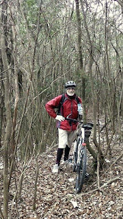
After ascending a steep incline, followed by passing-through several hectares of tea plantation - the area is famous for it's tea and is regarded as the 'Tea-Growing Capitol of Japan' - I then entered an area of dense shrub and had to walk pushing my bike in front of me. Not my cup-of-tea, but it was worth the effort when I emerged onto route-62 (the Ujitawara-to-Wazuka road) about 100-meters from the mountain lane leading to Kontai-ji Temple and Mt Jubuu.
That was it for this day and, as I made my return to home, I was already planning my next outing into the area. Which would be in five days time.
After a short side-trip to the summit of Mt Jubuu (632m), I move onto my next segment and a change of environment - dense scrub emerging into a tea-plantation. When I last came through here, going in the opposite direction, I was wearing my cycle helmet and, as I was to discover today, had protected me from the overhanging branches that were to leave several scratches on my scalp.
| Summit of Mt Iimori. |
 |
| Map Location. |
| Map Location. |
. . . . and this bridge, which is the junction leading to tracks-2 & 3. The phrase, 'third time lucky', was to prove true as, after some rugged uphill terrain,
with more awesome scenery, I was to arrive at the base of a power-pylon - my first thought was "oh no, not another dead-end" - where, after some searching, I discovered a marked track leading down through dense forest and onto, I hoped, was route-321 (the Ide to Wazuka road).
Course details https://ridewithgps.com/trips/7897728 and video https://www.youtube.com/watch?v=LxyvuLOolQ4 of the above outing.
Until next time, Sayonara.


No comments:
Post a Comment