My latest Post.

This view,this beauty
A tear unbidden
Creeps into my eye.

My stay is short
But I shall return to this place
If only my life is long enough.

Such beauty
Gazing upon it
I hope my years are many.

Bokusui Wakayama.
Showing posts with label Sekibutsu. Show all posts

Sunday, September 2, 2018

The Tombs & Kofun of Kyotanabe.


   During my research for my post - 'The Shrines & Temples of Kyotanabe' - I discovered there was a lot of history attached to this area. I mentioned in the post how Kyotanabe was once the Capitol of Japan (AD511-518). What I also discovered is that there are several Kofun located within the city boundaries.


Image courtesy of Google Maps.
   Kofun's are the Japanese equivalent of the Tumulus, or megalithic tombs, and were constructed between the early 3rd century and the early 7th century. The term Kofun is the origin of the name 'Kofun Period' (AD300-538). There are many hundreds of these, maybe thousands, spread throughout Japan. Some are very small, and inconsequential, while others are enormous and hold great importance, like the Daisen Kofun in Sakai City, Osaka Prefecture. It is considered to be the largest grave, by area, in the world, measuring in at 500-metres long and 300-metres at it's widest, and took some 20-years to construct.


Looking east, towards the Kizugawa River, from the Yakushiyama Kofun.
        
   My original plan involved checking-out five Kofun - Geshi Kofun, Yakushiyama Kofun, Ino'oka Kurumazuka Kofun, Osumi Kurumazuka Kofun and Osumi Minamizuka Kofun - and maybe a shrine-or-two along the way. And, as always, keeping off the beaten track. But, by the end of the day, I had discovered another two tombs - Gorogoroyama Kofun & Tomb of Motomichi Konoe - and an archaeology museum specializing in artifacts discovered in the Kyotanabe area - Doshisha University.


    I was out the door and on my bike at 8am and made a beeline for the settlement of Fugenji, and the Tomb of Motomichi Konoe. This was familiar territory to me as I have passed-through here many times since living in the area. It's a lovely area, especially at this time of year, with the rice-fields a sea of green.


Map Location.


   Motomichi Konoe (AD1160-1233) was a Kugyo from the late Heian Period to the early Kamakura Period. In 1179 Motomichi was promoted to Kampaku/Sessho (Regent) as a result of a coup led by Kiyomori, a military leader, and, in February the following year, he took the position of Regent-ship for Emperor Antoku, the 81st Emperor of Japan. Sadly the site has seen better days and, as can be seen in the images, is well overgrown with shrubs, grass and other weeds.


   My next destination, Shinguushaya-jinja Shrine and Geshi Kofun, were just a hop-step-and-a-jump away across the road.


   I don't know if the two are connected to each other; the staff I spoke to at the museum weren't aware there was a shrine there. Access to Shinguushaya-jinja is via a narrow lane, that ends at the steps to the shrine. The shrine itself looks very new, but the Torii and other structures look considerably older.
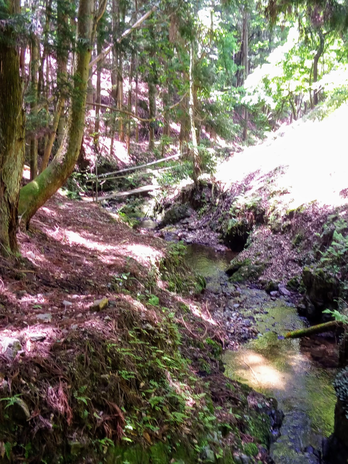
   After checking-out the site, and taking the obligatory photos, I tried to find a way to the Kofun. The site is surrounded by forest, which adds to the appeal of the shrine, and I began my search for a track which would lead me to my next destination. There were two tracks, the first of which lead nowhere (little did I know it did), and so I took the other.


   The second required some bush-bashing. Judging from the terrain, I felt that I was somewhere on the Kofun, and kept my eyes open for a marker of sorts; if you are interested in this style of pursuit, don't do it at this time of year as the insects and cobwebs are bloody annoying. I was wondering if I was ever going to reach my goal, when I looked down and saw a track. I descended and, much to my joy, I had arrived.


Geshi Kofun.
   
   The impression I got, is Geshi Kofun (map location) is not so much a burial mound, but a collection of several burial sites, eight in all, (I managed to find six) spread over a small area. The site, I was soon to discover, was located within the Dashisha University Campus.


                                                                                                                                                                             I have no information as to who is buried here, and when, but I have a friend that is doing some research for me. I may have to attach any information at a later date.Two of the graves were very distinct, with their sides lined by large boulders, while others were signified by a layer of rocks. In the vicinity of some of the graves, were signs giving details of the site. There was also a path throughout the graves, including one from the campus. When it was time to leave, I followed a track in the hope it would lead me out and back to where I parked my bike. I was walking blind, as I had no idea of my location in relation to where I entered the forest. The track suddenly petered-out and I found myself bush-bashing, again. Then, low-and-behold, there was track number-1, (the one I gave-up on earlier) and the shrine.


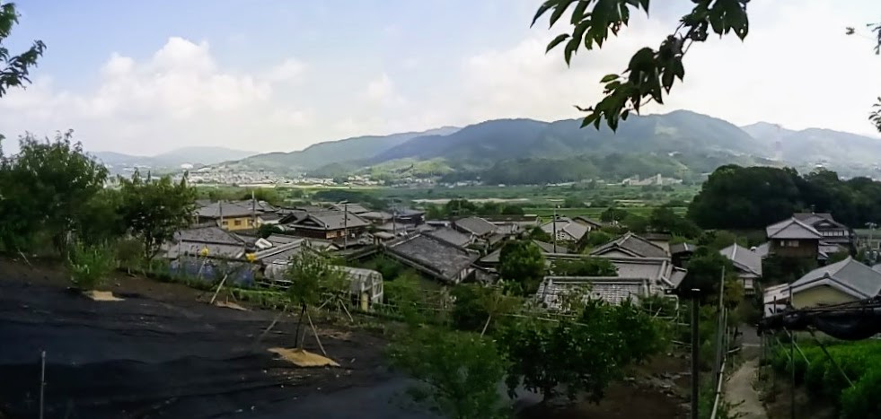
Settlement of Inooka (map location).
   
      From Geshi Kofun, I would make my way to the settlement of Inooka, and an unplanned discovery. Looking at the attached map, Inooka is located on a knob of land, surrounded by rice-fields & tea plantations (above image), and one can't help but get the impression that this site may not be natural, but excavated.


Yakushiyama Kofun.
                                                                    My research told me there were two Kofun located here - Ino'oka Kurumazuka  & Yakushiyama Kofun - but, while cycling-through the narrow lanes to my first site, I stumbled-across another - Gorogoroyama Kofun. 
                                                                   Atop the summit of Yakushiyama Kofun, stands a temple, with a religious icon inside behind a locked gate. The view from the summit, glimpsing through the trees, is awesome (see image at top of page). In front is the Kizugawa River and, in the distance, the town of Ide, at the foot of the Ide Hills.

   
   The impression I got, at the time of my research, was that Yakushiyama & Ino'oka Kofuns were located side-by-side. Wrong, as I was about to discover.
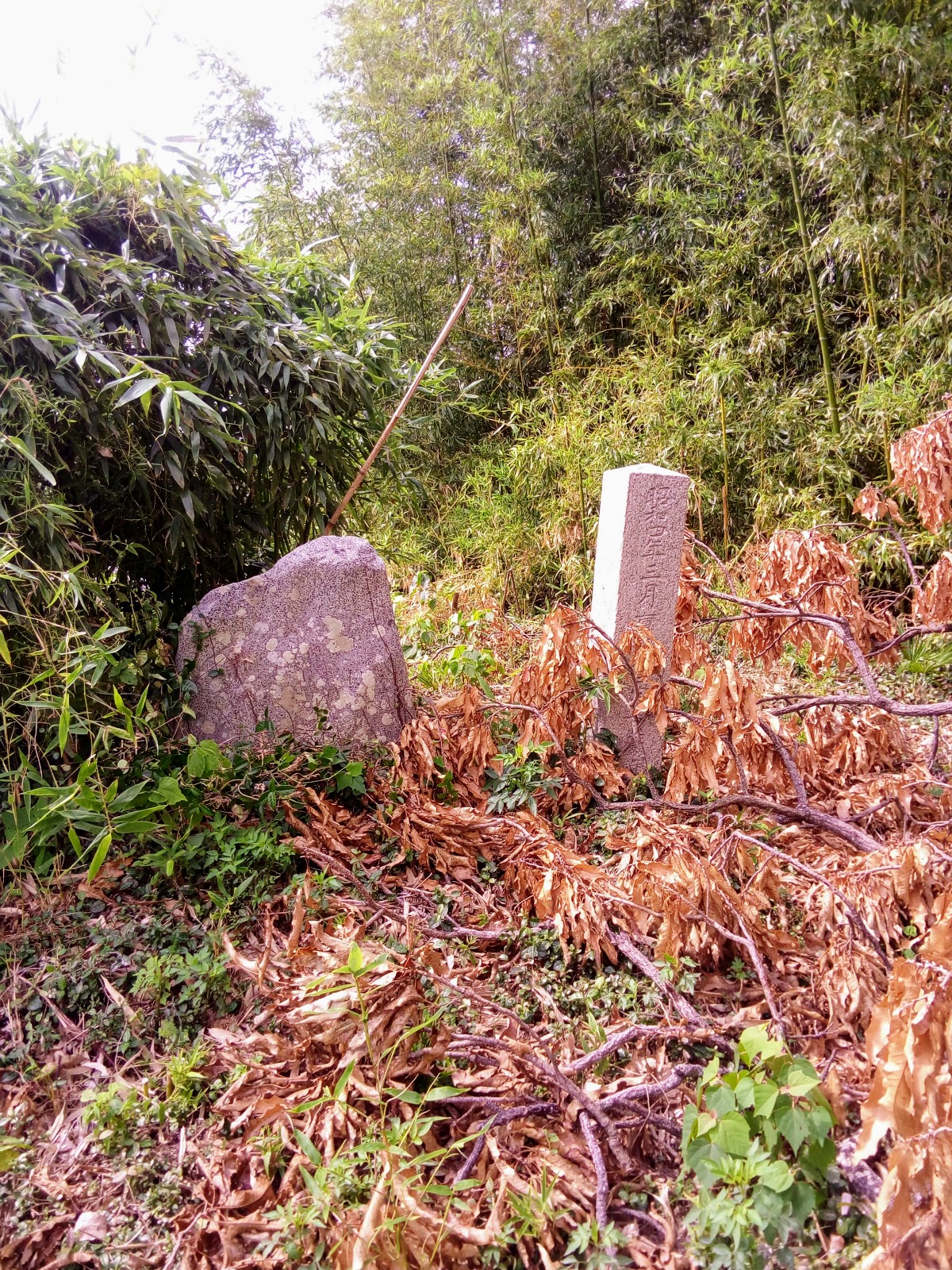

                                                                                                                              As I was making my departure for my next site, at the settlement of Osumi, I passed this sign, partly camouflaged by trees. A quick check revealed that this is the site of Gorogoroyama Kofun. Okay, this wasn't in my plans. Time to check this out. Parking my bike, I ascended the mound. All there was at the top was a concrete post with something inscribed into it.


Gorogoroyama Kofun.

    Taking note of this site, so as to apply it to 'Google Maps', I moved on, to another unplanned stop.


   As I was weaving my way through the narrow lanes of Inooka, I stumbled-across another sign. The inscription on this read - 'Ino'oka Kurumazuka Kofun. I was become more-and-more intrigued by this place; it seemed every corner I turned, there was another discovery.


    A hundred meters or so up the lane from the sign, was an old shed with a track, of sorts, leading up the hill to a clump-of-trees. The track soon petered-out and I found myself weaving my way through, what appeared to have once been, a bamboo grove, now cleared. If I thought my earlier view, from Yakushiyama Kofun, was awesome, the view from here was much better. Looking for a track that may lead me into the trees, and a monument, I literally stumbled-upon these . . . .


Ino'oka Kofun.
     
   When I said 'I literally stumbled', I did. If I hadn't tripped myself up on this dead branch, I possible would have missed these two headstones.
   It is thought that up to eight or more tombs may be located within the vicinity of Ino'oka Hill and that Emperor Keitai's Son/Prince may be laid-to-rest in one of them.
   As the day was beginning to heat-up (it was still only 10am), I decided to take a short break here, take in the surrounding view, before moving-on. While here I decided to take a short detour to the archaeology museum at Doshisha University.


Site of Tsutsuki Palace.
    I came here just over a week ago, to explore the site of the Tsutsuki Palace, the residence of Emperor Keitai. While here I was informed that there was a museum on the campus grounds but, as it was a weekend, it was closed and is only open weekdays.
   I have a special interest in museums, art-galleries, libraries and the like, and I was so pleased that I made the decision to include this on my itinerary. Arriving at the main entrance, a very kind security officer escorted me to the museum; if it had been left to me to find my own way there, I would still be looking now - this is a huge campus.


   I was escorted into the room by a member of the staff, who also gave me a tour of the displays and their history. It was like traveling back in time, which is the effect museums can have on one. There were artifacts, excavated from within the Kyotanabe area, that dated back to the Jomon Period (BC14,000-300), on to the Yayoi Period (BC300-AD300) and finishing at the Kofun Period (AD300-538). Pity my Japanese language skills were so poor, I might have been able to have learnt more from my visit.


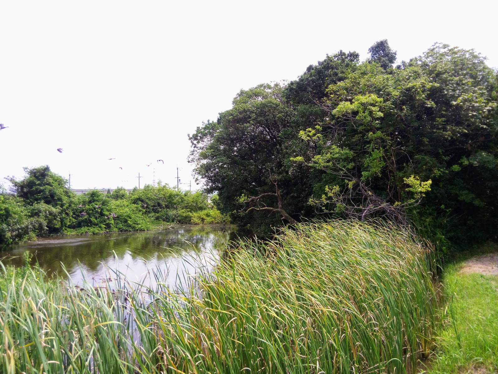
Osumi Minamizuka & Osumi Kurumakuka Kofu.
   
   I departed Doshisha, with the intention of returning (with someone with Japanese language skills) and headed to the settlement of Osumi, and the last two Kofun of my tour - Osumi Minamizuka & Osumi Kurumazuka Kofun (map location). To the casual passer-by, one would get the impression that these were just a couple of clumps of trees in the middle of a rice-field.


   Parking my bike, I went off to explore Osumi Minamizuka Kofun, but I needed to find access first. I made my way along a bank that separated two rice fields. Arriving at the site I set-out to explore but there was nothing - no monument or sign - so decided to circumnavigate instead. 


   To do this, I needed to zigzag my way around through muddy ground (there was no path around the Kofun), remnants of water used for the flooding of the rice-fields. Annoying as it was - I hadn't planned on getting my feet wet - it was quite picturesque. Around the rear was a pond (moat?), surrounded by reeds, with a family of geese enjoying the hot sunny day.


   Returning to my bike, I then headed for Osumi Kurumazuka Kofun. Out of all the Kofun I visited, this was the most distinct. It's 'keyhole' shape stood-out at the base of the trees that covered the mound.


     To the rear of the site were signs giving details of the Kofun and a concrete monument. Parking my bike, I then set-off to explore. First by circumnavigating, then onto the mound itself (a bit disrespectful, if I say so myself). Standing at both ends of the mound I could more clearly distinguish the shape. Again, it is totally unknown who is interred in either of the Kofun, but it is known that they were created in the late 4th to early 5th century.


   It was now getting-on to midday, and I had been on the road for four hours, and I still had an hours ride before reaching home. As I hadn't had a bite-to-eat since leaving home, I decided this site was an ideal location to take-on some much needed sustenance.
   While doing this I took the opportunity to assess the day and view images taken along the way. My impression is that  there is more history to be explored in Kyotanabe, along with it's scenic beauty.


So, until next time,

Sayonara.

   I would like to take this opportunity to express my deepest gratitude to Jaroslav, who operates a 'Facebook Page' on 'Japan Kofun'. His invaluable assistance would not have made this post possible.

Wednesday, May 30, 2018

No plan, getting lost in Hino-no Satoyama.


   It was this noticeboard that alerted me to the area known as Hino-no Satoyama, and, since that day three months ago, I have ventured into the area some seven times. Three of those times were a reconnaissance expedition, two were a planned hike, and once when I was invited to join the couple responsible for erecting the noticeboard.


   The options available are quite extensive, as can be seen in this map. Some of the tracks are well marked and beaten, others, like the ones I experienced with the couple I joined, are almost nonexistent, where an amount of patience is required.

   This 'No Plan - Getting Lost' outing was an opportunity for me to check-out some of the tracks not covered on my previous trips, and hopefully see some sights I had also missed. 


   My starting-point was an athletic park (map location), where a junction of three tracks converged. One of which I had taken on my first hike. 

   Little did I know, when I set-off, that I would return to this point 2-hours later, albeit by the (almost) same route. Which left me with the third track to take. 


   With these types of outings you can never be sure what you will experience. In some instances I have found myself returning and spending up to a year exploring the many tracks that area. Then there is the scenery, and hazards, as can be seen in the above images.


   According to my map, the track I took had the promise of a waterfall so, after crossing a small stream, I headed-into the bush. For the first few hundred meters my track was well defined, and followed the stream I had just crossed. I reached this waterfall and felt confident I was on course. But that was soon to change. Either I veered off course, or the track became non-existent, so, from this point, I was on-my-own and decided to press-on and continue uphill to, what I hoped, would be the main track at the plateau of the hills.
   As I made my way up the hill the calling of a wild deer caught my attention and I decided to see if I could catch a glimpse of the animal. But to no avail. So it was back to my ascent. By now I was working-up a sweat and needed to find a spot to take-a-break and store my jacket. I was relieved when I stumbled across this outcrop of rocks. While I was taking on some well deserved water, I took the opportunity to check my map to see if I could ascertain my location, which wasn't easy - my map is only lines drawn on a sheet of paper and has no contour lines. But, little did I know, the plateau and main track were just a few meters from where I was sitting and, to my delight, when I emerged, there was a sign pointing me in the direction from where I had just come from. So I wasn't lost.


    To confirm where I was, a small sign directed me to (Mt)Hinoyama (373m), and my third visit to this site. I knew that on the other side of the summit was a junction which would lead me to my first descent of the day, to the settlement of Sumiyama (map location).


   I have an envy for those that live in these settlements. With only the one road in and out, there isn't much transport passing through, plus there is the serenity and beauty that surrounds you.


   In preparation for this hike, I did a reconnaissance bike-ride into the valley the week before, to check there was a track up the hill. My map didn't show any tracks on this side of the hills, so I needed to be sure, that way I wouldn't be wandering up-and-down the lane looking for something that was quite possibly not there.

   If this track was the one I thought it was, I would arrive at the junction of the Yuurei-touge Pass, and from there to my next destination. Wherever that was. 


   From where I was standing the track looked steep, so I braced myself for a tough climb, and the day was beginning to heat-up. A few minutes in and I would (literally) stumble-across this collection of small religious icons. Always on the lookout for these, I was impressed with their location plus, on closer inspection, one of them resembled  'Fudo, the God of Waterfalls' (bottom left corner, image on the right).
   I was pleasantly surprised when my track began to level-out but, also at this stage, the track & markings petered-out and I was left scratching my head, again.


    I proceeded on up when, like my earlier ascent, I arrived at the plateau. A couple-of-hundred meters along I arrived at this junction, and the Yuurie-touge Pass. It was during the war, when the American bombers were bombing-the-hell out of Osaka & Kobe, the Japanese Defense Forces  erected a searchlight at this location.

   To the left I would return to (Mt)Hinoyama, to my right, Kami-Daigo Temple. I went straight ahead. If my map information was correct, I would return to where I commenced my hike. Which it did but, much to my consternation, it connected with the track I hiked-up at the beginning of the day. Oh well, nothing ventured, nothing gained. It was now time to take the third track, and to see where it led me to. Little did I know, at that point, that this track would merge with the first track and  back into familiar terrain. 


   I knew up ahead was this building, with many Sekibutsu located nearby. It would also make an ideal site for a lunch-break, and a rest. With all the bush-bashing and climbing & descending, I was beginning to tire. Or, more precisely, I was showing my age.


   On my first visit here, I was overwhelmed by what I was confronted with and, to this day, I still haven't been able to gather any information as to the name and reason of the location.

   During the course of my rest here, I decided to take a more thorough look around and, in a secluded corner of the site, obscured behind a Setsumatsusha (small shrine), was this collection of Fudo Statues. In a gap in the rock was a small stream of water flowing-into a concrete bowl. Someone had kindly placed a mug there which was my cue to refresh my thirst and, let me tell you, it was refreshing & pure. 


   During my lunch-break I perused my map for my next destination - do I go on ahead into familiar territory, or do I look for another track, one that I hadn't used before? On my way to this point I remember espying, what I thought was, another track (actually I noticed a couple). So I decided to u-turn and head back down towards where I had just come from. Five minutes along I reached the junction and proceeded in my new direction. A little further along was this fallen tree, with a large fungi attached, that lay over the track. Just around the corner from this tree was another junction, and a familiar site . . . .


   Nine days ago, while hiking in the area with my hosts, we passed this site from the other direction. The rock was enormous, and I was informed that locals worshiped here, as the rock was considered to have had some connection with  a God. The building was constructed as a shrine, which has become dilapidated over the years. But, judging by the many empty shochu bottles lying-about, I got the impression the site was still frequented.


                       From this point my hosts followed the stream that meandered through the valley and, eventually, leading us back into civilization. Although it was still quite early - it was only 12:30pm - I was beginning to tire, and so I decided to call-it-a-day.


Footnote:

   I would like to take this opportunity to acknowledge my hosts, Toshiyuki & Noriko Sawai, for giving me a guided tour through these hills and enlightening me on the history and beauty that lies within Hino-no Satoyama.
   Toshiyuki & Noriko have lived here all their lives and know the area like the back of their hands, and have frequented the area many times, guiding others like myself. Domoarigatoogozaimasu.


   In 1592 construction began on, what was to become, Momoyama-jo. The castle was being build for Toyotomi Hideyoshi who, just the previous year, had retired from the Regency. Some 20,000-to-30,000 workers were provided, from twenty provinces, to construct the castle. The rocks required for the foundation were gathered in this area and, to this day, evidence of their labors can still be seen. What amazed me, and to put this into perspective, is that back then, they didn't have the convenience of heavy machinery to assist them. 

  
   As always, thank-you for reading this post, and I look forward to sharing my next experience with you. So, until then,

Sayonara.