My latest Post.

This view,this beauty
A tear unbidden
Creeps into my eye.

My stay is short
But I shall return to this place
If only my life is long enough.

Such beauty
Gazing upon it
I hope my years are many.

Bokusui Wakayama.
Showing posts with label Off-road cycling. Show all posts

Monday, April 1, 2019

Nishigamo, Kyoto City.


   In the western suburbs of Kyoto City, is an area known as Nishigmo. There isn't much in this area that attracts the tourists, unlike other parts of the city, but, once a year, on the evening of August 16th, all eyes are turned to (Mt)Funayama, and what is known as 'Gozan no Okuribi'. This is a festival where five giant bonfires are lit on mountains surrounding the city. As one who has experienced this event, it is a sight-to-behold.

   This area was brought to my attention by a fellow outdoorholic, who I am connected to through our 'Strava' pages. Looking at a particular trip he had done, I became interested in what lay within the hills of Nishigamo. And so I decided to do some exploring of my own.


 'Exploring the Hills of Nishigamo'

   This was to be my first venture into the area. I had the choice of two tracks, both converging within a kilometer of the road, so I decided to take one through to the Himuro-michi Road, then u-turn and return via the second. I needed to be prepared to abort my trip at any stage, as I was conscience that there still may be remnants of 'Typhoon Jebi' obstructing my way. I had no problem in finding the track, and, upon arrival, I set-off. The first few-hundred meters the surface was concreted, which was nice, but then it turned into a muddy track, which one would expect of this type of terrain. With Kyoto City, and it's environs at my back, I was quite overwhelmed with how quickly my surroundings had changed. And peaceful too.


   About one-kilometer in, and I arrived at this junction. This was my second track and, all going well, I would return here in the not too distant future. But,before I moved-on, I did a quick check that this was where I thought I was. The reason for that, is that the track from this point changed dramatically.


   Gone was the soft undergrowth of fallen leaves & pine-needles, and wide open track. From this point on it would be rocky, rutted-out, tree-weaving and, for most parts, I had to walk and, at times, carry my bike. But I didn't mind. The surrounding scenery was worth the inconvenience. 


     I was surprised how little evidence there was of the storm of last August. I would have expected more obstructions. Not that I was complaining. In some sections I was able to mount my bike and cruise-along at a leisurely pace plus, as I was doing good time, stop and take a couple of photos. I noticed, as I made my way, several tracks branching-off the one I was taking. Taking note of these, I would research their destination upon returning home, in case there was the possibility of me returning here.


Map location.
                                                                                                                                                                          Then suddenly I emerged out into open space, and familiar territory. I had arrived at the junction with the Himuro-michi Road. Familiar, because I have traversed this road several times of the years as I hiked the 'Kyoto Trail'; an 80km trail that partly circumnavigates Kyoto City. I am feeling very exhilarated and, during a short break, I decide to change my plans and head for the settlement of Himuro, and link with the Kyoto Trail.


   My memories of this track are of a steep, narrow & windy descent and I prepare myself to the inevitability of having to carry my bike for the most part. But, what I did forget to take-into account, was the possibility of storm damage still in evidence. In some places the track took a detour, where I had to lug my bike up a hill, scramble under-&-over  fallen trees, before returning to the course proper.
Map location.

   There were some moments when my surroundings were very beautiful, like this bridge. It was while preparing to take this photo a group of elderly-women hikers appeared, and their surprise to seeing a lone cyclists in such an isolated location, brought-on rounds of giggles and chattering.


   For this 3km section of track, I think I only managed to cycle a combined distance of 100-meters, if that. So, when I emerged at route-61 (map location), I was somewhat relieved that I was able to re-mount my bike and move on at a better pace. Like my arrival at the junction with the Himuro-michi Road, I was still feeling great. So I made another change. I would take routes -38 & 40 through the settlement of Shizuhara to Ohara and from there back into Kyoto City and home.
   Six-and-a-half hours, and 92km later, I arrived home, somewhat saddened that the day had come to an end. It had been a awesome bike-ride and, as a 65-year old, I was very proud of myself. But I wasn't finished with the hills of Nishigama. That second track, the one I didn't explore, played on my mind over the following days, so I made the decision to return, and, while doing so, check-out another track in the area. Again, courtesy of my 'Strava' connection. But that's another post.

Course details & map - https://www.strava.com/activities/2212101579


So, until next time - 

Sayonara.  


Thursday, March 7, 2019

Checking-out the hills overlooking Yamashina.


                                                                                                                                                                          I have spent many hours cycling through this area over the years, but it was another post on my 'Strava' page that alerted me to the possibility of some off-road cycling/hiking tracks. Checking this map, and other maps of the area, I came to the conclusion that there was quite a network of tracks, entering & exiting at different locations within this part of Kyoto City.


   Access to the area known as Yamanaka, is via the Yamanaka-goe Road, or route-30. This road, that connects the cities of Kyoto and Otsu, is narrow and quite windy, and care is needed when traversing. At the plateau is the entrance of the 'Hieizan Driveway'. 
   There are also several distractions, especially on the Kyoto side, like the . . . .


Nitten-ji Temple & Shrine (map location). As car-parking is non-existent, being on a bike/foot is an advantage.


   Other distractions include religious icons.


   My plan was to do a reconnaissance ride into the area, and connect with the track my Strava connection had taken but, unlike his trip, I would descend. My research revealed that some of the tracks lead to (Mt)Daimonjiyama, a mountain overlooking Kyoto City and made famous for the 'Gozan-no Okuribi' Festival.


   Arriving at the plateau of the Yamanaka-goe, I then branched off and made my way through the settlement to where my off-road adventure would, I hope, commence. The settlement is constructed in a Grid Plan  layout (map location) and one wrong turn, and god-knows where you can end-up. Like I did on my first venture into the area. Exiting the settlement, my road entered a forest then, after passing a small temple, it became a rocky forest road. A couple of kilometers in, and I arrived at this small shrine (map location). This isn't the first time I have been here and, on each occasion, and others like this, I am continually intrigued as to such a place to establish a religious site.


   After a banana and a few mouthfuls of water to wash it down with, I turned and began to head in the direction of the track I needed to take. And this is what greeted me, remnants of 'Typhoon Jebi' that wreaked havoc throughout the region in early September 2018: wherever one goes they will see scenes like this. I leaned my bike against a tree-stump and headed up to the track. The devastation surrounding me was horrific. It didn't take much to convince me that proceeding was not only impossible, but dangerous. So I decided a u-turn was my best, and only, option. It was just as I was about to return to my bike, when a lone hiker appeared. He had just come from (Mt)Nyoigadake - where I was planning to head to - and was heading to Daimonjiyama. He told me, once I reached the summit, I wouldn't be able proceed further, due to the storm damage, and my best option was another track, which would emerge at Bishamon-do Temple, at Yamashina (map location).


    Shaking hands and expressing my gratitude, I returned to my bike and made my way down. At first I was a bit nervous - dragging my bike over, under or around fallen trees, isn't my idea of a bike-ride - but, as I proceeded, evidence of a clean-up was all around and, at times, I was able to mount my saddle, and ride. Albeit for a few meters.


    Partway down I came to a clearing with a large rock in the middle. This was my cue to take-a-break, have a bite-to-eat, and take a photo.While here I had to re-plan my course, and my best route home. I decided to get onto the Biwako Canal path and, from there, another path that would take me through to Rokujizo and home. I missed my turn-off and ended up cycling through Kyoto City. No sooner had I arrive home, that I was planning my return. And, eleven days later, I did just that.
   Course details & map - https://www.strava.com/activities/2151913989 


                                                                                                                                                                          The morning of Wednesday 27th dawned cold, miserable and overcast; the previous day we experienced spring/summer like conditions. I made a beeline for the shrine - no sightseeing this trip - and, 40km x 2-hours later, I arrived with the overhead conditions improving. I decided to lock my bike up behind the shrine and explore the track to (Mt) Nyoigadake on foot, and also look for the track that lead down the valley.


   That way, if my reconnaissance wasn't successful, I wouldn't have had to lug my bike the sixteen-hundred meters there & back for nothing. But I was in luck. Like my previous excursion eleven days prior, the track had been cleared. Arriving at the summit, I then went in search of the junction that would eventually take me out and down the valley. And again I was in luck.
  Excited at the prospect of a successful conclusion to this outing, I returned, retrieved my bike, and made my way back to (Mt)Nyoigadake.
   By now it was about 10:30am and the temperature was beginning to heat-up.


Summit of (Mt)Nyoigadake.
Map Location.
        
   The summit was somewhat of an anticlimax. Where someone would expect a marker denoting the summit, with possibly a view of the surrounding hills as a bonus, an aircraft communication/navigation facility was located there instead.


   Leaving the sealed access road, I now commenced my descent down a well maintained forestry road to emerge at, I hope, at Fujio-jinja Shrine. I visited this facility a couple-of-years ago, when I was in the area checking-out other off-road tracks, and would give me an idea where I was in relation to my journey home. The first three kilometers were made-up of several hairpins and, it was about now I was congratulating myself for taking the descent option. Unlike my friend who took the ascent. But, when I arrived at this site, my smile soon disappeared. It was at this point my well-maintained forestry road suddenly became a rough-and-rocky track. In some places it was too hazardous to cycle and I needed to dismount and walk and, on top of that . . . .


   . . . . I had to navigate my way through, or over, or around several fallen trees. At this point, in the above image, I began to get the feeling I was nearly at my goal.


Fujio-jinja Shrine.
(map location).
   And my hunch was right. As I broke through the barrier, there, just a few hundred meters down the track, was Fujio-jinja. It was a sight-to-behold; at one stage of my descent I began to worry if & where I would emerge. Parking my bike, I grabbed my drink-bottle, took a banana out of my bag and went and sat on the Kagura-den. By now the sun was unobstructed and glaring in my face - a far cry from the conditions when I left home. I didn't want to get too comfortable, I still had the best part of 40km to ride.
   While sitting here a plan was beginning to form in my mind of a hike, commencing here, that would zig-zag through the hills, ending at the summit of (Mt)Daimonjiyama. But that is another post. 
   Course details & map - https://www.strava.com/activities/2178374376

   As always, thank-you for viewing and, until next time - 


Sayonara.

Saturday, February 23, 2019

Hisashiburidesu - long time no see.


   It's amazing how fast six months can pass. That's about how long it has been since my last post. I had almost forgotten I had a blog. It was just after my last posts on the Shrines & Temples and Tombs & Kofun of Kyotanabe that I began to experience a discomfort in my left knee. A visit to the doctor revealed that I had damaged the cartilage; I had dreaded this moment for many years, where I reached a point where I could no longer enjoy the great outdoors. But the news wasn't all bad. I needed to take-a-break from hiking while the tissue healed, but cycling was okay. Phew.


   So I decided to use my down-time to explore new areas and sights. To start-off with, I honed my sights on the rural areas of Takatsuki & Ibaraki Cities. As these would be 'Tiki Tour' rides, I would be in tourist mode, so anything that attracted my attention, I would stop and check-out. The area I was about to explore had recently been devastated by one of the worst typhoons in history and, to this day, five months on, evidence is still to been seen. As I made my way up route-6 to the settlement of Tano, what was once dense forest, was now littered with fallen trees.
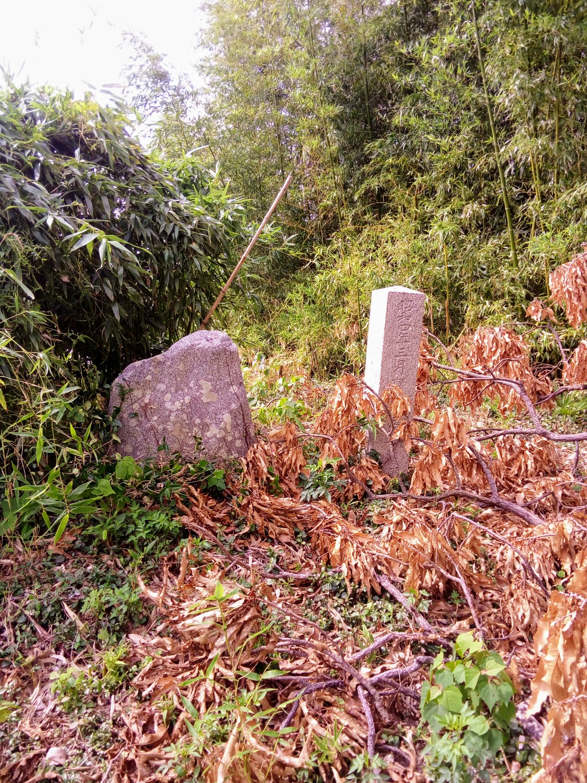
   My first stop was at Koumei-ji Temple & Shrine (map location),  where I briefly visited some years ago. On this time around I decided to take a more thorough look. And I am so glad I did. I was overwhelmed by what I was to discover.


   The surrounding dense forest and moss-covered ground added an atmosphere of beauty to the complex, especially with the sun trying it's best to break through the canopy. The site covered quite a large area and consisted of a temple, main shrine, small sub-shrines and waterfall.


   From Koumei-ji I made my way to Ibaraki, passing-through rural scenery I enjoy so much. In some places the rice fields were reaching their peak before being harvested, in other places the harvest was already underway. 


Takakura-jinja (map location).
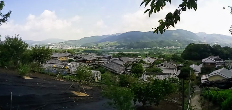
My next stop was at Takakura-jinja, where I was afforded a fine view down a valley which would take me back through Takatsuki City and on home. But, before I proceeded, I needed to find a place where I could take a lunch-break, preferably somewhere in the sun.
   88km and 5.5-hours after leaving home, I returned in high spirits. Not only had I experienced some great scenery, my knee didn't give me any problems. 
   Course map & details - https://www.strava.com/activities/1899247594 

                                                                                                                                                                   Two weeks later I returned to the area in search of Emma and M's Cafes. Emma Coffee, in the settlement of Toyono (map location), is a popular destination by members of the Osaka cycling community.

   But on this day, of all days, I was greeted by this sign, and locked door telling me it was closed on Thursdays. Just my luck. Anyway, I couldn't complain, I did manage to experience some more great scenery on my way here. And I still had M's Cafe on my list.
   Not wanting to backtrack to the settlement of Sendaiji (map location) via the same route, I took a more circular course that bordered Kameoka & Takatsuki Cities. 

Tenmangu-jinja (map location)
   
   I arrived at the settlement in glorious sunshine and, as it had been some hours since I had had anything to eat, I searched for a spot where I could take-in the views and devour my lunch. And the steps to Tenmangu-jinja was that ideal location.

   And this was my view - 


   A week earlier and these fields would have been full of the new seasons rice which, believe-me, is a sight to behold. On a more sadder note, to the right of this image is the recently opened 'Shin-Meishin Expressway', that was carved through, what would have been, a very picturesque settlement. The price we pay for progress.

   Lunch over, and it was time to move-on. 'M's Cafe' was just around the corner - less than a minute to be exact - and the possibility of enjoying a nice coffee, while sitting on a deckchair. But this just wasn't my day - the cafe is only open on weekends. After checking-out the facilities, I headed home with my tail between my legs with the determination to re-visit these establishments. That's when they were open. Course map & details - https://www.strava.com/activities/1925857965 

Map Location
     Nine days later I would return to the area again, this time via route-208 past Nishiyama Yoshiminedera Temple, at the base of (Mt)Ponponyama, and onto route-733, at the summit of the Osaka-toge Pass.


   Again it was another brilliant fine day, with a November chill in the air, perfect for what I had in mind. My plan was to return to 'M's Cafe', (hopefully) have a coffee, and move-onto the Ai River cycle/walkway through Takatsuki and onto the Yodo River. Trying my best to charter new territory. 

Map Location.
   Route-208 to Yoshiminedera Temple is a gradual climb requiring the use of all twenty-seven gears on my bike, but the track to the base of Ponponyama required me to walk. From the plateau through to the Osaka-toge pass, and through to the settlement of Tano, is rural Japanese scenery at it's very best. Passing through Tano, and onto route-733, I encountered this collection of used rail carriages, and what looked like an art/nick-nack center. Before long I was crossing the border of Takatsuki and entering rural Ibaraki City with the thought of a nice hot coffee firmly in my mind.


   But again it wasn't to be. It could have been, if I was prepared to wait an hour for the cafe to open but, as I was eager to press on, I did just that. Another track, passing the cafe entrance, looked promising, so I took it and, to my annoyance, it ended at a rice field. Dejected, I u-turned and discovered this bench, and time for a bite-to-eat.

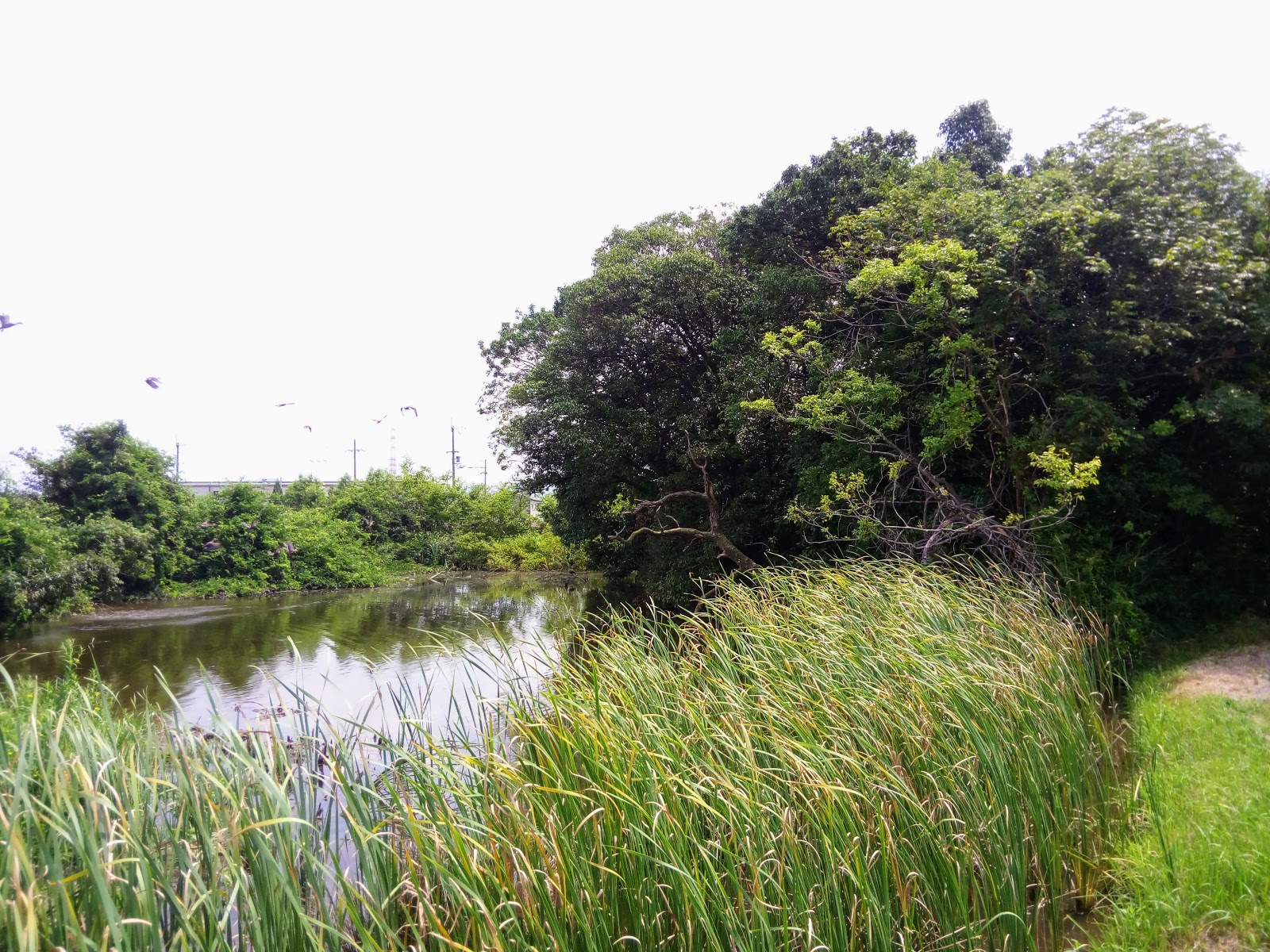
   From here I made a beeline for the Ai River. I like these cycleways as they avoid the very many and annoying traffic lights; the stop/start action burns more energy that the uninterrupted course along the river. 
   Fifteen kilometers on and the Ai River merges with the Kanzaki River, which merges with the Yodo River 2km away. From here it is a nice one-hour ride home, and a nice hot shower. But I wasn't finished with this area yet. 
   Course map & details - https://www.strava.com/activities/1942360412  

  
    Out of the previous three ventures into this area, this trip would be the longest, albeit by about 1-km. 'Four rivers and an Airport', the title of this outing, would take me along four rivers - the Yodo, the Kanzaki, the Ina and Mo rivers - and would also include checking-out the runway at Itami Airport and a small train park. 
   As with trips like this, I like to take many photos, which I did but, for some reason, all but one have been deleted from my computer. So, to avoid boring you with all my usual chit-chat, instead I shall just have to attach a link to my 'Strava' page, and the course map & details - https://www.strava.com/activities/1990458547 

To be continued . . . .

Sunday, September 2, 2018

The Tombs & Kofun of Kyotanabe.


   During my research for my post - 'The Shrines & Temples of Kyotanabe' - I discovered there was a lot of history attached to this area. I mentioned in the post how Kyotanabe was once the Capitol of Japan (AD511-518). What I also discovered is that there are several Kofun located within the city boundaries.


Image courtesy of Google Maps.
   Kofun's are the Japanese equivalent of the Tumulus, or megalithic tombs, and were constructed between the early 3rd century and the early 7th century. The term Kofun is the origin of the name 'Kofun Period' (AD300-538). There are many hundreds of these, maybe thousands, spread throughout Japan. Some are very small, and inconsequential, while others are enormous and hold great importance, like the Daisen Kofun in Sakai City, Osaka Prefecture. It is considered to be the largest grave, by area, in the world, measuring in at 500-metres long and 300-metres at it's widest, and took some 20-years to construct.


Looking east, towards the Kizugawa River, from the Yakushiyama Kofun.
        
   My original plan involved checking-out five Kofun - Geshi Kofun, Yakushiyama Kofun, Ino'oka Kurumazuka Kofun, Osumi Kurumazuka Kofun and Osumi Minamizuka Kofun - and maybe a shrine-or-two along the way. And, as always, keeping off the beaten track. But, by the end of the day, I had discovered another two tombs - Gorogoroyama Kofun & Tomb of Motomichi Konoe - and an archaeology museum specializing in artifacts discovered in the Kyotanabe area - Doshisha University.


    I was out the door and on my bike at 8am and made a beeline for the settlement of Fugenji, and the Tomb of Motomichi Konoe. This was familiar territory to me as I have passed-through here many times since living in the area. It's a lovely area, especially at this time of year, with the rice-fields a sea of green.


Map Location.


   Motomichi Konoe (AD1160-1233) was a Kugyo from the late Heian Period to the early Kamakura Period. In 1179 Motomichi was promoted to Kampaku/Sessho (Regent) as a result of a coup led by Kiyomori, a military leader, and, in February the following year, he took the position of Regent-ship for Emperor Antoku, the 81st Emperor of Japan. Sadly the site has seen better days and, as can be seen in the images, is well overgrown with shrubs, grass and other weeds.


   My next destination, Shinguushaya-jinja Shrine and Geshi Kofun, were just a hop-step-and-a-jump away across the road.


   I don't know if the two are connected to each other; the staff I spoke to at the museum weren't aware there was a shrine there. Access to Shinguushaya-jinja is via a narrow lane, that ends at the steps to the shrine. The shrine itself looks very new, but the Torii and other structures look considerably older.
   After checking-out the site, and taking the obligatory photos, I tried to find a way to the Kofun. The site is surrounded by forest, which adds to the appeal of the shrine, and I began my search for a track which would lead me to my next destination. There were two tracks, the first of which lead nowhere (little did I know it did), and so I took the other.


   The second required some bush-bashing. Judging from the terrain, I felt that I was somewhere on the Kofun, and kept my eyes open for a marker of sorts; if you are interested in this style of pursuit, don't do it at this time of year as the insects and cobwebs are bloody annoying. I was wondering if I was ever going to reach my goal, when I looked down and saw a track. I descended and, much to my joy, I had arrived.


Geshi Kofun.
   
   The impression I got, is Geshi Kofun (map location) is not so much a burial mound, but a collection of several burial sites, eight in all, (I managed to find six) spread over a small area. The site, I was soon to discover, was located within the Dashisha University Campus.


                                                                                                                                                                             I have no information as to who is buried here, and when, but I have a friend that is doing some research for me. I may have to attach any information at a later date.Two of the graves were very distinct, with their sides lined by large boulders, while others were signified by a layer of rocks. In the vicinity of some of the graves, were signs giving details of the site. There was also a path throughout the graves, including one from the campus. When it was time to leave, I followed a track in the hope it would lead me out and back to where I parked my bike. I was walking blind, as I had no idea of my location in relation to where I entered the forest. The track suddenly petered-out and I found myself bush-bashing, again. Then, low-and-behold, there was track number-1, (the one I gave-up on earlier) and the shrine.


Settlement of Inooka (map location).
   
      From Geshi Kofun, I would make my way to the settlement of Inooka, and an unplanned discovery. Looking at the attached map, Inooka is located on a knob of land, surrounded by rice-fields & tea plantations (above image), and one can't help but get the impression that this site may not be natural, but excavated.


Yakushiyama Kofun.
                                                                    My research told me there were two Kofun located here - Ino'oka Kurumazuka  & Yakushiyama Kofun - but, while cycling-through the narrow lanes to my first site, I stumbled-across another - Gorogoroyama Kofun. 
                                                                   Atop the summit of Yakushiyama Kofun, stands a temple, with a religious icon inside behind a locked gate. The view from the summit, glimpsing through the trees, is awesome (see image at top of page). In front is the Kizugawa River and, in the distance, the town of Ide, at the foot of the Ide Hills.

   
   The impression I got, at the time of my research, was that Yakushiyama & Ino'oka Kofuns were located side-by-side. Wrong, as I was about to discover.


                                                                                                                              As I was making my departure for my next site, at the settlement of Osumi, I passed this sign, partly camouflaged by trees. A quick check revealed that this is the site of Gorogoroyama Kofun. Okay, this wasn't in my plans. Time to check this out. Parking my bike, I ascended the mound. All there was at the top was a concrete post with something inscribed into it.


Gorogoroyama Kofun.

    Taking note of this site, so as to apply it to 'Google Maps', I moved on, to another unplanned stop.


   As I was weaving my way through the narrow lanes of Inooka, I stumbled-across another sign. The inscription on this read - 'Ino'oka Kurumazuka Kofun. I was become more-and-more intrigued by this place; it seemed every corner I turned, there was another discovery.


    A hundred meters or so up the lane from the sign, was an old shed with a track, of sorts, leading up the hill to a clump-of-trees. The track soon petered-out and I found myself weaving my way through, what appeared to have once been, a bamboo grove, now cleared. If I thought my earlier view, from Yakushiyama Kofun, was awesome, the view from here was much better. Looking for a track that may lead me into the trees, and a monument, I literally stumbled-upon these . . . .


Ino'oka Kofun.
     
   When I said 'I literally stumbled', I did. If I hadn't tripped myself up on this dead branch, I possible would have missed these two headstones.
   It is thought that up to eight or more tombs may be located within the vicinity of Ino'oka Hill and that Emperor Keitai's Son/Prince may be laid-to-rest in one of them.
   As the day was beginning to heat-up (it was still only 10am), I decided to take a short break here, take in the surrounding view, before moving-on. While here I decided to take a short detour to the archaeology museum at Doshisha University.


Site of Tsutsuki Palace.
    I came here just over a week ago, to explore the site of the Tsutsuki Palace, the residence of Emperor Keitai. While here I was informed that there was a museum on the campus grounds but, as it was a weekend, it was closed and is only open weekdays.
   I have a special interest in museums, art-galleries, libraries and the like, and I was so pleased that I made the decision to include this on my itinerary. Arriving at the main entrance, a very kind security officer escorted me to the museum; if it had been left to me to find my own way there, I would still be looking now - this is a huge campus.


   I was escorted into the room by a member of the staff, who also gave me a tour of the displays and their history. It was like traveling back in time, which is the effect museums can have on one. There were artifacts, excavated from within the Kyotanabe area, that dated back to the Jomon Period (BC14,000-300), on to the Yayoi Period (BC300-AD300) and finishing at the Kofun Period (AD300-538). Pity my Japanese language skills were so poor, I might have been able to have learnt more from my visit.


Osumi Minamizuka & Osumi Kurumakuka Kofu.
   
   I departed Doshisha, with the intention of returning (with someone with Japanese language skills) and headed to the settlement of Osumi, and the last two Kofun of my tour - Osumi Minamizuka & Osumi Kurumazuka Kofun (map location). To the casual passer-by, one would get the impression that these were just a couple of clumps of trees in the middle of a rice-field.


   Parking my bike, I went off to explore Osumi Minamizuka Kofun, but I needed to find access first. I made my way along a bank that separated two rice fields. Arriving at the site I set-out to explore but there was nothing - no monument or sign - so decided to circumnavigate instead. 


   To do this, I needed to zigzag my way around through muddy ground (there was no path around the Kofun), remnants of water used for the flooding of the rice-fields. Annoying as it was - I hadn't planned on getting my feet wet - it was quite picturesque. Around the rear was a pond (moat?), surrounded by reeds, with a family of geese enjoying the hot sunny day.


   Returning to my bike, I then headed for Osumi Kurumazuka Kofun. Out of all the Kofun I visited, this was the most distinct. It's 'keyhole' shape stood-out at the base of the trees that covered the mound.


     To the rear of the site were signs giving details of the Kofun and a concrete monument. Parking my bike, I then set-off to explore. First by circumnavigating, then onto the mound itself (a bit disrespectful, if I say so myself). Standing at both ends of the mound I could more clearly distinguish the shape. Again, it is totally unknown who is interred in either of the Kofun, but it is known that they were created in the late 4th to early 5th century.


   It was now getting-on to midday, and I had been on the road for four hours, and I still had an hours ride before reaching home. As I hadn't had a bite-to-eat since leaving home, I decided this site was an ideal location to take-on some much needed sustenance.
   While doing this I took the opportunity to assess the day and view images taken along the way. My impression is that  there is more history to be explored in Kyotanabe, along with it's scenic beauty.


So, until next time,

Sayonara.

   I would like to take this opportunity to express my deepest gratitude to Jaroslav, who operates a 'Facebook Page' on 'Japan Kofun'. His invaluable assistance would not have made this post possible.