My latest Post.

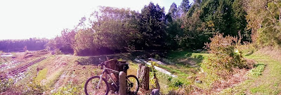
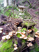
This view,this beauty
A tear unbidden
Creeps into my eye.

My stay is short
But I shall return to this place
If only my life is long enough.

Such beauty
Gazing upon it
I hope my years are many.

Bokusui Wakayama.
Showing posts with label Buddhist Temples. Show all posts

Friday, April 26, 2019

Back on my feet again.


      May 2018, and I was out hiking the hills on the Eastern border of Kyoto Prefecture, in an area known as Hino-no Satoyama. It was a clear, calm & fine day, perfect conditions for hiking. I remember arriving home feeling elated, although, in saying that, I experience that emotion most times I return home from a days hiking.
   Over the coming weeks my joy would be shattered when I began to feel some discomfort with my left knee. After applying a salve and strapping to the area, all to no avail, I headed-off to the doctor. The diagnosis was the cartilage over the said knee was the cause of my problem and I needed to rest-up until it healed. I thought my life had come to an end. But the news wasn't all bad. Cycling was okay, and beneficial to the healing process. Now, almost a year after that near-fateful day, I feel I can get my gear out of storage, and go hiking again. 


Map location.
     I have a couple of big hikes I want to do but, to be on the safe side, I want to do a warm-up hike before I attempt either. So I have chosen an area around the periphery of Fushimi Inari-taisha, in Kyoto City. It was the chance discovery of this concrete Torii on the Daigo-michi Road - a hilly road that connects the wards of Higashiyama & Yamashina - that alerted me to a network of tracks around the base of (Mt)Inariyama. I did a couple of exploratory bike-rides into the area and bookmarked the area for when the problem with my knee was sorted-out. Well, the time has come. Will my knee be up to it? My plan is to enter the area from the Higashiyama side, after arriving at the Keihan Tobakaido Station.


Map location.
     
     I arrived at the station just on 9am and was eager to be on my way but, in the back of my mind, I was feeling some apprehension as to how my knee would respond. The conditions couldn't be more perfect - clear, calm, fine & warm. My first stop was at the southern entrance to Tokufu-ji Temple - this is an enormous complex and is a day-tour in itself. As seen in this satellite image.


     The street I have been walking along for the past ten-or-so minutes, suddenly ends and I descend down a flight of steps to a junction where three tracks converge. A post, placed there by the guardians of the 'Kyoto Trail', points me, in one direction, to Fushimi Inari-taisha,in another, to Sennyu-ji Temple, and the third to (Mt)Inariyama. My course is via the third route but, before I proceed, I take a short detour to Fushikura-Daijin Shrine (map location). This complex has seen better days and, as one reviewer said - "This site has been returned to nature". My sentiments exactly. The shrine emits an eerie atmosphere, bordering on spooky.


      Moving on from Fushikura-Daijin, I leave the sounds of the city behind and head-into a territory I enjoy so much, and my next junction. It's just on 9:30am and the sun is streaming in through the trees, illuminating the canopy of overhanging leaves.


     I reach my next junction, where four tracks converge. Two of those tracks, in the left of the image, are part of a circuit that takes the hiker through to (Mt)Inariyama and ends-up back at this point. I take this track, but I don't plan to return here. Instead I hope to descend down to another shrine and make my way in the other direction. 

   It's not quite 10am, and already I am beginning to work-up a sweat. I reach a clearing and decide to take-a-break. Some of this section has required some steep climbing and, although my knee seems to be bearing-up, I don't want to risk aggravating the cartilage. A little further on and another junction. Here I can descend into Yamashina or proceed. Needless-to-say what option I take.


     Next stop is at this interesting collection monuments, small shrines and religious icons.


     The 'Google Map' app' on my smartphone informs me I have arrived at Oiwa-Inari Shrine. Although this complex was on my itinerary, I didn't realize it extended this far up the hill. But there was more to come.


   About now I wasn't quite sure exactly where I was, then this tree with attached sign relieved any anxieties I was beginning to have. I was still on course and proceeded.


     From the junction my track proceeded along a plateau for a couple-of-hundred meters, before suddenly descending and emerging at a collection of Torii. 


      At this site was a large platform constructed over a deep ravine, with a small shrine erected on top. Behind the shrine was a large rock-face with a collection of Torii of various shapes & sizes.
   

From the platform my path descended down more steps to emerge . . . .


. . . . at another collection of Torii and religious icons. One would be forgiven for thinking they were actually at Fushimi-Inari. This, according to my map app', is Oiwa-Inari Shrine and is a very large complex. As seen on this satellite map.


   Emerging from Oiwa-Inari, I arrive at this junction. I have now joined the 'Kyoto Trail' - a 80km trail that partly circumnavigates Kyoto City - and, whereas the trail heads straight-ahead to my next destination, I turn left here, and take a shortcut through an industrial area, being careful not to be run-over by the many trucks carrying aggregate.

   My course takes me under the Meishin Expressway then across a busy road, before re-entering another forest and onto my next stop.


     Oiwa-jinja Shrine (map location) is located on the highest peak of Mt Fukakusa, Mt Oiwa. The name means 'Honorable Grass', as it provided feed for Tokugawa Ieyasu's horse when he rested here on his way to Kyoto. The shrine is famous for it's male & female deities, which are believed to reside in the two Iwa (boulders) near the peak.


      I emerge from the forest onto a gravel road and arrive at the (Mt)Oiwayama observation platform, and my first break for the day. Although I have only been on the trail for two-hours, it's been quite a strenuous journey so far. Sitting here, in front and below me is an awesome view.


     And this is the view. To my far left I can see the skyscrapers of Osaka City. Just in front of me is Fushi Momoyama Castle (on the treeline on the left), my next destination. And Kyoto City makes-up the remainder of my panorama. What a view, and what a glorious day to appreciate it while having lunch.


   Lunch over, I make a beeline for Fushimi Kitabori Park and onto my next stop . . . .


. . . . Fushimi Momoyama Castle.


Map location.

     The current structure is a 1964 replica of the one built by Toyotomi Hideyoshi, the original built in 1594. The castle is rarely open to the public, which is a pity, as the view from the upper Tenshu would be awesome. I have visited this site many times over the years and never tire of coming here. The grounds are abound with many Sakura and is a popular destination for those wanting a quiet location to celebrate Hanami, as I did on one occasion. The grounds, that the castle is sited, is very large, as can be seen in this satellite map, and is rich in history. Many Japanese come here to pay to homage to Emperors who are entombed here. In one area is the Tomb of Emperor Kanmu and, in another area, is the Tomb of Emperor Meiji.


      From the castle I make my way to the Keihan Fushimi Momoyama Station and home. But, before I catch my train, I treat myself to a celebratory can-of-beer and reflect on the past three-and-a-half hours. Because of the joy to be out hiking again, plus the great scenery I have experienced, I had forgotten all about my knee. But I'm not going allow myself to become too complacent. If any harm has been done, it won't be until the following day before any symptoms emerge. I wake the next morning, my legs feel a bit stiff, which is normal after a hike, and I test my luck by heading-out for a short bike-ride. I return feeling elated that my knee has passed the test. So now I can go-ahead and plan a more substantial hike. And that, I hope, will be another story.


As always, thank-you for reading and, until next time,

Sayonara.


   Course details & map - https://www.strava.com/activities/2303372709


Monday, February 25, 2019

Hisashiburidesu - continued.


   My cycling wasn't just limited to exploring new areas and paths. Inbetween these marathon rides, I would incorporate a shorter outing as part of my rehabilitation, for example - 


                                                                                                                                                                                                        'Tiki-Tour around Kyoto', where the first snowfall of the season appeared on (Mt)Atago-san and other hills surrounding the western suburbs of the city.


   This trip - 'Ride through Yamashiro, Wazuka, Kamo & Kizu Towns' - took me to the eastern reaches of Kyoto Prefecture, and tea-growing country. This is one of my most favorite areas as there is always a new track to check-out and a surprise around every corner.


End of the road.
   
   Now this ride - 'Off-road cycling through Ujitawara Town' - didn't go as planned. It had been some time since I last did a butt-gusting, mountain-biking, getting dirty bike-ride, and I was keen to rectify that. And this area is the ideal location for just that. But, what I didn't take into account, was the residue left behind from the massive storm of the previous August. So, when I reached this wall of fallen trees blocking my path, I realized I was pushing the proverbial uphill and a u-turn was the result. 


   Then there are those relaxing outings with my wife, where we would make our way to a chosen eating establishment, and chill-out over a nice lunch. And, if we had the energy, finish-up at our local Starbucks.

   With the arrival of the New-Year, I set myself a goal for 2019. That was to complete 150-outings over the following 52-weeks. That is based on three rides per week. With us already 8-weeks into 2019, I have already logged-up 31-rides. During 2018 I discovered this interesting website - 'Love to Ride' - that is designed to encourage people to ride bikes; with this site my 'Strava' rides are automatically logged onto my L.t.R. page. It's important that I don't turn this into an obsession, and stick to my purpose for riding a bike - health, enjoyment, appreciation.


   A few weeks ago I discovered an area to the east of Kyoto City - Fushimi-ku, Higashiyama-ku and Yamashina-ku. I have spent many hours cycling through these wards, but never payed much attention to what actually lies hidden amid the forested hills that overlook this part of the city. But that was about to change.

To be continued . . . .
   

Saturday, February 23, 2019

Hisashiburidesu - long time no see.


   It's amazing how fast six months can pass. That's about how long it has been since my last post. I had almost forgotten I had a blog. It was just after my last posts on the Shrines & Temples and Tombs & Kofun of Kyotanabe that I began to experience a discomfort in my left knee. A visit to the doctor revealed that I had damaged the cartilage; I had dreaded this moment for many years, where I reached a point where I could no longer enjoy the great outdoors. But the news wasn't all bad. I needed to take-a-break from hiking while the tissue healed, but cycling was okay. Phew.


   So I decided to use my down-time to explore new areas and sights. To start-off with, I honed my sights on the rural areas of Takatsuki & Ibaraki Cities. As these would be 'Tiki Tour' rides, I would be in tourist mode, so anything that attracted my attention, I would stop and check-out. The area I was about to explore had recently been devastated by one of the worst typhoons in history and, to this day, five months on, evidence is still to been seen. As I made my way up route-6 to the settlement of Tano, what was once dense forest, was now littered with fallen trees.
   My first stop was at Koumei-ji Temple & Shrine (map location),  where I briefly visited some years ago. On this time around I decided to take a more thorough look. And I am so glad I did. I was overwhelmed by what I was to discover.


   The surrounding dense forest and moss-covered ground added an atmosphere of beauty to the complex, especially with the sun trying it's best to break through the canopy. The site covered quite a large area and consisted of a temple, main shrine, small sub-shrines and waterfall.


   From Koumei-ji I made my way to Ibaraki, passing-through rural scenery I enjoy so much. In some places the rice fields were reaching their peak before being harvested, in other places the harvest was already underway. 


Takakura-jinja (map location).
My next stop was at Takakura-jinja, where I was afforded a fine view down a valley which would take me back through Takatsuki City and on home. But, before I proceeded, I needed to find a place where I could take a lunch-break, preferably somewhere in the sun.
   88km and 5.5-hours after leaving home, I returned in high spirits. Not only had I experienced some great scenery, my knee didn't give me any problems. 
   Course map & details - https://www.strava.com/activities/1899247594 

                                                                                                                                                                   Two weeks later I returned to the area in search of Emma and M's Cafes. Emma Coffee, in the settlement of Toyono (map location), is a popular destination by members of the Osaka cycling community.

   But on this day, of all days, I was greeted by this sign, and locked door telling me it was closed on Thursdays. Just my luck. Anyway, I couldn't complain, I did manage to experience some more great scenery on my way here. And I still had M's Cafe on my list.
   Not wanting to backtrack to the settlement of Sendaiji (map location) via the same route, I took a more circular course that bordered Kameoka & Takatsuki Cities. 

Tenmangu-jinja (map location)
   
   I arrived at the settlement in glorious sunshine and, as it had been some hours since I had had anything to eat, I searched for a spot where I could take-in the views and devour my lunch. And the steps to Tenmangu-jinja was that ideal location.

   And this was my view - 


   A week earlier and these fields would have been full of the new seasons rice which, believe-me, is a sight to behold. On a more sadder note, to the right of this image is the recently opened 'Shin-Meishin Expressway', that was carved through, what would have been, a very picturesque settlement. The price we pay for progress.

   Lunch over, and it was time to move-on. 'M's Cafe' was just around the corner - less than a minute to be exact - and the possibility of enjoying a nice coffee, while sitting on a deckchair. But this just wasn't my day - the cafe is only open on weekends. After checking-out the facilities, I headed home with my tail between my legs with the determination to re-visit these establishments. That's when they were open. Course map & details - https://www.strava.com/activities/1925857965 

Map Location
     Nine days later I would return to the area again, this time via route-208 past Nishiyama Yoshiminedera Temple, at the base of (Mt)Ponponyama, and onto route-733, at the summit of the Osaka-toge Pass.


   Again it was another brilliant fine day, with a November chill in the air, perfect for what I had in mind. My plan was to return to 'M's Cafe', (hopefully) have a coffee, and move-onto the Ai River cycle/walkway through Takatsuki and onto the Yodo River. Trying my best to charter new territory. 

Map Location.
   Route-208 to Yoshiminedera Temple is a gradual climb requiring the use of all twenty-seven gears on my bike, but the track to the base of Ponponyama required me to walk. From the plateau through to the Osaka-toge pass, and through to the settlement of Tano, is rural Japanese scenery at it's very best. Passing through Tano, and onto route-733, I encountered this collection of used rail carriages, and what looked like an art/nick-nack center. Before long I was crossing the border of Takatsuki and entering rural Ibaraki City with the thought of a nice hot coffee firmly in my mind.


   But again it wasn't to be. It could have been, if I was prepared to wait an hour for the cafe to open but, as I was eager to press on, I did just that. Another track, passing the cafe entrance, looked promising, so I took it and, to my annoyance, it ended at a rice field. Dejected, I u-turned and discovered this bench, and time for a bite-to-eat.

   From here I made a beeline for the Ai River. I like these cycleways as they avoid the very many and annoying traffic lights; the stop/start action burns more energy that the uninterrupted course along the river. 
   Fifteen kilometers on and the Ai River merges with the Kanzaki River, which merges with the Yodo River 2km away. From here it is a nice one-hour ride home, and a nice hot shower. But I wasn't finished with this area yet. 
   Course map & details - https://www.strava.com/activities/1942360412  

  
    Out of the previous three ventures into this area, this trip would be the longest, albeit by about 1-km. 'Four rivers and an Airport', the title of this outing, would take me along four rivers - the Yodo, the Kanzaki, the Ina and Mo rivers - and would also include checking-out the runway at Itami Airport and a small train park. 
   As with trips like this, I like to take many photos, which I did but, for some reason, all but one have been deleted from my computer. So, to avoid boring you with all my usual chit-chat, instead I shall just have to attach a link to my 'Strava' page, and the course map & details - https://www.strava.com/activities/1990458547 

To be continued . . . .