My latest Post.

This view,this beauty
A tear unbidden
Creeps into my eye.

My stay is short
But I shall return to this place
If only my life is long enough.

Such beauty
Gazing upon it
I hope my years are many.

Bokusui Wakayama.
Showing posts with label Hiking Shiga. Show all posts

Thursday, March 7, 2019

Checking-out the hills overlooking Yamashina.


                                                                                                                                                                          I have spent many hours cycling through this area over the years, but it was another post on my 'Strava' page that alerted me to the possibility of some off-road cycling/hiking tracks. Checking this map, and other maps of the area, I came to the conclusion that there was quite a network of tracks, entering & exiting at different locations within this part of Kyoto City.


   Access to the area known as Yamanaka, is via the Yamanaka-goe Road, or route-30. This road, that connects the cities of Kyoto and Otsu, is narrow and quite windy, and care is needed when traversing. At the plateau is the entrance of the 'Hieizan Driveway'. 
   There are also several distractions, especially on the Kyoto side, like the . . . .


Nitten-ji Temple & Shrine (map location). As car-parking is non-existent, being on a bike/foot is an advantage.


   Other distractions include religious icons.


   My plan was to do a reconnaissance ride into the area, and connect with the track my Strava connection had taken but, unlike his trip, I would descend. My research revealed that some of the tracks lead to (Mt)Daimonjiyama, a mountain overlooking Kyoto City and made famous for the 'Gozan-no Okuribi' Festival.


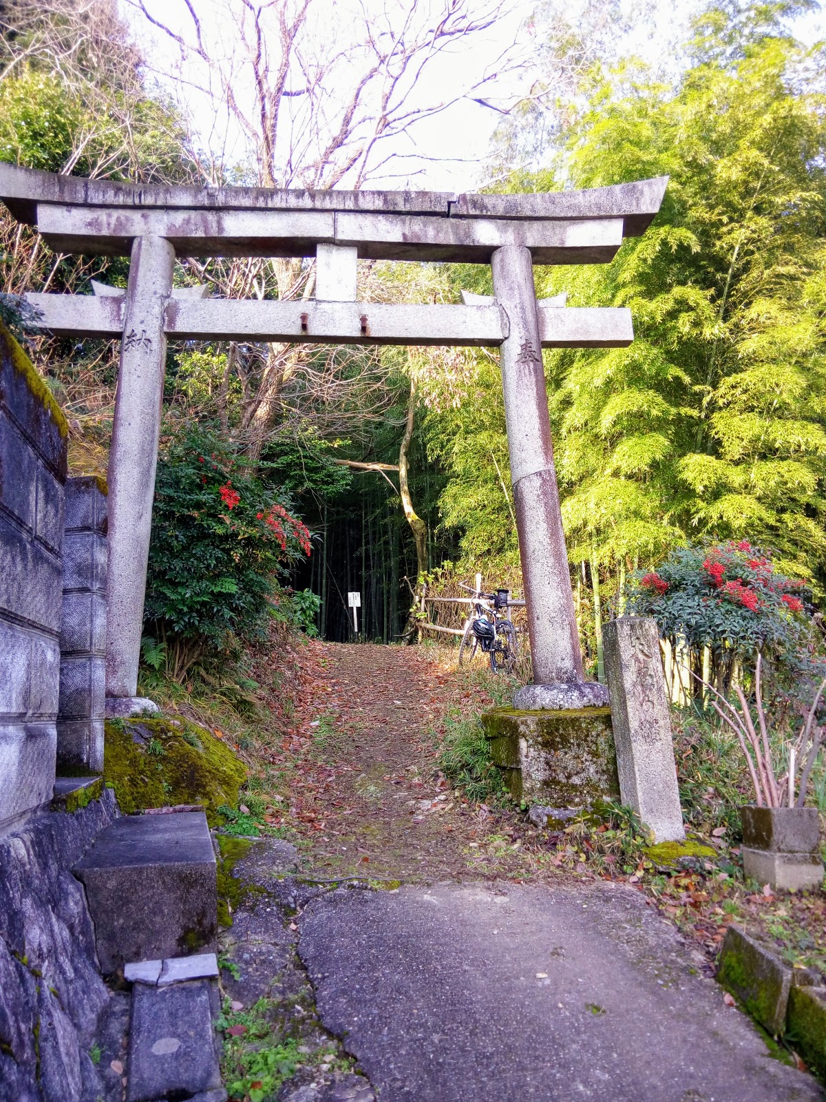
   Arriving at the plateau of the Yamanaka-goe, I then branched off and made my way through the settlement to where my off-road adventure would, I hope, commence. The settlement is constructed in a Grid Plan  layout (map location) and one wrong turn, and god-knows where you can end-up. Like I did on my first venture into the area. Exiting the settlement, my road entered a forest then, after passing a small temple, it became a rocky forest road. A couple of kilometers in, and I arrived at this small shrine (map location). This isn't the first time I have been here and, on each occasion, and others like this, I am continually intrigued as to such a place to establish a religious site.


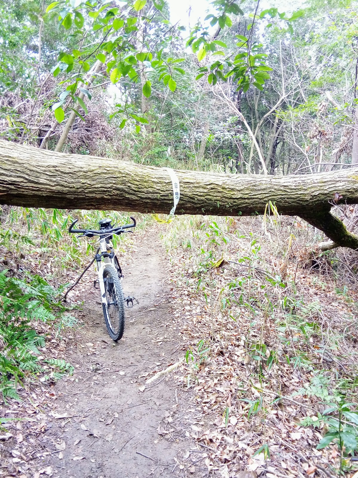
   After a banana and a few mouthfuls of water to wash it down with, I turned and began to head in the direction of the track I needed to take. And this is what greeted me, remnants of 'Typhoon Jebi' that wreaked havoc throughout the region in early September 2018: wherever one goes they will see scenes like this. I leaned my bike against a tree-stump and headed up to the track. The devastation surrounding me was horrific. It didn't take much to convince me that proceeding was not only impossible, but dangerous. So I decided a u-turn was my best, and only, option. It was just as I was about to return to my bike, when a lone hiker appeared. He had just come from (Mt)Nyoigadake - where I was planning to head to - and was heading to Daimonjiyama. He told me, once I reached the summit, I wouldn't be able proceed further, due to the storm damage, and my best option was another track, which would emerge at Bishamon-do Temple, at Yamashina (map location).


    Shaking hands and expressing my gratitude, I returned to my bike and made my way down. At first I was a bit nervous - dragging my bike over, under or around fallen trees, isn't my idea of a bike-ride - but, as I proceeded, evidence of a clean-up was all around and, at times, I was able to mount my saddle, and ride. Albeit for a few meters.


    Partway down I came to a clearing with a large rock in the middle. This was my cue to take-a-break, have a bite-to-eat, and take a photo.While here I had to re-plan my course, and my best route home. I decided to get onto the Biwako Canal path and, from there, another path that would take me through to Rokujizo and home. I missed my turn-off and ended up cycling through Kyoto City. No sooner had I arrive home, that I was planning my return. And, eleven days later, I did just that.
   Course details & map - https://www.strava.com/activities/2151913989 


                                                                                                                                                                          The morning of Wednesday 27th dawned cold, miserable and overcast; the previous day we experienced spring/summer like conditions. I made a beeline for the shrine - no sightseeing this trip - and, 40km x 2-hours later, I arrived with the overhead conditions improving. I decided to lock my bike up behind the shrine and explore the track to (Mt) Nyoigadake on foot, and also look for the track that lead down the valley.


   That way, if my reconnaissance wasn't successful, I wouldn't have had to lug my bike the sixteen-hundred meters there & back for nothing. But I was in luck. Like my previous excursion eleven days prior, the track had been cleared. Arriving at the summit, I then went in search of the junction that would eventually take me out and down the valley. And again I was in luck.
  Excited at the prospect of a successful conclusion to this outing, I returned, retrieved my bike, and made my way back to (Mt)Nyoigadake.
   By now it was about 10:30am and the temperature was beginning to heat-up.


Summit of (Mt)Nyoigadake.
Map Location.
        
   The summit was somewhat of an anticlimax. Where someone would expect a marker denoting the summit, with possibly a view of the surrounding hills as a bonus, an aircraft communication/navigation facility was located there instead.


   Leaving the sealed access road, I now commenced my descent down a well maintained forestry road to emerge at, I hope, at Fujio-jinja Shrine. I visited this facility a couple-of-years ago, when I was in the area checking-out other off-road tracks, and would give me an idea where I was in relation to my journey home. The first three kilometers were made-up of several hairpins and, it was about now I was congratulating myself for taking the descent option. Unlike my friend who took the ascent. But, when I arrived at this site, my smile soon disappeared. It was at this point my well-maintained forestry road suddenly became a rough-and-rocky track. In some places it was too hazardous to cycle and I needed to dismount and walk and, on top of that . . . .


   . . . . I had to navigate my way through, or over, or around several fallen trees. At this point, in the above image, I began to get the feeling I was nearly at my goal.


Fujio-jinja Shrine.
(map location).
   And my hunch was right. As I broke through the barrier, there, just a few hundred meters down the track, was Fujio-jinja. It was a sight-to-behold; at one stage of my descent I began to worry if & where I would emerge. Parking my bike, I grabbed my drink-bottle, took a banana out of my bag and went and sat on the Kagura-den. By now the sun was unobstructed and glaring in my face - a far cry from the conditions when I left home. I didn't want to get too comfortable, I still had the best part of 40km to ride.
   While sitting here a plan was beginning to form in my mind of a hike, commencing here, that would zig-zag through the hills, ending at the summit of (Mt)Daimonjiyama. But that is another post. 
   Course details & map - https://www.strava.com/activities/2178374376

   As always, thank-you for viewing and, until next time - 


Sayonara.

Thursday, February 28, 2019

Hisashiburidesu - Fushimi, Higashiyama & Yamashina Wards, Kyoto City.


                                                                                                             In September I signed-up with 'Strava' so as to take advantage of their G.P.S. tracking and the opportunity to share my rides with other like-minded cyclists and outdoorholics and, if possible, discover new routes that may be of interest to me.


Torii, entrance to Atago-jinja Shrine.
   One such post alerted me to the 'Daigo-Michi' Road. This thoroughfare connects the area around Tofuku-ji Temple , in Higashiyama, with the residential area of Yamashina. It's a narrow windy lane, with many hairpin turns on the Yamashina side but, if you have enough gears on your bike, it's quiet easy to navigate, whatever direction you cycle it.
   Towards the base of the hill, on the Yamashina side, is this unobtrusive concrete Torii. After my third-or-fourth trip over the hill, my curiosity got the better of me, and I decided that this site needed checking-out. And I am very pleased I did take the time to do just that, as this was to become the beginning of something big.


   Locking my bike to a fence, I proceeded on foot and, about a hundred meters up an incline, was a derelict collection of buildings and religious icons that added an eerie feeling to the site. This was Atago-jinja Shrine. Map location - https://goo.gl/maps/FcfoRB4Led12


     The path continued further up the hill and, as my curiosity was getting the better of me, I proceeded. Several hundred meters on and I arrived at this junction of four tracks. I decided to leave it at this point with the intention to return once I had done some research on the area, and check-out what lay beyond. And my research revealed that I was in the vicinity of Fushimi-Inari Taisha. By now a plan was beginning to build in my mind but, before I set it in motion, I needed to go for a reconnaissance bike-ride; any excuse to get-out for a ride. 


   On a cold and miserable morning, with remnants of the previous evenings snow falling from the overhead canopy, I headed to the Higashiyama side to check if-and-where the track emerged. Upon arrival at the track-head I discovered the 'Kyoto Trail' - an 80km track that circumnavigates the city - passed through the area. This was getting better-and-better, and I was beginning to envisage a great ride in the making. Course map & details - https://www.strava.com/activities/2105734754 


   The big day arrived. I had done all my research and, barring any mistakes and other unforced errors, set-out from home in ideal conditions - clear, calm & warm. I made a beeline for Atago-jinja, taking another couple of photos, and headed for the track junction. Upon arrival I was greeted by a young American who, as it turned-out, was a local tour guide out with a client. As he knew the area like the back of his hand, he gave me some very invaluable advice. Which I was most grateful for. As they were heading in the same direction, I tagged-along behind and, in doing so, missed my turn-off, and ended up at the precincts of Fushimi-Inari.


   After a quick u-turn, I headed back to the missed junction and from there out into familiar terrain. The first 'Kyoto Trail' sign I encountered, I followed, which was to take me in the direction of Sennyu-ji Temple (map location), and on.


    Exiting the Sennyu-ji complex, I soon found myself crossing the Daigo-Michi Road and into a forest where remnants of last August storm were still being cleared; the 'Kyoto Trail' is maintained by volunteers and, as it is a popular course, work gangs would have been out at the first opportunity to clear any fallen trees, as can be seen in the images on the left.
   Like the previous section, there was very little opportunity to ride my bike plus, not knowing where & when I would encounter a hiker, the risk of hitting someone was high. This being a weekend day. 
   
   The track made a sudden descent and emerged onto the Higashiyama Driveway. A bridge took me over route-1, a main arterial road in-and-out of Kyoto City, and on up to the Higashiyama Mount Peak Park and Observatory (map location). The 90-degree view from the observatory allowed one to see as far as Yamazaki & Yawata to my left, south-west, and Kurama to my right, north, with great views of the city front & below.
   Backtracking a short distance, onto the Driveway, I soon arrived at Sanjo Dori, another busy arterial road.
From here I cycled to Kawabata-dori, where I soon joined the Kamogawa River cycleway and on home. Course map & details - https://www.strava.com/activities/2118245057  Upon arrival home I was buzzing with joy, but I felt I needed to return as there something - another track, religious site - that I needed to explore. And a week later, I did just that. 


    On this occasion I returned to Higashiyama and made my way up to the junction, where I had met the young tour guide the week before, and too one  of the other tracks that lead into the forest.


   As I commenced, I noticed how well the track was clearly marked, some of which were in the form red tape, with a black arrow pointing in the direction I was heading. This indicated that this was a course that, I surmised, returned to the junction I had just left. Before long I reached another junction, with a track branching-off to my left. Curious, I took it. It came to a sudden end when I arrived at a monument - above image - before returning to my original course. A little further on, another junction. Thankfully a lone hiker was here who translated where each track led. Apart from the one I had arrived on, one of the other tracks let to the summit of ((Mt)Inariyama, the other down to Yamashina. As I didn't want to repeat my encounter with Fushimi-Inari the week before, I decided on Yamashina.


   The track was steep in places, and well maintained. Partway down I came-across this small shrine partly camouflaged by trees. I could hear the many sounds of civilization rising to greet me, but I was unsure exactly where I would emerge. In the following minutes that question would be answered, when I emerged onto the Daigo-Michi Road. 


   As I had no plan from this point, I decided to head back up the road, and link-up with the 'Kyoto Trail'. And from there through to the junction of the Higashiyama Driveway. This bench, at the plateau of this section, provided an ideal location for a break and a bite-to-eat.


Map Location.


    I had heard about this tunnel, and was interested in checking it out for myself. It turned out to be a pedestrian/cycling tunnel that ran parallel to route-1.
   As I now knew where I was, it was time to call it a day, and head for home. I took route-1 towards Yamashina, where I connected with a cycleway alongside a stream. From there to Rokujizo, Yawata and home. 
   Course map & details - https://www.strava.com/activities/2135765242

Sunday, March 4, 2018

Ushiozanhougon Temple and Beyond - Oiwake Station to Rokujizo Station.


Chitodake & Nishi-Chitodake
from the summit of Otawayama. 

   Unlike my previous two visits into this area, my course, from Oiwake Station to the start of the track, was well signposted. And, as I made my way up the valley, I could soon see why - more about that later.
   My research gave me the impression that this was going to be a very-long day, so I decided an early start was in order, so as to reach my final destination of the Keihan Rokujizo Station before sunset.


    I decided on this occasion to bypass Ushiozanhougon Temple, and make my way directly to the summit of Mt Otawayama. From there onto Mt Ushiosan, followed by Mt Chitodake and Mt Nishi-Chitodake and, if time permitted, topping the day off with Mt Daigoyama (you can see why I opted for an early start).


   Nestled in the hills, surrounded by trees, and overlooking a small settlement, is the Shiraishi-jinja Shrine. The shrine is dedicated to the husband & wife deities of Izangi and Izanami. The shrine itself is believed to date from circa 806-to-810AD.


Map Location.
    Within the main shrine complex stands a very-large boulder and is considered as the home of the deity come down to Earth, and is the shrine's sacred object. Upon the top of the boulder are three holes which were bored so as to split the stone. This is believed to have been caused when Tokugawa Ieyasu attempted to have the stone cut up in order to rebuild Fushimi Castle


   My next stop, just down from Shiraishi, was this interesting water-wheel. I say interesting, as the water is pumped up so as to turn the wheel that, in turn, causes the piston to hammer onto a stone bowl. Normally the water comes directly from a stream. As impressive as this is I would hate to be living in the immediate vicinity, as the sound of the piston hammering all day long would drive me to madness. 


   My hike proper was about to commence when I arrived at this sign with a map detailing the trails throughout the area. For the next 2km, every bend I came to would reveal another sight that would reveal either a religious icon, a waterfall, or something of sheer beauty. If I was to write about the next 2km, it would require a separate blog. So instead I shall post a few images with explanations.


   The impression a got was that this was a well-beaten path. A pilgrimage of sorts. On each occasion I have been to Ushiozanhougon Temple, five in all, there have always been devotees there performing a religious ritual and, on three occasions, the same couple. In several locations along this path, there are shelters or seating, like in the above image. 


   The path is also famous for the many waterfalls, five in all, that are dotted-along the stream that I crisscross on my journey. One such waterfall has these two plaques set-into the rock.


   One encounter that impressed me, was this statue of a Shinran Priest, standing there, with his back to the rock, looking down the road at those ascending the path.

   I noticed a track that looked like it was circling the rock, so I decided to take a peek to see what, if anything, it revealed. But the track seemed to descend down to the stream and from there. Well, I didn't find-out, and proceeded on up the valley.


    My next stop was this small, and unusual, place of worship, referred to as 'Shizukudani Fudoson'. Embedded amongst the rocks is this small statue of Fudo, who is the God of Waterfalls.


    A few hundred maters along from the Shizukudani Fudosan, the path and I would part company and, after crossing this stream, I would commence my ascent to Mt Otawayama.


   After four-kilometers of a relatively gradual ascent, I was about to commence my first serious climb of the day. The first section of my ascent was aided by these plastic steps, placed here to allow maintenance crews access to the many power-pylons dotted throughout the area. At my next junction, I was greeted by my first direction sign, kindly placed here by the guys from the 'Yamashina Hiking Club'.    


   Forty minutes after commencing my ascent, I arrived at the summit of Mt Otawayama. On a beautiful, clear, fine day, the view below . . . .


. . . . is nothing short of spectacular. But, on a partly-cloudy day, with a strong cold wind blowing, it is decidedly miserable. So, I shall leave you with this impression, taken on a day when the conditions were perfect.


   On the opposite side of the summit, I got a view of my destination from this point. The hill in the foreground, between the two power-pylons, is Mt Ushiosan. In the distance, in the left of the image, is Mt Chitodake and, to the right, is Mt Nishi-Chitodake.


   Midway between Otawayama and Ushiosan, I came-across this bench that offered views overlooking Otsu City. As it was sheltered from the cold wind, it was an ideal location for a bite-to-eat, but I opted to try my luck at Ushiosan. On this occasion my luck wasn't with me, so I continued walking. 


   An hour later I found the perfect spot. There wasn't a breath-of-wind, the sun had emerged in full force, and I had a comfortable bench to sit on. Today's lunch was sandwiches, hot coffee and, for desert, bananas. Looking at my watch, and checking my location, I realized I was doing good time, so I decided on an extended break.


  While I was sitting here I could hear noises of people working and machinery operating. "Way out here and in the middle of nowhere?" I thought. So I made my way into the forest to see if I could find the source of this disturbance and discovered a work gang halfway up a power-pylon doing god-knows-what. A little further on, I would discover another gang performing the same task atop a pylon located on the summit of Mt Nishi-Chitodake. Any thoughts of a career in pylon maintenance were very quickly put-aside as I opted to stick with what I was doing with my life at present.


   Fifteen-Hundred meters along from my lunch spot, was the summit of Mt Chitodake (600m). As can be seen in the images, it was nothing spectacular. There was no view to be had. At this point I had also arrived at another junction. From here a path would take you the long way to Ishiyama-dera Temple. But, for me, I was going in the other direction.    
  
   A few hundred meters along from Chitodake, was her cousin and neighbour, Nishi-Chitodake. Of all the summits I have conquered, this one takes-the-cake. Perched atop the summit was another power-pylon, with another maintenance crew hard at work. 

   My route from here would descend down a rutted track gouged-out by years of rain and emerge onto a sealed lane where several maintenance vehicles were parked. My question, "How the hell did they get here, and with all their gear?" was now answered.

   Emerging from the bush, I was greeted with this sight of hectares and hectares of solar panels. Not so long ago this was an 18-hole golf course and, like many such courses throughout Japan,was located in a very isolated place. To give you an accurate idea of how isolated and huge this site is . . . .

  
. . . . I have taken a 'screen-shot' of 'Google Maps'. At the top right are the two Chitodakes.


  As I weaved my way through the golf-course (for want of a better description) I arrived at a sealed lane, that once provided access to the area, and realized I had been here before. It was about 10-years ago that I cycled up here in search of a hiking track. Unable to find the track, I turned-around and headed for home. Partway along I discovered a gap in the trees that allowed me a view of Fushima Ward, of Kyoto City. From here I was able to see my intended course, all the way to Rokujizo Station. I love views like this where I try to spot landmarks.


   Then, before I knew it, I had arrived at this junction. The path directly in front of me lead to Mt Daigoyama and Kami-Daigo, or Upper Daigo-ji Temple, the track to the right would emerge at Shimo-Daigo, or Lower Daigo-ji temple. It was decision time. I opted for the track on the right as I plan to return to Mt Daigoyama at a later time; I had recently discovered a network of hiking tracks on the other side that may, I hope, connect with Daigoyama.


   My descent from the top was uneventful, unlike the time, 10-years ago, when I tried my luck at cycling down. I'm not an adrenaline-junkie, at the best of times but, even if I was, this track scared the shit out of me. So I knew what was in store for me. In parts it was sweet, like in the image on the left, in others it required 100% concentration.

   I emerged, unscathed, at the entrance to the Upper-Daigo-ji path. With my days hike almost over, I proceeded from here through the streets that led to the Yamashinagawa River. From there I followed the river through to the Rokujizo Station, arriving there at 2:30pm, not 5pm as I anticipated. As I still had enough hot-water in my flask for one more coffee, and a pack of sultana buns in my pack, I found a nice spot in the sun, and rewarded myself by relaxing and reminiscing of the days hike. I was buzzing. Looking back it was a great days hiking and I was more-than-satisfied.


   So, as I usually say, it's been great sharing my experience with you, and thank-you for taking the time to read my post and, until next time - 


Sayonara.


   A few weeks ago I discovered this area, known as Hino-no Satoyama. It stretches from the southern border of Fushimi Ward, through to the area around Mt Daigoyama. 

   As mentioned earlier in this post, I hope to hike this area and, all going well, connect up with Daigoyama and the Upper Daigo-ji Temple.

   My plan, at this stage, is to do a 'No Plan, Getting-Lost' hike and just see what I uncover. When I do, I will be sure to share my experience with all.