. . . . are four mountains in close proximity to the settlement of Shizuhara, in the northern suburbs of Kyoto City.
Konpirasan's existance I discovered in 2003, in Lonely Planet's guide to Hiking in Japan - the chapter on the Kansai Area. There was something about the course that appealed to me and was placed on my 'must see' list. Minouragatake I learnt of very recently, when I was sitting at this Kagura-den at the Shizuhara-jinja Shrine, when a fellow hiker stopped by and, during the course of our conversation, he told me of his days hike. So, after a few hours of pouring-over maps, I devised a course - I would commence my hike at the Ichihara Station (map location) and, from there I would make my way to Minouragatake (432m), then onto Konpirasan (572m), Suitaiyama (577m), Yakisugiyama (717m) and finishing at Ohara.

I decided on an early start so I wasn't putting myself under any pressure and could complete the course at my leisure. I stepped onto the platform at 8am, after a 90-minute journey to get to this point, in perfect hiking conditions. My track proper was located in the far corner of a residential estate, about 10-minutes from the station and, within 100m, I was in my favorite environment. I took the long route to Minouragatake, not out of any personal desire, as I took the wrong track that almost caused me to loop back to where I started. Once I realized my error, I gave my map a study and soon found my way back on course - when I checked my G.P.S. upload, I was only a few meters away from my planned turn-off.

My track soon became a forestry road, which made my ascent a little easier. If I hadn't been paying attention though, I would have missed this junction to Minouragatake, as the sign was lying on the ground behind a shrub. From this point, to the summit, was a bit-of-a-grunt that required me to slow my pace. Even after taking-off my jacket at the station, I was beginning to feel the heat and was wondering if I should have brought more water. Hopefully, if need be, I could top-up somewhere along the way.
Two hours after leaving Ichihara Station, I had conquered my first summit of the day, and a well-deserved cold drink and banana. The summit was shrouded by trees and offered no view of the surrounding district below. But, it's always an exhilarating feeling when one reaches the summit of any mountain, regardless of it's height.
During my descent to the settlement of Shuzhara I encountered a couple of track junctions - a later perusal of my map revealed a network of tracks in the area - which gave me the incentive to return and check-out more of this area (watch this space).
As I emerged from the forest, and into rice-growing country, I espied this interesting water-wheel. The rotating motion of the wheel generated electricity that, I assume, was used to electrify the surrounding fence. Quite ingenious.
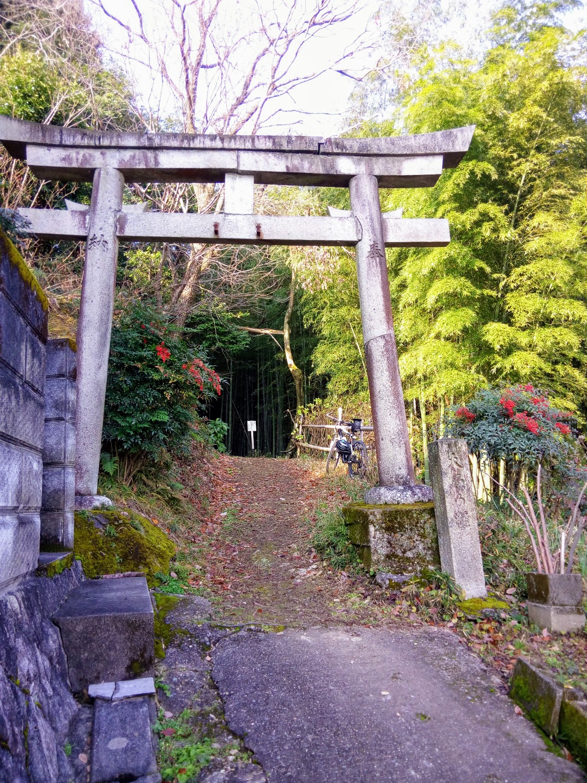
Unlike the last time I was in the area, on this occasion I didn't stop at Shuzuhara, but concentrated my energies on reaching Konpirasan for a well deserved lunch-break. My next stop was at this concrete Torii, heralding the gateway to the Kotohira Shingu Shrine, further up the mountain.
The 'Lonely Planet' article talked about a pilgrimage in this area and, judging by the state of the path - well beaten, concrete-slabs for steps - I was now part of this historical trail.
About 20-minutes after leaving the Torii, I arrived at Kotohira Shingu Shrine,which was located at the junction of two paths. Behind the shrine is a small spring that is reputed to have water with healing powers.
 A few hundred meters on from Kotohira Shingu, and still climbing, I turned a corner and, upon a ridge in front of me, was another concrete Torii, heralding my arrival at the Kotohiragu-jinja Shrine.
A path, leading me behind the small shrine, took me to my next photo-stop....
. . . . and, what I assume, is part of Kotohiragu-jinja. Unfortunately I can't provide any information regarding the monument inside the fenced enclosure.
 A path,leading from the enclosure, took me to a junction where a sign pointed me in the direction of Konpirasan. And lunch. The 'Lonely Planet' article mentioned the views to be had in this section of the course. Any they weren't wrong about that. At this point I was rewarded with breathtaking views overlooking Ohara, with Mt Hiei (Hieizan) in the distance. The article also mentioned the area was popular with members of the rock-climbing fraternity. I could see why. The guide also mentioned this was a popular area for hikers. To this point I hadn't met with any other hikers. The only two people I saw was at Kotohira Shingu Shrine and, judging by what they were there for, they weren't hikers.
 So, you can imagine the relief I felt, when I exited the forest, that there was not another soul in sight - some popular mountain-summits can be so crowded that it's standing-room only - and I could eat lunch with nothing but the sounds of the great outdoors as company.
Two hours after leaving Minouragatake, I had arrived at Konpirasan. My head was in a spin with all I had encountered over those past 120-minutes and, after 14-years after first hearing of this mountain, I just sat down, poured myself a coffee, had some bread rolls and a banana, and absorbed the moment. As I was doing good time, I was in no hurry to move on.
 As I left the summit, to make my way to Suitaiyama, I passed this interesting set of monuments. My research revealed some interesting information about this area - It is said that previously there were natural pots of fire, wind and rain on the top of this mountain and the people of Ohara Village prayed to them whenever there was a natural disaster.
From the next junction my path made a steep descent, which was followed by an equally-steep ascent. Which was followed by another steep descent, which was followed by another equally-steep ascent. Which was followed by . . . . - I think you get my drift.
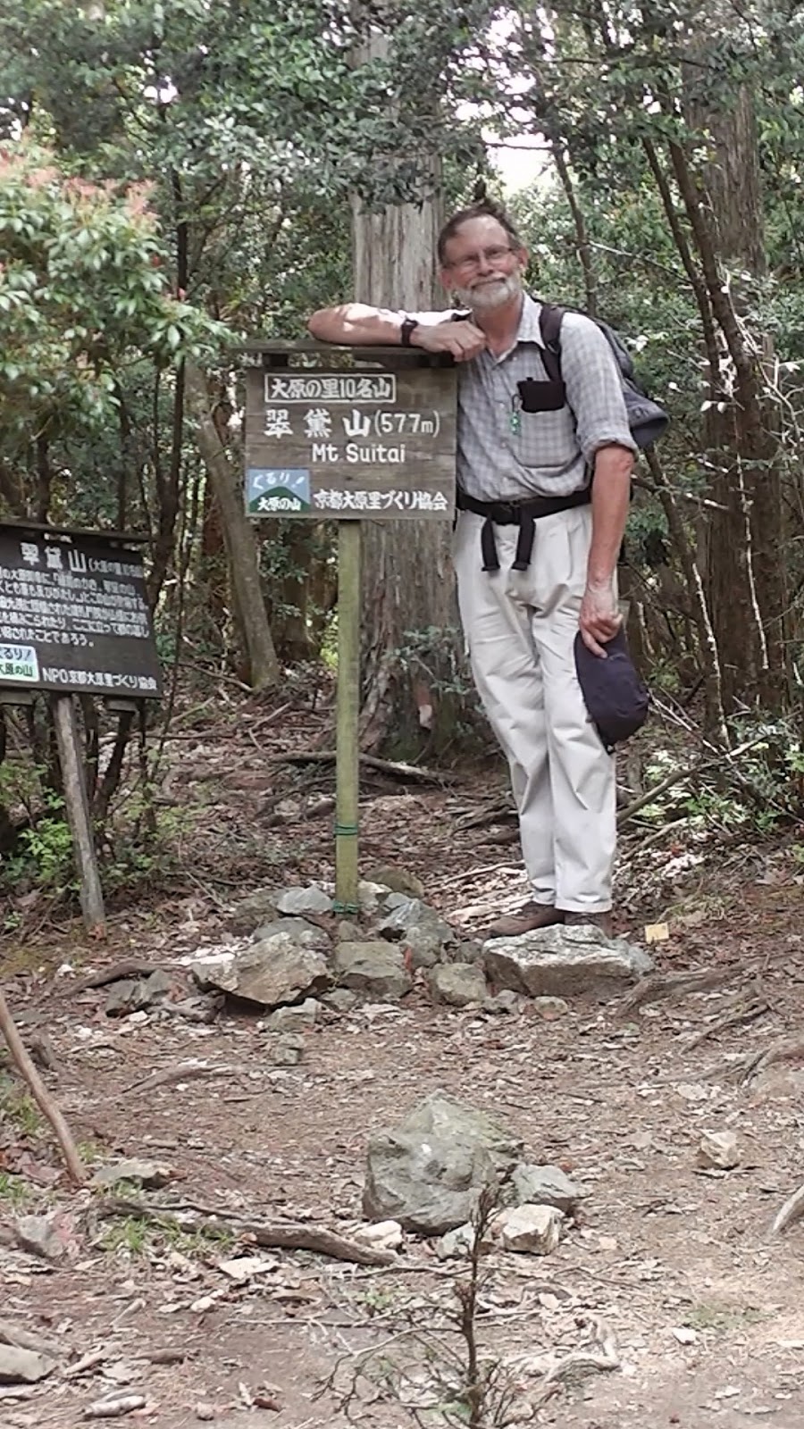
 Suitaiyama, my third summit of the day, was less than a kilometer away and, after all the descents & ascents - four in all - I was ready to take on more water and boost my energy source with another banana. Thinking that was the end of the roller-coaster path, I was mistaken and, for the following 2km, until I reached Yakisugiyama, I had to get used to this type of terrain.

At the base of one of my descents, at the junction of two paths, I stumbled-across this very friendly group of hikers. My first contact with other hikers of the day. We had a great chat about our days hike, and where we had been and were going to. As it turned-out, we were heading in the same direction, Ohara, albeit via different routes.
After parting company with my fellow outdoorholics, my path arrived at a plateau until I reached Yakisugiyama, my fourth and final peak of the day. I had done it, and the exhilaration I felt is indescribable. Another mouthful of water and a banana, and time to make my final descent of the day.
The next kilometer my path took me along the ridge. Below me I began to hear the sounds of civilization - vehicles travelling along route-367 - when I emerged at this clearing. Below me was the village of Ohara, with the mountain range that separates the prefectures of Kyoto and Shiga behind. What I was about to experience I would rate as one of the most scariest moments of all my outdoor activities, in the forty years I have been doing this.
From where I stood, to where I arrived at Ohara, my path would drop 273-meters, over a distance of 1-kilometer. The path, of loose stone and rock, zig-zagged in about 20-meter sections, with very little to grab hold of that was secure. One slip, and I would find myself surfing over the edge. One trip, and I would find myself rolling over the edge. There were a couple of respites though, like these power-pylons.
So . . . .
. . . . as you can no-doubt guess, I was relieved when my track emerged onto the sealed lane that was the entrance to the Kochidaniamida-ji Temple.
From here, it was a 2.5km walk that followed Takanogawa River, through the settlement of Ohara, to a bus terminal, and a bus back to Kyoto. After having only encountered a handful of people during my hike, I was now amongst a throng of tourists who were waiting to catch the same bus.
As I was in no hurry to catch that bus - it was only 3pm - I found a path that led to the river, where I sat-down, peeled-off my boots, and consumed any food and coffee left-over from my day. I also needed the time to chill-out, as I was on a high (no pun intended) after what I had achieved.
Until next time,
Sayonara.
Course details and images - https://ridewithgps.com/trips/14326939
The attached video has no narration, I have relied on the sounds of the outdoors.


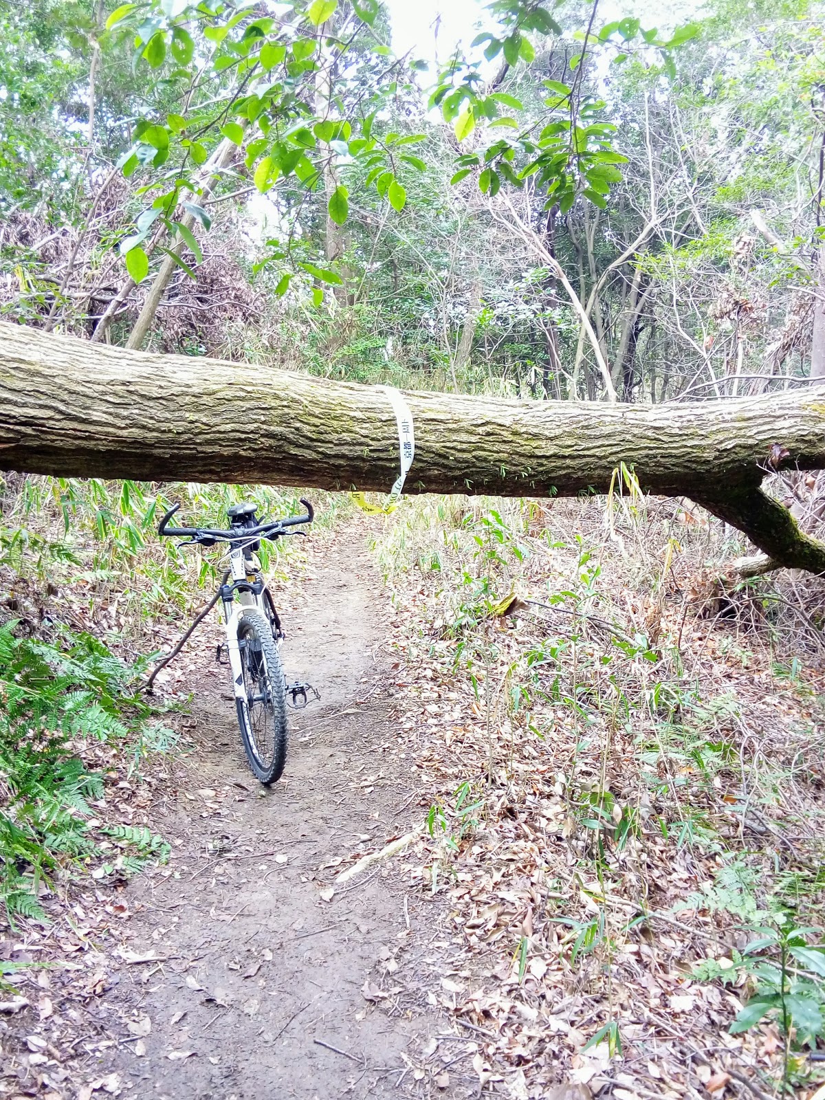
 Locking my bike to a fence, I proceeded on foot and, about a hundred meters up an incline, was a derelict collection of buildings and religious icons that added an eerie feeling to the site. This was Atago-jinja Shrine. Map location - https://goo.gl/maps/FcfoRB4Led12