My latest Post.

This view,this beauty
A tear unbidden
Creeps into my eye.

My stay is short
But I shall return to this place
If only my life is long enough.

Such beauty
Gazing upon it
I hope my years are many.

Bokusui Wakayama.
Showing posts with label Ujitawara. Show all posts

Tuesday, February 21, 2017

Otaki Waterfalls and Shrine.


     The settlement of Yuyadani (map location) is nestled-amongst the hills of rural Ujitawara and is encompassed within an area known as 'The tea growing capitol of Japan'.


   The settlement was home to Nagatani Soen (1681-1788) who was responsible for developing a method of manufacturing Sencha Green Tea that led to today's mainstream tea. A museum, and former residence of Soen, still stands today and is open to the public.
   
      I have passed-through this area many times over the years, on two feet and on two wheels, and the settlement always reminds me of an era long time passed. But today's trip takes me up another valley in search of the Otaki Waterfalls and Shrine (map location). If it wasn't for the kind soul who posted this facility onto Google Maps, I would never have known of it's existence.


    After a 30km x 90-minute bike-ride, I arrived at a junction that separated the two valleys of Yuyadani and, since my last visit here, I noticed the local council had posted an information sign detailing visiting-sites in the vicinity. After a quick drink and a banana, I was off.


                                                                                                                                                                The open area between the valleys, used for rice-growing . . . .


      . . . . soon became compressed as I made my way up the valley. Driving a motor vehicle through here could prove inconvenient, especially if one encountered a vehicle coming the other way. This small Jizo, always a favorite of mine, caught my attention.


    I was soon to encounter my first sign of what the area is famous for - 


   a tea plantation. Albeit a small one.


                                                                                                                                                                                                                               By now my surroundings were becoming more densely forested and my path more steeper.


                                                                                                                                     Because of the increased gradient, and another Jizo I needed to photograph, I decided to walk the rest of the way.


   I didn't have far to go though. A couple-of-hundred meters further up was a collection of buildings and the distinct sound of cascading water. I had arrived at . . . .


. . . . the Otaki Waterfalls and Shrine. In Japan, in the Shinto tradition, waterfalls are held as sacred and standing under them is believed to purify. Many of the waterfalls I have visited one can see an area, at the base, where someone would stand or a spout, jutting-out at the top, for the purification ceremony.


   I park my bike and set-out to discover the complex and, after a few short steps, am rewarded with the magnificent sight of a series of waterfalls.


      Crossing a small bridge, I stand between a small building and the Torii. A set of stone steps leads up to the falls and a discovery.


   Located under an overhanging rock, is this small statue of Daimyojin, the God of World Rectification. An imposing sight, especially it's location. I am keen to clamber my way further up, to the the upper waterfall but, with the ground wet from recent rain and wearing only cycling shoes, I don't take the risk.


   I turn to take a look below me and, as I do, I notice this Setsumatsusha, or auxiliary shrine to my left. If I thought my earlier view looking up was magnificent, the view from this point was spectacular. 


   It's cold, being the middle of winter, and I need to move on. I still have a ride home and more to see. So I say farewell to the Otaki Waterfalls and Shrine and head to the hills. I am keen to return, and hike up the hill overlooking the 'falls, but that won't be until it's not so wet underfoot.

                                                   So, until next time, Sayonara.

   Video. 


Friday, March 18, 2016

Ujideka Revisited.


     Today's course is made-up of six different tracks, four of which I have explored in recent weeks, the other two unexplored territory.
Map Location.
   After a 7km x 75-min' walk from where I alighted my bus, I reached this small tea-plantation on route-62, on the border seperating Ujitawara & Wazuka Towns. For the next 4-hours my surroundings would consist of trees, trees and more trees, with very few view opportunities. 
The tracks are well marked and defined with an assortment of markers ranging from red-colored pegs, tape, and signs hanging from trees.
Map Location.
   Twenty minutes in and my first junction (actually it would have been 15-minutes, but I overshot the junction and had to backtrack). The last, and first, time I came through here, it was from the other direction and, if my memory served me right, most of this next segment would be undulating, but mostly downhill.
   Ten minutes later and I reached this rocky-outcrop. Although I had only been on the track for little under an hour, it had been in fact 2-hours since alighting the bus, and 5-hours since I last had anything to eat or drink. So, as I wasn't in any great rush, this was an ideal location for a banana and some ice-coffee. 


   Throughout  the day I would pass trees with a varying array of fungi, something I have taken a photographic interest in over recent weeks. In the image on the right, if my research is correct, is a member of the Ganoderma  family. 
Map Location.
   Two hours, two junctions, one descent and one ascent (I'm cutting a long story short here) after my rest-stop, I enter into the first of my unexplored tracks. But, before I do, . . . .
. . . . I manage to take-in a couple of vistas of the surrounding area. In the image on the left, I look back at where I have just come from. The hill, I hazard to guess, is about where I had my rest-stop. On the right is Jubusan (632m), famous for the 13-hundred year-old Kontai-ji Temple that lies a few meters below the summit.
   The next segment passes very quickly and, another power-pylon and two junctions later, I arrive at . . . . 
Map Location.


 . . Gonzan, or Ushitorayama, (443.7m) depending on what map you read - both names use the same Kanji characters. Just as I arrive, I can hear the fire-alarm sirens sounding below, heralding 12pm, and time for a well deserved lunch-break.
   I am back in unexplored territory and, from here, things began to turn to custard. The track, that I assumed would be there, was there and, like up to this point, also well marked.
   My next destination was Takaoyama (433m) and, about 15-minutes after leaving Gonzan, I arrived at, what I thought was, my next summit - if my Japanese language skills were better than what they are, I would have realized that this wasn't Takaoyama.
   Moving on I began to notice the track markings began to change - gone were the red-colored pegs, to be replaced with faded and tatty ribbon. But I wasn't panicking (that was about to come, sooner, more than later) when, just a bit further on . . . .
Map Location.
 . . . . I arrive at this clearing and, guess what, yes, Takaoyama (the Kangi characters concurring with what was on my map). From here any markings became few-and-far-between, and eventually nonexistent. 
   After some bush-bashing, I could hear the faint sound of a running stream below me, and so I decided to head for there. I soon emerged at a track which revealed where exactly I was and, not liking where I was, did a u-turn and headed back up the hill and through the bush in search of my planned track. I soon found that track which eventually led me onto another track that I had biked on a couple-of-weeks prior. Phew. 
   Also at this point I could hear the sounds of civilization, in the form of traffic moving along route-307. I had arrived at Ide Town.
Map Location.
   Four-and-a-half hours after entering the forest at route-62, I emerged from the forest to be greeted by the sound of a motor pump-sprayer and farmers spraying their tea crop. From here it was a leisurely stroll through Ide Town, over the Kizugawa River and onto Kyotanabe Station for my train trip home.
   Since completing this hike, my mind has been working overtime with questions such as - Where did I do wrong? Are there other tracks there that I missed? 
   So, in line with my obsessive nature, I plan to return and, on that occasion, commencing from the Ide Town end.   
         Until next time - Sayonara. 


Video-https://www.youtube.com/watch?v=9djFrhhipHI
Course Details - https://ridewithgps.com/trips/8184942

Saturday, March 12, 2016

No Plan/Getting Lost in Ujitawara.

 
   It's been some time since my last 'no plan/getting lost' outing and, as I have been spending some time in the Ujitawara area of late, where best to reacquaint myself with this idea, than amongst the many tea-plantations, hills-&-valleys & forests that make-up this area. So, with scenery as in the above image to look forward to, I was eager to get on the road. It dawned a cold, fine & calm morning and, after an 18km x 1-hour ride, I reached my first junction.
Map Location.
Map Location.
   After spending a few minutes setting-up my cameras, and taking-on energy, in the form of a banana, I was off down my first lane. With scenery like this, one has to concentrate in case a local appears in front of you driving a light truck/van.
   About 1km in and my sealed lane becomes a muddy track - I was conscience of the recent rain and the possibility of getting wet underfoot - when I happened-across this signpost directing me, and other eager outdoors people, to a site further up the trail.
Map Location.
   About a half-kilometer later my track came to an end, heralding my arrival at the Ryuou-no Taki Shrine & Waterfalls (video). I was immediately blown-away with the isolation & serenity of this complex. It wasn't until I saw the vermillion-colored Torii hidden amongst the trees that I realized what I had stumbled-upon.

It didn't take me long to make out where the 'falls were and, after ascending some steps, I arrived at . . . .
. . . . the Shrine itself, nestled midway between two waterfalls, with much moss and vines adding a touch of color & atmosphere to the site. Waterfalls in Japan hold strong spiritual significance and, in many cases an icon of Fudo, the God of Waterfalls, can be found.
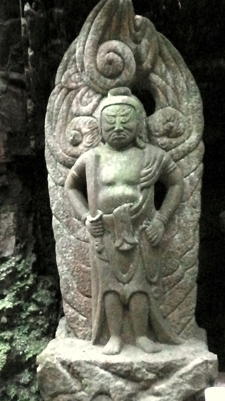
   So,  just as I was about to depart this site, I spotted, hidden amongst a rocky outcrop, two religious icons. The gentleman on the left is Fudo, but the one on the right I can't seem to find a name for. It has been suggested it may be Chinese - Taoism.
    After exiting the forest, my next destination was immediately on my right, through a plantation of tea and, a few meters on, my next stop -  this concrete lantern. It seemed a strange place to have this object. 
Map Location.
From here it was another forest track, and another dead-end but, in front of me, I could make out a concrete flood-protection dam, but it was a track to one side that attracted my attention. After scaling a steep/muddy hill I gave-up and returned to my bike. As I was descending  I managed to catch glimpses of the Ujitawara rural countryside below me and, as I did so, wondered if there were any tracks down there for me to explore. There was. My third track of the day was to take me just below where the above image was taken and my first irrigation reservoir of the day. What resembled a faint track, bypassing the reservoir, came to it's conclusion on the trail I had just descended from 5-minutes earlier.
Map Location.
   From here I re-emerged onto route-62, about 100m up the road from where I entered, about an hour earlier. My next track was about 100m down the road. A kilometer up the path I came to a junction where five tracks converged.  
One track was blocked by a truck, so I proceeded straight-ahead, leaving the other two for when I returned (if I returned). This track ended at my second irrigation reservoir of the day and a very nice angler who bade me kiotsukete (take care) as we parted. Oh how I envied this man - sitting here, in the bright/warm sunlight of the day, with a fishing-rod in one hand, and a mug of coffee in the other (the site has been placed on my 'picnic location' book for future reference).
Map Location.
   Returning to the junction my next track, my 5th of the day, was on my immediate right and, after a short ascent, I emerged at a power-pylon (above image). There are thousands of these spread throughout Japan and, those located in isolated places, have access tracks leading to each.
   I was aware, thanks to the online topography map, that there may be a track from here ascending to the ridge-line. So I decided to go for it - bike, bike-shoes and all. The track looked well defined and, five minutes in, I emerged at a clearing that overlooked the reservoir, angler-and-all, that I visited about 10-minutes previous. Looking at the way he was pulling at his fishing-rod, he was about to secure his breakfast for the following day. As I proceeded along the track, my surroundings began to close-in on me, and the going tougher.
    My path was becoming more difficult as I proceeded, with many fallen trees laying-over the small stream I was following and, with the recent rain, traction was becoming impossible.
Map Location.
    I reached a point (in the above image) where to proceed would be nothing short of suicidal. What I was confronted with (in the image on the right) was an almost vertical ascent with no guarantee of the track amounting to anything. So I decided to cut-my-losses and return to the 5-track junction, not before placing this track on my 'must do' list - on that occasion without my bike. Upon my arrival at the junction, track-6 was now blocked by a farmers vehicle, so I took this as an omen and decided to finish my no-plan, getting-lost excursion and head for home and a hot shower.
   Each excursion into the outdoors always provides me with great satisfaction and exhilaration, but none more so than these outings. Because I have no idea what to expect, and what is around the next corner, I always come-away with an appreciation of what we have here on this planet.
   Thank-you for reading this post and, until next time, sayonara.

   Video of the days outing - https://www.youtube.com/watch?v=_X_csVWLL3s

   Course details - https://ridewithgps.com/trips/8113385 (I cannot guarantee the accuracy of the map location & course details).