My latest Post.

This view,this beauty
A tear unbidden
Creeps into my eye.

My stay is short
But I shall return to this place
If only my life is long enough.

Such beauty
Gazing upon it
I hope my years are many.

Bokusui Wakayama.
Showing posts with label Buddhist Temples. Hiking Kyoto.. Show all posts

Saturday, November 25, 2017

Atago-san (Mt Atago).


Mt Atago, 924m. On a misty winters morning.

   This is another area that is very popular with members of the hiking community, along with devotees of the Shinto religion. At any day of the year the mountain attracts many outdoor enthusiasts from all parts of the globe. Then, from 9pm of the evening of July 31st, for one night only,the mountain will witness a huge number of pilgrims making their way to the Atago-jinja Shrine, atop the summit, to celebrate Sennichi Mairi .

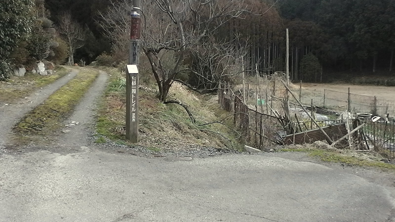
   There are many different routes accessing the summit - I counted six on my map - with the most popular commencing at the settlement of Kiyotaki. Another route, via the farming settlement of Mizuo, is more scenic and, in my opinion, less boring. For those who want a gut-busting route to the summit, then the track via Kuuya-taki Waterfalls and the Kamakurayama Tsukinowa Temple (Map Location)might satisfy your thirst for adventure.


Bridge over the Kiyotaki River.
   For this trip, I chose the course that took me past the junction to the Kuuya Falls & Kamakurayama Tsukinowa Temple, that I completed three months ago to the day, and around the back of Mt Atago, with the intention of reaching the summit from the north-west, then descending into the settlement of Mizuo, where I would check-out the Mausoleum of Emperor Seiwa, before making my way down the road to the J.R. Hozukyo Station, and home.To get to Kiyotaki by direct bus from Kyoto Station, I needed to be at the bus-stop in time for the 07:25am bus. An hour and ten minutes later, along with a dozen-or-so fellow outdoorholics, we arrived at the settlement of Kiyotaki, with perfect conditions for hiking - clear, calm & not-too-cold.


   I have passed-through Kiyotaki many times over the years, either coming or going and, on each occasion, having taken a different course. It's a lovely spot, and lies on the junction of many tracks. As I had been up since 04:30am, I didn't want to waste too much time checking-out the scenery, and wanted to get on my way without too much delay.


    Each of my fellow bus-passengers were possibly taking a different path, to a different destination. The gentleman in this image, after passing through this wooden Torii, was taking the direct route to the summit and shrine. One-or-two others I would pass as I made my way to my first photo break (One couple I would be reunited with later on. More about them later.)


Track to the Kuuya Waterfalls.
Track to Kamakurayama Tsukinowa Temple, and Mt Atago.


   Thirty minutes in and I arrived at the junctions of the Kuuya Waterfalls . . . .


. . . . the temple & mountain track and the path I intended on taking but, first, I wanted to check-out the waterfalls. Something I didn't do when passing-through the last time.


   Just as I set-off towards the waterfalls, I was confronted with these Racoon-dog statuettes, or Tanuki, nestled amongst the roots of a tree, just above the track. Normally found outside Bars and Restaurants, I couldn't hazard-a-guess as to why they would be located in such a spot.


   A 200m path of concrete-block steps, soon brought me to the first of two Torii, heralding my arrival at Kuuya-Taki. As I approached the site, the sound of the falls was clearly discernible. There were a few dilapidated buildings between to two Torii, with no sign of life that I could notice. 

   Then . . . . 


Map Location.

 . . . . there it was, the Kuuya-Taki Waterfalls (12m). And, like any waterfall, this was a sight-to-behold. This site is known to be the training ground of Kuuya Shonin. The practice of Takigyo - meditation of sitting or standing under a waterfall - is still practiced here.


   The waterfalls wasn't the only object that impressed me. Throughout there were a collection of religious icons. As can be seen in the above collage.

   I was soon back on my planned course, and my ascent of Mt Atago. As I made my way up the valley, evidence of the recent storms that passed over the area, were evident.
Map Location.

    Thirty minutes on, and I reached this rock monument that stood at the junction of two tracks. A quick perusal of my map, along with the map of the area posted on a post nearby, convinced me the track on the left was my track to the summit. It wasn't marked, but I could see evidence of a track of sorts.
   After making my way up the hill, I soon arrived at this well-beaten path. Just as I arrived an elderly couple appeared, the couple I had passed earlier in the morning, just out of Kiyotaki. My first thought was - "How the hell did they get here, and without passing me?" Once we recognized each other, I asked them where I was. So out came the map again and, before long, I realized my mistake -  I was on the Temple path, the one that commenced at the junction with the waterfalls. With Mt Atago not far away, I proceeded on and, while doing so, hatched another plan - I would descend from the summit, via my planned ascent route, and make my way to Mizuo from another direction.

  
Map Location.


       My time at the summit was brief - a prayer at the altar, a hot coffee & buns - as, having been here five times in the past, and knew what was here. Also I was unsure of my new route and how long it would take. It was just on 12pm and I was doing good time, but was wary of the shortening days.


   From the shrine I needed to backtrack a few hundred meters, passing the junction I had just ascended from, and passing this set of Torii,to my next junction.
                                                                                                                                                                       Which was highlighted by this collection of Jizo. While here, I had a quick perusal my my map and discovered that this was the junction I would have ascended to, if I had taken the correct course earlier. I was also joined by three other hikers, who were going in the same direction as I was. They kindly offered me some advice as to what track to take and wished me well.


   My next junction was highlighted by this interesting statue. The hikers I met earlier described this statue by slicing his finger across his throat and, once here, take the track on the left. I was somewhat confused by his actions but, upon closer look, the statue was headless. 

   My descent was steep, as was to be expected and, before long, I emerged onto route-50, with Mizuo just down the road. But, before I entered the settlement, a detour, to checkout the Mausoleum of Emperor Seiwa.
Map Location.
Emperor Seiwa (850-878) ascended the throne at the age of 9 but, after 18-years, he ceded the throne to his 5-year old son.Two years later he became a Buddhist Priest adopting the name of Soshin. During his time on the throne, in the early Heian Period, Emperor Seiwa decided to live in this town, after falling in love with this land, during his travels around Kinki. But sadly the Emperor passed-away at the Enkaku-ji Temple, in the village, after only living here for 4-years.


Map Location.
Nestled in the hills, overlooking the settlement,is a sacred place where the soul of Emperor Seiwa is enshrined. Seiwa-jinja Shrine was established here after his death. The Torii, the entrance to the shrine, is located almost next to Enkaku-ji, where Seiwa died.


                                                                     The settlement of Mizuo is also known as Yuzu Town, and is famous for it's local produce of Yuzu Citrus. As one wanders through the town, you can't help but notice the trees scattered all about.


   Mizuo is one of those settlements I enjoy experiencing, and is typical of many towns dotted throughout Japan. In many cases, like here in Mizuo, the houses are located very close to the road, as can be seen in the image on the right. That is route-50, a thoroughfare that links Kyoto City with the north-western area of Kyoto prefecture. And, on any given day, can be quite busy. And difficult to negotiate, especially if you are driving a large vehicle.


   My next destination from here is the J.R. Hozukyo Station, and I take a path that follows the river, passing through this avenue of Autumn colored trees. 


   The platform of the station spans the Hozukyo Gorge,where the Katsuragawa River flows under, on it's way through Arashiyama, and eventually ending-up in Osaka Bay.


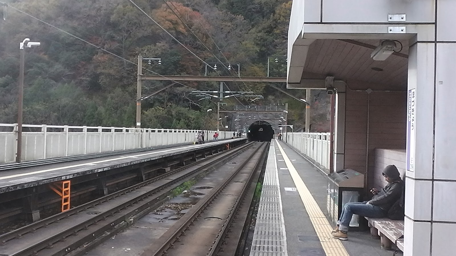
   As I hadn't managed to stop for a decent lunch-break, I take shelter in this seating area - there is a cold, strong wind blowing across the platform - and pour myself a hot mug of coffee and devour my curry & buns. The shelter is so close to the rails that, when the Express Train passes, one can feel the slipstream. And the noise is quite deafening. 

   Lunch over, I board my train for Kyoto, then another train home. Although I didn't cover my planned course, my alternative was just as good and, over a good cold can-of-beer when I arrived home, I reflected on my day. I was contented.


So, until next time,

Sayonara.

   I would like to acknowledge the guys at 'Trans-word+' for granting me access     to their website for information regarding this post.

   Video of the hike - https://www.youtube.com/watch?v=wygztcMdbRA&t=17s

   Course details - https://ridewithgps.com/routes/26535944


Tuesday, September 12, 2017

Rural Nara Circuit.


   With the temperatures beginning to cool, heralding the arrival of Autumn, and the rice-growing season in full swing, I decided to take the risk and head-out for a long overdue tour. I decided on the rural area bordering Nara and Tenri Cities for my excursion. It has been a couple-of-years since I was last in this area and was keen to return and check-out a couple of new tracks.


   After a 36km x 2-hour cycle through Kizugawa and Nara Cities, I arrived at the settlement of Takahicho, at the junction with the Yamanobenomichi Path. My course would take me to Shoryaku-ji Temple, 2km up the road then, from there, a narrow lane through to the settlement of Yadawaracho (map location).


    I was thankful of the first 36km being flat as, from this point, the next 8km would be a continuous climb - steep in some places, nearly level in others. This section of lane, through the forest, was quite steep and required me to dismount and walk in places. 
   Luckily it was still early - 09:30am - and the temperature was still cool. My main concern was my water supply and did I bring enough (I had three 1-litre bottles on my bike) and, if I ran-out, would there be a supply where I could refill?


   Yadawaracho, and a surprise sight - rice fields already harvested, or in the process of being harvested. What was so amazing was, where I live, the buds were only just forming. My lane now became an unsealed track which, looking at it, provided access to the many rice fields in the vicinity. The track, I hope, was to connect me to route-186, and the 
Map Location.

settlement of Bessho, and familiar territory. Back in November (Blog) and December (Blog) of 2013 I hiked through this area on an exploration of the history of the area. 


   But, before I reached Bassho, I passed this metal Torii, partly camouflaged by trees and other assortment of undergrowth. What was so amazing was there wasn't a Shinto Shrine in site and metal Torii are very rare in Japan. Maybe a return visit is on-the-cards to see what-else lurks in the bush.


   The Nanamagari Path, linking the settlements of Bassho and Nakahatacho, was uneventful, with the exception of a segment that was almost washed-away by a landslide. With some careful maneuvering, I was able to lug my bike over fallen branches and rocks.

   One always knows when they are nearing Nakahatacho, by the sounds of the traffic. The settlement is almost completely surrounded by route-25 (Map Location), a major road linking Osaka and Mie Prefectures.


   Here, like at Yadawaracho, rice harvesting is in full-swing. In this image on the left, I was interested to see this elderly couple machine-harvesting the field, considering the size. But, I daresay, they probably had more fields to tend to. 
   

   After a brief time cycling on sealed road, I was soon to returned to the forest and an unsealed track that would emerge, about 3km later . . . .


 . . . . at the settlement of Minamitsubaocho (Map Location). As it was getting on lunchtime, my plan was to seek-out Kasuga-jinja Shrine, for my first break of my ride but, somehow, I missed the turnoff (there is a network of narrow lanes in this town, that something like this can be easily missed) and found myself descending a very steep road back to my start/finish point at Takahicho.


   I arrived at the start/finish point just on 12pm and, thankfully, there was a shaded spot for me to have a bite-to-eat and drink before the ride home. It was another great ride with plenty of rural scenery along the way. 

Until next time,

Sayonara.

   Course details and images - https://ridewithgps.com/trips/17627206

Monday, March 6, 2017

The Kyoto Trail - Kiyotaki to Route-61.


   I arrived at the J.R.Hozukyo Station (map location), that overlooks the Hozukyo Gorge, on a cloudy, crisp morning. With the recent rain the Katsuragawa River was flowing high and strong. I had about a kilometers walk before arriving at my planned start of the 'Kyoto Trail' so, after getting my camera ready, I set-off.
   After a short detour to check-out the confluence of the Katsura and Kiyotaki Rivers, I arrive at my first junction. In my introduction to the 'Kyoto Trail', I mentioned how well signposted the trail is plus, in some places, accompanied by noticeboards detailing sights in the vicinity, like in this image on the left. At this point I leave the sealed road and descend down to the Kiyotaki River, which I follow for the next 6km at Takao.

   About 200m along I make my first river-crossing. Like the Katsura, the Kiyotaki River is high and the path very wet & slippery. Extreme care is needed. I also notice how much debris is lying over the path and in the river. As I make my way upstream I discover a pool, crystal-clear with a touch of green, with fresh-water trout waiting for their next morsel.
   Then, before I know it, I have arrived at the settlement of Kiyotaki (map location). This is another start/finish point, with regular bus-services two-and-from Kyoto Station. The area is very popular with hikers and devotees of the Shinto Religion, as the settlement lies at the base of Mt Atago (924m) with the Atago-jinja Shrine at the summit.
   Once across the bridge, the path meanders through the settlement before arriving at this junction. This vermilion-colored Torii is the gateway to the shrine, albeit 4km up the mountain. But my path leads to the right and I soon rejoin the Kiyotaki River. It is here I encounter my first hikers of the day, but only briefly as they take another track to another destination (maybe to the Waterfall of Kuuya).
   Midway between Kiyotaki and Takao I arrive at this pleasant picnic spot. Some years ago, on my first excursion into this area, there were dozens of people picnicking under the Sakura trees. They were celebrating Hanami. Try to imagine, as you look at this image, the trees full of vivid-white blossoms. it is a sight to behold. It is one of my favorite times of the year.
Map Location.


  As I am doing good time, I spend a few minutes checking-out the surroundings, and take a few photos. The colors, in the image on the right, remind me of another good time to be in this area (and Japan for that matter) - Autumn. The colors of the foliage during October/November are easily etched into ones mind and are a joy to behold.
   Takao (map location),and the end of my first section. Takao is a day-trip of it's own. A 1-hour bus-ride from Kyoto, the area is worth the time to visit and experience at any time of the year and is home to three historic temples - 'Kozan-ji', 'Jingo-ji' and 'Saimyo-ji'. Although the area was very quiet, as I passed through it, during the Autumn it can be very busy. 
   A short walk along route-162 - the main Kyoto-to-Fukui road - I arrive at my next junction, and a return to the peace-and-quiet of the forest. I bid farewell to the roaring sound of the Kiyotaki River back at Takao and was about to experience my first serious hill-climb. 
    The first kilometer-or-so was on a sealed track, when I arrived at my next junction. This segment, which was to take me to the Sawano Pond (map location), zigzagged it's way up a hill before reaching the plateau and a descent to the pond and, hopefully, a warm-dry spot to break for lunch. Unfortunately I had to delay my lunch-break for another location.
                                                                                                                                                                On a warm and calm day, the pond is an ideal location for a picnic and, judging by the remnants of ash, also a popular destination.


Map Location.
   The track exits the pond and heads back-into the forest and, not far away, leaves the sealed lane and returns to the muddy path. It's not long before I encounter this isolated Jizo and stop to admire it's location - upon the side of a hill.
  
   A few meters from the Jizo I get my first view overlooking the northern suberbs of Kyoto City. To the left, partly obscured by a group of trees, is Mt Hiei (Hieizan).
   The next junction, a short distance from my Kyoto view, requires some serious study. There is four tracks converging here and, one wrong turn, god-knows where you will end up. The map, behind the signpost,is a great help and, before long I am on my way. 
Thinking all my troubles were over, the next junction was just as confusing. This is signpost-70, the junction of three tracks. Signpost-69, as you can see in the image, heads straight-ahead and I am not sure as to where it emerges.


 At the junction is this log cabin (the track I have just emerged from, is to the left in the image) and, opposite the signpost, is another sign giving directions to a toilet and restaurant. Seeing this I now know where I am and I head downhill. . . .
. . . . to my next junction, and this restaurant (map location). 


   A month ago, I hiked through this area checking-out the temples and shrines that lay hidden amongst the small hamlets that dotted this part of Kyoto. I took note of this establishment, and it's location, for this return trip. This confirmed my location and I was able to move on to my next junction, which was just a kilometer down the road.
   By now my stomach was screaming-out for nourishment and I needed to find a sheltered spot (although it was fine, there was a brisk/chilly wind blowing) to take-a-break. And, what better spot, than this dry concrete foundation overlooking several rice fields. As I sat there, consuming my flask of stew with bread-sticks, washed-down with a hot cafe au-lait, I thought back to a month ago, when I passed-through here, and the foot of snow that covered my surroundings. Now all was green and not a sign of any snow.
Map Location.
   Lunch over it was time to move-on to my next stop - Himura-jinja Shrine (you will need to scroll down to view this post). This complex is steeped in history and, along with it's serene & isolated location, makes the site more impressive.
   Nishigamo was the next, and last, hamlet I was to pass through today. A typical rural settlement - old farmhouses & out-buildngs, rice-fields yet to be flooded and and prepared for the coming season, narrow lanes - Nishigamo is one of those places someone could easily escape to for the sheer peace & quiet.
  
   As I left the sealed lane, and entered the forest, I turned and took one last look at the scene I was leaving, and felt a pang of envy for those that resided here. Having lived the rural life, it's a life that is easy to dream of but, in reality, it's not that easy. Miles away from your nearest convenience, sometimes snowed-in during the winter months, are just some of the pitfalls one has to endure when living in such an isolated environment. 
   As I made my way through the forest I began to get the feeling my day was nearing it's end. Arriving at this wooden bridge I paused for a few moments to look back and take in my surroundings and reminisce of the past day. And what a day it has been.
Map Location.
                                                   Then, five-and-a-half hours after alighting the train at Hozukyo Station, I arrived at route-61 and the end of another great days hiking. The day had come to an end too soon. I didn't want it to stop. But, sadly, it had. I will be back here though, in about a month when, on that occasion, I shall be commencing my next segment of the 'Kyoto Trail', which will take me to Ohara.
   As I sit here composing this post, I look back at the Trail and appreciate all the hard work that has gone into maintaining this course by the volunteers from the 'Kyoto Trail Association' and the 'Kyoto Alpine League'. 

                                                               Until next time, 

                                                                             Sayonara.

   Course map details and images - https://ridewithgps.com/trips/13248187

   Video - https://www.youtube.com/watch?v=_Jl0b4MbDzg