My latest Post.

This view,this beauty
A tear unbidden
Creeps into my eye.

My stay is short
But I shall return to this place
If only my life is long enough.

Such beauty
Gazing upon it
I hope my years are many.

Bokusui Wakayama.

Wednesday, August 22, 2018

The Shrines & Temples of Kyotanabe.


Ikkyu-ji Temple.
Tsutsuki Palace Site.

                                                                                                                                                                                                                                                                                                                                        Kyotanabe City was once the capitol of Japan, albeit briefly,during the reign of Emperor Keitai (511-518). It's not a big city, covering an area of just under 43-square kilometers. Kyotanabe, like many other metropolitan areas of Japan, has it's fair share of history; like the site of the 'Tsutsuki Palace', and a collection of shrines & temples; some famous, like Ikkyu-ji Temple, and some not-so-famous.


    The idea for this post stemmed from my need to visit a bike-shop in the area, a 30-minute ride from home and, as the shop didn't open until 10:30am, I decided to leave early and do a tiki-tour of the area - namely the shrines & temples dotted-about rural Kyotanabe. Two of the sites I was familiar with, the others were first time experiences.
   Some of the sites have important history attached to them, while others, location is their main attraction. With an outing like this, my main aim was to keep off the beaten-track as much as possible and stick to the narrow lanes & paths so common in rural Japan. 


    I was out the door and on my bike by 07:30am, so as to arrive home by midday and avoid the scorching heat. My destination was the settlement of Mizutori, one of three settlements located within the 'Kyotanabeonesugi Hiking Course', an 8-kilometer circular walk that takes you through rural Kyotanabe.

    As I made my way my attention was distracted by the green rice-fields, still a month away from being fully grown and harvested. A scene I would witness throughout my tour.


Saiko-ji Temple.
                                                                                                                                                                         Saiko-ji Temple (map location) isn't one of those religious sites one will find in a tourist guide, but it was it's location - tucked-within a narrow lane surrounded by houses, with rice-fields all about - that gave it it's appeal. 


             The complex wasn't huge, about the size of a basketball court and, by standing in the center of the site, one is able to take-in the entire area. I was very impressed with how neat-&-tidy the site was, and the trees & shrubs nicely trimmed. In the above image is the main entrance and belfry. The structure, in the image on the right, has left me a bit confused; is it a Chozuya, or some other purification font? 


   Moving on from Saiko-ji, my course took me off the road and onto a narrow sealed lane, and some pure rural Japanese scenery. It doesn't get more beautiful than in the above image, and it is so serene.


   About six-weeks ago, whilst on one of my 'rambling bike-rides' in the area, I approached this junction. Looking into the trees on my left, I got the feeling there was something in here that may be of interest to me. About 100-meters in was the Chozuya, indication there may be a shrine in the vicinity.


   I ventured further into the forest, passing a stone monument, when I reached this flight of steps and, up in the distance, was the distinct vermilion-colored Torii.


Shiroyamadaimyoji-jinja.


   Shiroyamadaimyoji-jinja (map location) is located in the settlement of Fugenji. It's nothing spectacular, as shrines go, but again, it's the location that gives the site it's appeal. Which is why I included it in this post.


   Just along the lane from Shiroyamadaimyoji-jinja I passed-through a cluster of houses and, as I did so, my attention was drawn to these lovely orange-colored flowers, prompting me to stop and take this photo of them. Set against the white backdrop of the building, I thought I did well.


   I was now about to enter rice-growing territory and, with the rice just weeks away from harvest, this is a sight-to-behold. I arrive at a junction where a narrow lane leads me to my next two religious sites - Omido Kannon-ji Temple & Chigi-jinja Shrine (map location ).


                                                               Twice a year this complex is a sea of color. Sometime during May (Spring),when the Sakura are in full bloom, many come here to celebrate Hanami. Then, in October/November, it's the Autumn colors that attract the visitors.  
Omido Kannon-ji Temple.


   I lean my bike up-against a lamp-post, and wander down this tree-lined avenue to the main temple. 


Built in the Asuka Period (AD 538-710), Kannon-ji was, until the Muromachi Period (AD 1336-1573), one of many buildings that made up a large Buddhist Temple.
   The temple is home to the eleven-faced figure of Kannon. Made with wood-core and dry lacquer, the statue was created during the Nara Period (AD 710-794) and is designated a 'National Treasure'. If you inquire at the priests house, you might be fortunate to be guided to a small hall where the statue is housed. Although there is no admission fee, it would be polite to purchase a souvenir to provide protection of this priceless image.

   The temple exudes an atmosphere of serenity and beauty, and I was fortunate to have had the place to myself. The temple is partly-surrounded by a moat, with a large pond off to one side. 


   In a corner of the complex, partly hidden by trees, is a concrete Torii, with a flight of steps leading to Chigi-jinja Shrine.


Chigi-jinja.

   The shrine is totally enveloped by trees and covers an area about the size of a basketball quart. It's a combination of the old and the new. The old, I would hazard-a-guess, dates back several centuries, with the new being only recently constructed.


Shibayama-jinja.
                                                                                                                                                                       Shibayama-jinja (map location) took some careful navigating, and patience, to reach, and I am sure I passed the entrance more than once.


   Again, location was the main attraction here - nestled amid a bamboo forest - with all facilities sited within a small area. The shrine was located inside a fenced-off enclosure, with barbed-wire to prevent intruders.
   I did find this collection of Ema, or small wooden plaques quite impressive. These are a common sight at Shinto Shrines & Buddhist Temples.


Saga-jinja Shrine.

   Saga-jinja has an ancient history. Re-built in the Azuchi-Momoyama Period (AD 1573-1600) it's main hall is designated a 'National Cultural Asset'.


   After passing through the Ryobu Torii - distinctive with it's four supporting posts - the main complex is up two flights of steps; I didn't realize until after my visit, that there is an access lane & car-park.


             Saga-jinja is the largest site of today's outing. In the courtyard is another Torii and Setsumatsusha - small auxiliary shrine - next to a shelter. Plus the Chozuya and a collection of Toro - stone lanterns. In an enclosed area, behind the main building, are a collection of shrines and, to view or photograph them, one has to peek over the wall.


   Re-mounting my bike, my route took me through this avenue of trees and onto my next site . . . .


Shofuku-ji Temple.
   . . . . Shofuku-ji Temple (map location). On my way here I passed a cemetery and I got the impression that the two were connected, so, not wanting to be intrusive, I had a quick look around.


   As-soon-as I entered the complex, through this gate, I was impressed with the variety of color. Upon entering I was greeted with a small garden and this lovely pink-colored tree. In another corner was a tree that gave me the impression it was early Autumn. 


Hakusan Shrine.

   After cycling through the settlement of Miyazu, I arrive at the penultimate religious site of the day - Hakusan Shrine (map location). The shrine has three historically interesting points - it is the oldest shrine building in Kyotanabe, the shrine is of Muromachi Era (AD 1336-1573) architectural style and has been designated an 'Important Cultural Asset'.


   Dotted throughout the grounds are a collection of miniature shrine-like structures, along with several concrete lanterns. The complex has seen better days but, as seen on the map link, the view is what gives this shrine it's appeal - overlooking fields of rice.


    It was now time to head to the final site of the day, which required me to partly backtrack. Trying to avoid this as much as I could, I continued on from Hakusan along a dirt track, through this orchard, and onto a busy sealed road. I then changed-onto a narrow lane.


Sakaya-jinja Shrine.
     
   I soon arrived at a junction, and was greeted by these two large concrete lanterns. The path lead along an avenue of trees, passing more lanterns along the way and, as I reached the top, in front of me was - Sakaya-jinja (map location).

    
   The shrine's established date is still unknown to this day, however, according to the shrines history, it is said the Empress Consort Jingu (AD 169-269) left Sake barrels here as an offering to the gods before departing on an expedition to the Korean Peninsula. Today many people visit the shrine to worship the Gods of Sake.


   As I entered the complex I was about to purify my hands at the Chozuya (the first time today) but, as luck would have it, there was no running-water. So I proceeded towards the main building, passing a collection of Ema and O-mikuji.


   The main building is a magnificent wooden structure and, unfortunately, is enclosed within another confine. As I wondered-about the perimeter of the enclosure, I found myself in a large park-like area.


Looking around I espied this concrete Torii and several small Setsumatsusha, or auxiliary shrines, plus more concrete lanterns.


   In one corner of the park, partly camouflaged by trees, was a path. Eager to see where it lead, I entered the forest and discovered some steps and, atop, a wooden Torii. And another shrine. 


   Upon arrival, I took a peek into the shrine and noticed the two Kitsune, indicating that this may be an Inari Okami Jinja. This is where people may come to worship 'The Gods of Sake'.
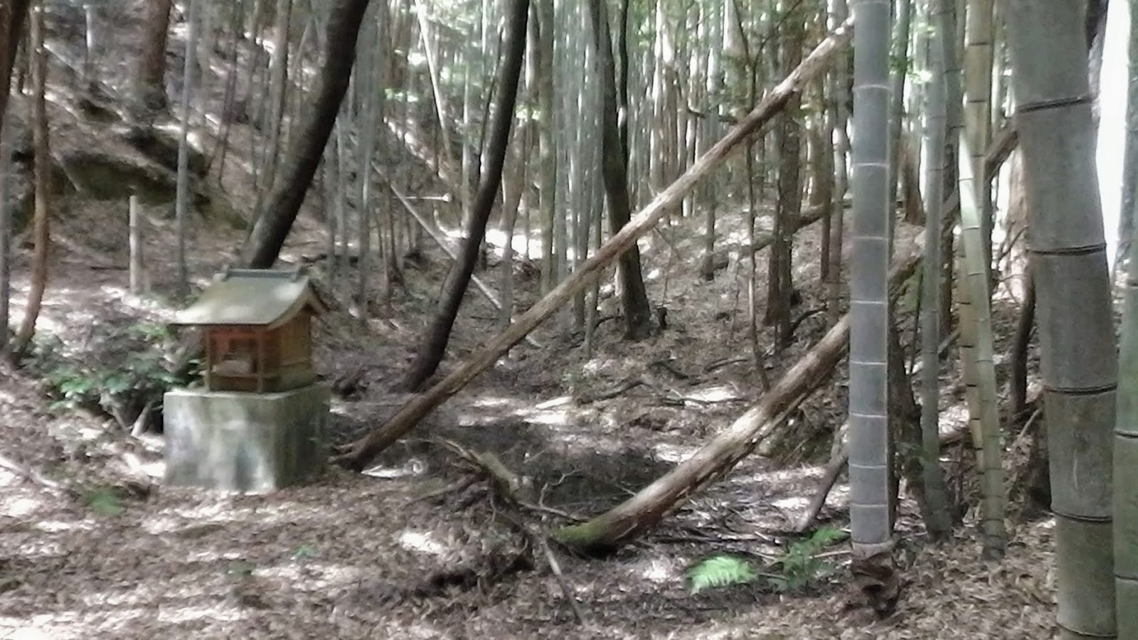

   By now, after about four hours of checking-out nine different religious sites, I was feeling a bit 'shrined-out' (a personal description) and ready to return home. But there was one more surprise in store for me. As I was making my way back to my bike, I noticed another track leading into the forest. "Why not, one more  won't do any harm" I thought. About a hundred meters in, almost camouflaged by bamboo, was this small structure. How quaint but, for what purpose, I have no idea. No doubt it was connected with Sakaya-jinja. 


   Before mounting my bike, and returning home, I couldn't resist the temptation for a photo-opp' and, where better, than among the green foliage with the Torii & Chozuya in the foreground. 

   During my research for this post, I discovered other historical sites in-and-about Kyotanabe City. As I live just 30-minutes from the area, I think a return visit may be on the cards. 


So, until next time - 
        
Sayonara.

   Map & course details - https://ridewithgps.com/trips/26861511
   Video - https://www.youtube.com/watch?v=9fUZsJ9CKmM 

Monday, July 30, 2018

Early Morning Ride Through Outback Kyoto.


    The Summer of 2018 will go down in Japanese history as being the severest on record, with temperatures being recorded in the high 30'sC - to - low 40'sC. To avoid problems associated with this heat, avid cyclists like myself have to either put-aside any plans for a ride, shorten their rides or head-out early to be home before the temperature reaches it's peak. As it's been some time since my last marathon bike-ride, which has left me chafing-at-the-bit to rectify, I decided on an early morning wake-up and ride.


   When I said 'early morning', I mean early morning. 2am to be exact. I have done these rides in the past, and they are great. Cycling in the dark can be dangerous, but, with the dawn appearing about 04:30am, it's not for long. I had devised a route that would take me through Kyoto City, along the Kamogawa River to it's source at the settlement of Kamogahara, then over the Mochikoshi-toge Pass to the settlement of Nakagawa, returning to Kyoto City along the old Tokaido Road. After a breakfast of bananas and muesli, washed-down with warm water, I was out the door at 03:15am. Without waking my wife. I hope.


   I made a beeline for the Yodogawa River Cycleway and then on to the Yawata-ohashi Bridge where, to my amazement, were a group of teenage cyclists waiting to head-off on a ride. From here I connected with the Katsuragawa River Cycleway that would take me into Kyoto City. By the time I reached the outskirts of the city, the dawn was already showing itself through light cloud. Much to my joy.

   I reached my first rest-stop at Demachiyanagi, at the confluence of the Kamo and Togano Rivers, and had the first of four bananas. It was 05:20am and by now it was full daylight. I spent a couple of minutes setting-up my G.P.S. so as to record the trip and, without much ado, I was off. 


    The route from Demachiyanage is a gradual climb and, 30-minutes after leaving, I was working-up a sweat. So, when I happened-across this fresh water spring, I had no hesitation but to stop and fill-up, and take a short break. My bike has three drink-bottle holders, and for this trip I loaded all three just in case there was no water supply along the way.In situations like this, whenever I encounter a water supply, I top-up my bottles.


 I 

   As I made my way up the valley, evidence of the recent typhoon & heavy rain was evident, with several very large landslides on both sides of the Kamogawa River. Throughout I was worrying if I would come-across a roadblock preventing me from proceeding but, in true Japanese style, the work crews had already been in and cleared the road. My next stop was at the Deaibashi Bridge, at the confluence of the Kamogawa & Nakatsugawa Rivers. To this point I hadn't encountered another soul. It was eerie, and very quiet.


   Further up, passing several houses, and Itsukushima-jinja Shrine, I got my first glimpse of the Mochikoshi-toge Pass, partially camouflaged by cloud. Before I made my ascent of the pass, I continued on up the valley to another area of Kumogahata, that is very picturesque. 


   It is at this juncture where the Kamogawa River nears it's source. There are a couple of hotels (not sure if they still operate) and an eatery and a shrine.


   Returning back down the valley I took another break to prepare for the ascent up to the summit of the pass. I still hadn't, to this point, encountered another person, but that was about to change. During the course of my ascent, I was overtaken by two vehicles, both, it appeared, maintenance crew checking-out the road.


   Although the ascent is short-and-steep (about 1km), it still takes the wind out of me. As I was setting-up my camera to take this shot, I could hear the sound of music nearby. Then another cyclists suddenly appeared, with a transistor radio blaring for all to hear. Thanks mate.


   On a clear day the view from the pass can be spectacular, as one looks down over the settlement of Kumogahata and the valley beyond, with the hills enveloping the area. This-mornings view was still spectacular, albeit in a misty sort of way. The sun was trying it's best to break through the cloud and commence it's heating-up of those below. It was still only 06:20am and, at this altitude, a little chilly.

   After another couple of bananas, while I posted the above image to my wife's 'Line' page who, I assume, was having her breakfast and preparing herself for work, I made my descent and onto my next destination - the settlement of Nakagawa. 

    The descent from the pass, route-107, is very windy in places, and can be dangerous if you aren't concentrating, especially if you encounter a vehicle coming the other way. Once reaching the junction with route-31, at the settlement of Sugisaka, a right turn here took me to route-162, the Kyoto to Obama National Highway.


   A narrow lane branches off route-162, just before a new tunnel, constructed about 10-years ago to detour traffic from passing through the settlement of Nakagawa. Nakagawa is a quaint town, comprising of several wood-working factories & stores. With the cedar forest surrounding the settlement, it is understandable why this is so.


                                                                                                                                          As I made my way down the main street, my attention was drawn to this concrete lantern and, behind it,a shrine. This is Nakagawahachimangu Shrine. But not the one I was on the look-out for.


   The site I was looking for was nestled-amid the surrounding forest, well off the main street. Access to Soren-ji Temple (map location) was via this very narrow lane where, at times, I needed to dismount my bike and carry it up several flights of steps. But, as I made my way, I was treated to some fine views overlooking the settlement.

   The houses here are build within close proximity to each other and, judging by the peacefulness of the area, I can't imagine any rowdy neighbours  surviving here for very long. But, there again, it was still early morning - 06:45am.

   My narrow lane soon merged with an access drive then, as I turned a bend, the entrance to Soren-ji Temple. 

   This temple was founded at the end of the Muromachi Period, after the Onin War (1477). The temple belongs to the Jodo Sect, and has been beloved by villagers for generations as their parish temple.


    As I made my way up the concrete steps to the main entrance, I got this feeling I was about to experience something very beautiful and serene, a feeling I always experience when visiting a complex of this type. But Soren-ji felt different.


   As I entered through the main gate I was greeted by a small pond and the very distinct sound of a Shishi-odoshi, or   bamboo water feature, as it tapped onto a rock. It's interesting that the purpose of these devices is to frighten-away animals.


   It wasn't a very large pond, as ponds go, about the size of a full-size snooker table. The pond was adorned with several small religious icons, the most distinctive being one of Fudo, the God of Waterfalls. Albeit there being no waterfalls in sight. The pond was home to several large Carp.

   Scanning the surroundings, I noticed that this wasn't a large complex, everything was sited within close proximity or, as we say back home, a stone's throw from each other. To my left was another flight of concrete steps that took me to . . . .


  . . . . . this small shrine. Like all the other buildings here, it too was camouflaged by the forest.


   At the entrance to the shrine I was able to look back down to the pond and other buildings. The temple is known as the "Flower Temple", with Mountain Cherries in Spring, as well as Rhododendrons, Calanthe flowers, and Japanese primrose blooming in the garden.


   To my left of the shrine were three avenues of small shed-like structures each containing a collection of various religious icons.


   From here I returned to ground level and continued my wandering. Looking up to where I had just come from, I spotted the Belfry, it too hidden by the trees. This experience was getting better-and-better as my exploration proceeded, and it wasn't over yet. 


                                                                                                                Behind where I was standing was another gate that led down another flight of concrete steps to, what I was to discover, the lane I had cycled along earlier.


   At the base was a small Chozuya, or purification fountain. Nestled in amid the trees was a small shelter, which was my cue for where to have my next break.


   With this thought in mind, I returned through the complex to where I parked my bike, and made for the shelter and an intake of sustenance. In this instance Onigeri, or Rice-Balls. 
   I wasn't alone though. Nearby was this small statue of Ebisu, one of the Seven Gods of Fortune.

   From Soren-ji my lane soon connected with the Bodai Road, which was once the only route leading to the capital during the Heian Period (794-1185), and my next stop . . . .


   . . . . the appropriately named, Bodai-no Taki Waterfalls. The fine sand at the basin beneath the falls was used to finely polish debarked Kitayama logs.
   An interesting story goes that a high-ranking priest once fell ill on a journey here. He said "If you sell your Cedar logs polished with sand from the Bodai falls basin, the area will prosper". So, from then on, the area began to produce polished logs, and the priest is considered the founder of the famous Kitayama polished log industry. 
   After leaning my bike against a road-barrier, I set-off down the path. Like my earlier experience, the area was showing signs of the recent storms and, as I made my way, I had to weave my way over fallen branches and, at one point, wading through the stream.

   On a previous visit to the waterfalls, on a very hot day, the water looked so tempting, I decided to cool-down in it. Stripping-off all my clothes, I waded-into the pool and, to my horror, a medium size snake swam past me. From where I was standing, to where I landed, took me the best part of 1-second. 


   Returning to my bike, I continued along the Bodai Road, weaving my way around the fallen debris that was littering my route. My sealed lane soon became an unsealed path, which soon deteriorated to become a rutted track, which required me to carry my bike. A couple-of-hundred meters along I arrived at this junction. It is at this point where the 'Tokaido Road' and tracks associated with the 'Kyoto Trail', a 70+km trail that partly circumnavigates Kyoto City, converge.


   If I thought the previous section was difficult, the next was worse. My path was only about 1-meter wide, with a deep rut in the middle, leaving me with a 200mm path on each side to navigate. And, to add to my woes, there were steps to contend with. But it was only a short stint. My path soon emerged at this collection of buildings, where some very kind person(s) had erected several benches. Just what I needed - another break, another rice-ball, more water. It was hard to believe, while sitting here, that Kyoto City was just on the other side of the hills and, within 15-minutes, I would return to a city that was still waking-up. 07:50am. Ten kilometers after leaving my serene rest-stop, I had arrived back at the start-point, Demachiyanage.


    As always, it has been a pleasure sharing my experiences with you, and thank-you for reading my blog.

So, until next time,

Sayonara.

   Trip details - https://ridewithgps.com/trips/25965333